


20,000 years ago, much of North America was covered by an enormous ice sheet. Geoglyphs, burial mounds, and other structures thought to have been built by the indigenous people of North America can be found throughout the US and Canada. This article explores the possibility that some of these structures could have been built by an earlier prehistoric civilization that inhabited the southern US during the last ice age.
Clovis Second (or Third)?
The prevailing theory is that the first people of North America arrived by way of a land bridge from Asia at the end of the last ice age. Genetic analysis indicates that a group of people, known as the Clovis culture, based on the distinctive stone tools they used, were the ancestors of most of the native people of North and South America. Genetic analysis also reveals links to populations in other parts of the world that challenge the “Clovis First” hypothesis. One possibility is that an even earlier people known as the Solutreans migrated from southern Europe 21,000–15,000 years. Regardless of how they arrived, evidence in form of human footprints shows humans were living in the American Southwest 21,000 to 23,000 years ago during the last glacial maximum (LGM).
Archaeological Sites
Using Ancient Locations and other sources to identify candidate sites, the geographic orientations of almost two dozen structures were analyzed with respect to the equinox (E), solstices (S), major (M), and minor (m) lunar standstills.
| Site/Structure | Arctic Pole | Hudson Bay Pole |
|---|---|---|
| Natchez | E | |
| Ocmulgee | S | |
| Rock Wall | E | |
| Winterville | M | |
| Blythe Intaglios (S) | S | |
| Blythe Intaglios (NE) | E,S | |
| Blythe Intaglios (NW) | E,S | |
| Etowah | S | |
| Wupatki | M | |
| Nalakihu | M | |
| Pueblo Pintado | m | |
| Tusayan | M | |
| Tsin Kletsin | E | |
| Pueblo Bonito, Chaco Canyon | E | |
| Chetro Ketl | S,m | |
| Pueblo del Arroyo | m | |
| Mound Bottom | E | |
| Sun Temple, Mesa Verde | S | |
| Cohokia | E | |
| Great Serpent Mound | S | |
| Aztalan | E |
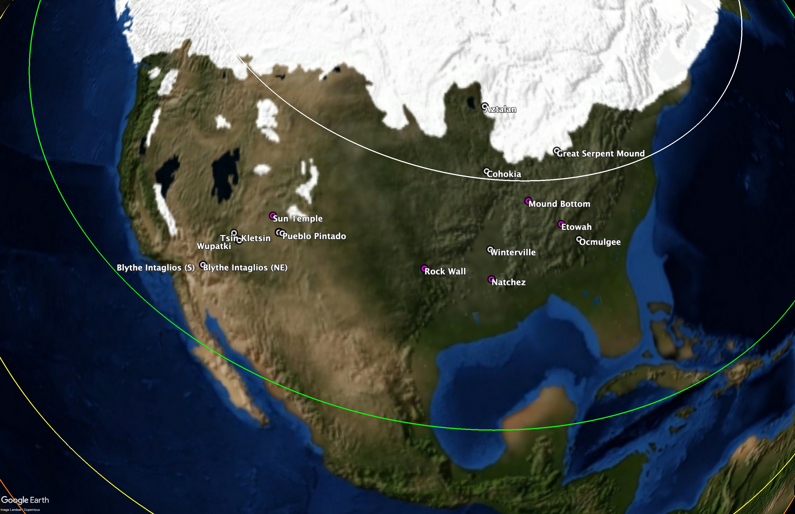
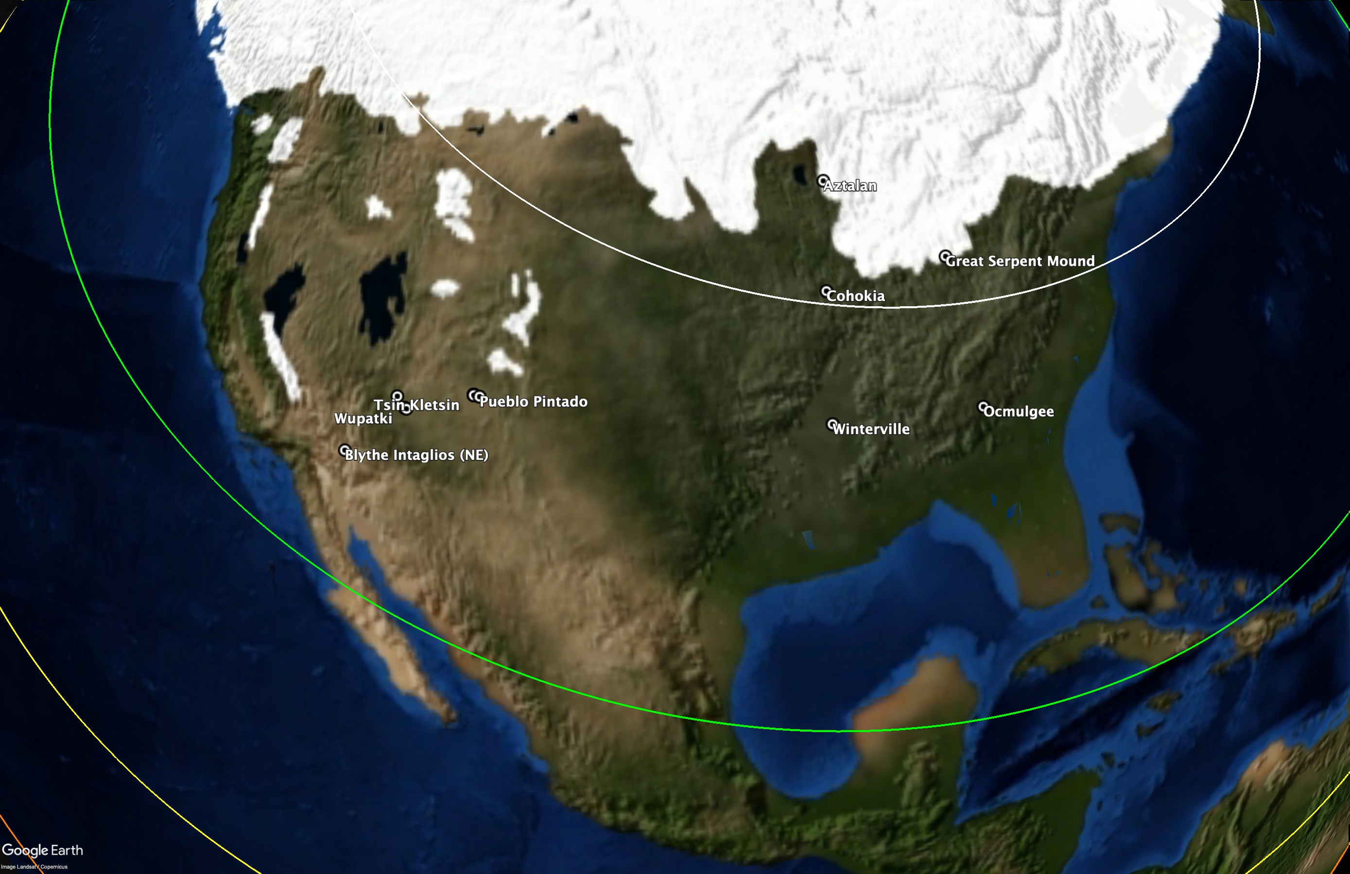
About 2/3 of the sites/structures are oriented in directions that reference the current (Arctic) pole.
Aztalan (cardinally-aligned) was first settled around 900 CE by the Middle Mississippian culture that was centered at Cahokia. 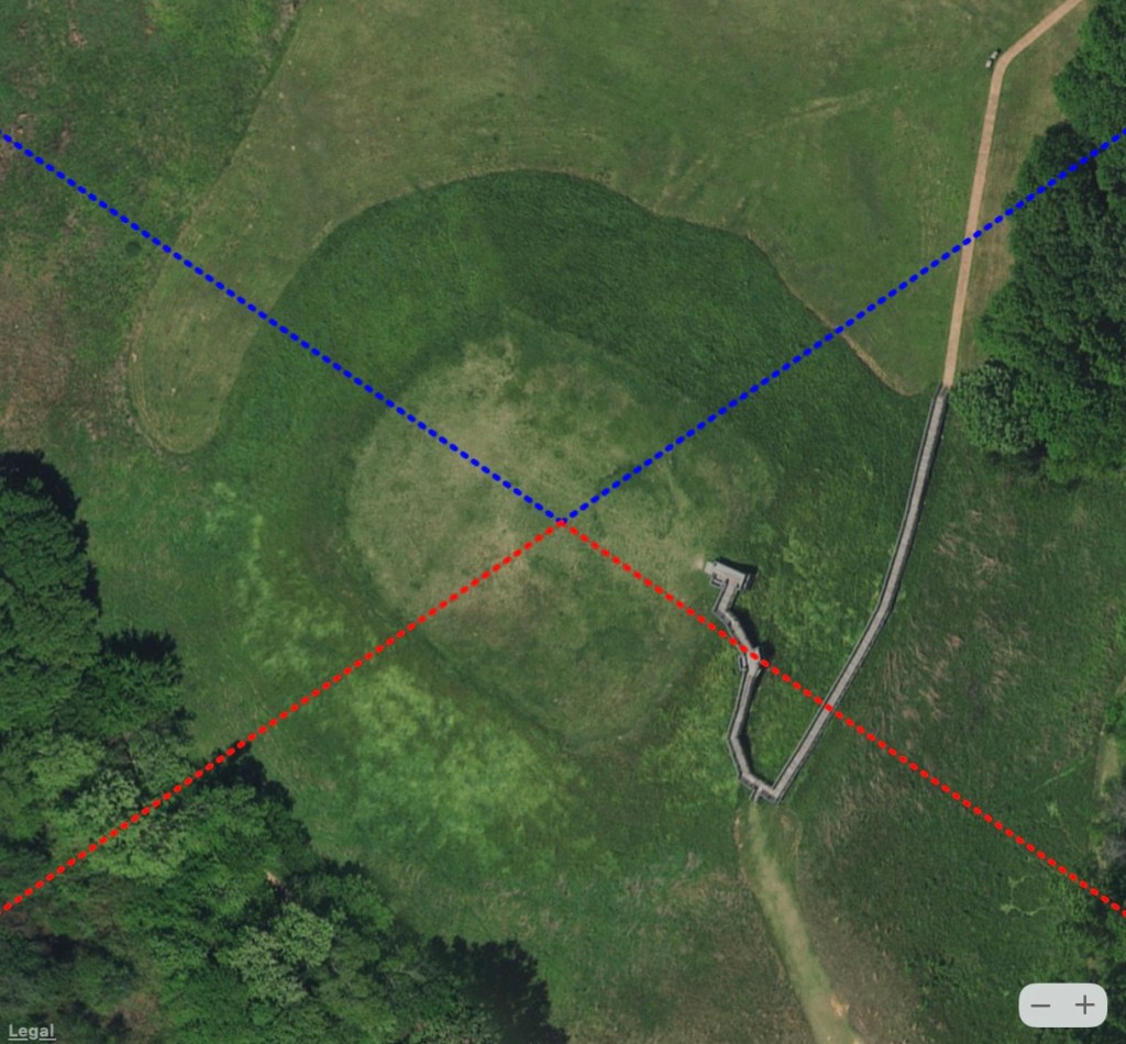
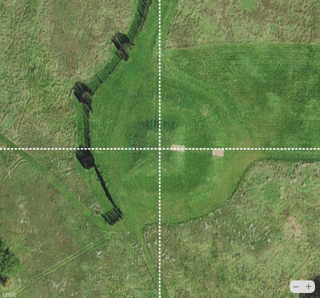
Ocmulgee (aligned to major lunar standstills) was built before 1000 CE by the South Appalachian Mississippian culture and contains evidence of having been occupied for more than 17,000 years 
Pueblo del Arroyo (aligned to minor lunar standstills) is an ancestral great house in Chaco Canyon, which was a major center for the Pueblo people between 900 and 1150 CE 
The Great Serpent mound (head faces the summer solstice sunset) was built up over a period of time starting with the Adena culture (800 BCE to 100 CE).
The other 1/3 are not aligned in any of these directions but instead appear to reference a location near Hudson Bay that Charles Hapgood argued was the position of the geographic North Pole during the North American ice age.
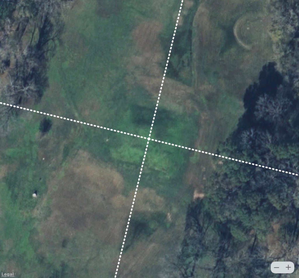
Natchez mound (cardinally-aligned relative to the Hudson Bay pole) is in an area first occupied by the indigenous Plaquemine culture, part of the larger, prehistoric Mississippian culture, whose largest center was at Cahokia. 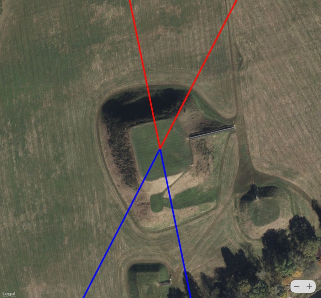
Etowah (aligned to solstices relative to the Hudson Bay pole) is thought to have been built by prehistoric indigenous peoples of the Mississippian culture of eastern North America 
The Sun Temple at Mesa Verde (aligned to minor lunar standstills relative to the Hudson Bay pole) is an unfinished ceremonial structure whose walls were between 11 and 14 feet high. Mesa Verde was inhabited starting around 9500 BCE 
Pueblo Pintado (aligned to solstices relative to the Hudson Bay pole) is the ruins of another ancestral Great House in Chaco Canyon.
South of the Ice Sheet
If the North Pole were in Hudson Bay, the southern US would have been in the northern temperate climate zone and ice-free during the LGM. Sites aligned to the current pole are found throughout the area while those aligned to the Hudson Bay pole are only found south of the Laurentide Ice Sheet, which is what one would expect if they were built during the LGM.

Although all of these sites are attributed to various Native cultures, like sites throughout the world believed to have been established within the past few thousand years, the alignment of sites to the Hudson Bay pole raises the possibility they could be much older, perhaps built over more ancient structures.
Rock Wall
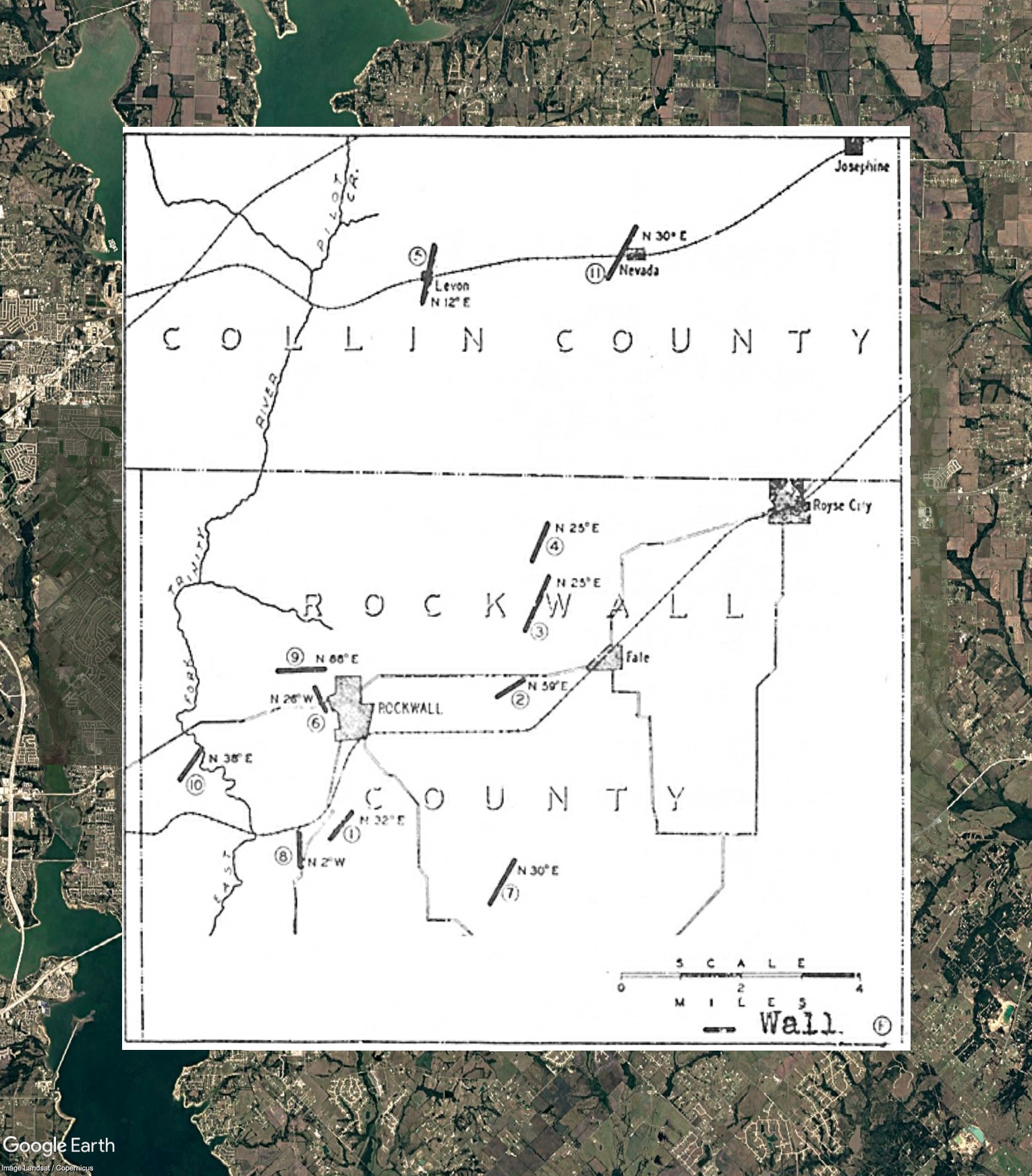
Approximately 20 miles northeast of Dallas is the town of Rockwall, Texas. Soon after the first settlers arrived in the 1840s, a rock wall was discovered on a farm owned by Terry Utley Wade. Later another rock wall to the northeast was encountered while digging a well. A square opening resembling a window was found at a depth of 35 feet. In 1933, a map prepared with the help of the county surveyor showed the location of numerous rock outcrops.

Geological investigations found the outcrops to be clastic sandstone dikes – natural structures associated with geological faults that resemble stone masonry. Comparing this map with another compiled by John Lindsey, a native Rockwall architect, who led a reinvestigation of the reported features, including an excavation in the 1990s, independent investigator Josh Reeves determined that the sections of the rock wall analyzed by geologists and found to be natural were not part of the structure mapped by Lindsey.

In an independent analysis of the geology of the rock wall motivated by Lindsey’s investigation, James J. (Bud) Shelton, a petroleum geologist, found “the current geological explanation, that of a clastic sandstone dike sourced by the Upper Cretaceous Trinity Group Lower Wolf City sandstone member does not adequately explain the presence of the feature” citing “seemingly out of place and context stone, possible mortar and plaster-like materials related to distinguishable architectural-like features” specifically “staggered joint stone masonry features” and “linteled portals and archways complete with arch guiding springer stones.” Also in Shelton’s report was the presence of large cavities in the rock wall complex, which corroborates descriptions of reported underground spaces mentioned by Reeves in his video.
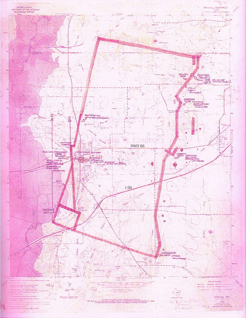


Although none of the rock wall is currently visible from the air, it is possible to register Lindsey’s map to Google Earth using roads and other cultural features. As shown in the above figure, the lower left section of the rock wall complex appears to be oriented in the direction of the Hudson Bay pole. Our discovery of other sites in the southern US that reference the Hudson Bay pole suggests the orientation of the rock wall in this same direction may not be a coincidence and that the largest antediluvian structure in North America may be beneath the suburbs just outside Dallas.
Image at the top of the article courtesy Google Earth/ Zürich University of Applied Sciences.
Discover more from Before Atlantis
Subscribe to get the latest posts sent to your email.


Thank you for this great article. Mario Buildreps is someone to learn from…his work is mind blowing and is this topic exactly.
LikeLike