


In Before Atlantis, we set out to explore the idea that shifts in the location of the North and South Poles were responsible for the misalignment of hundreds of ancient sites across the world. In the process, we have discovered (or rather rediscovered) how displacements of Earth’s crust – the reason the poles move – could also explain glacial cycles. In a recent paper, we described how changes at the North Pole predicted by pole shifts are correlated with the rise and fall of global sea levels over the past 130,000 years. In this article, we show that what was happening at the South Pole over this period also supports the crustal displacement theory.
Changes in the Northern Polar Zone
Charles Hapgood first hypothesized that glacial cycles were the result of climate changes caused by slippages of the Earth’s crust – that ice ages were not caused by global temperature fluctuations but were the direct result of different geographic regions moving in and out of the polar zone.

We showed in a previous article that the extent of the northern ice sheet at the time of the last glacial maximum (LGM) was consistent with the accumulation of ice over a gradually increasing landmass that had been shifted into the northern polar region by a series of crustal displacements as illustrated below.

As shown below, the union of these regions is a pretty good approximation of the extent of the ice sheet at the LGM.

What is interesting is that if we take the intersection of these circles – the current and past northern polar zones (from about 66° N) over the past 130,000 years, the area highlighted in the following figure has remained in the polar zone continuing to accumulate snow and ice over this period.

It turns out that the thickest ice in the current northern polar zone, in Greenland, is in this region.

Antarctica
Performing a similar analysis at the South Pole, the largest area in Antarctica having the thickest ice has also been in the polar zone for the past 130,000 years.

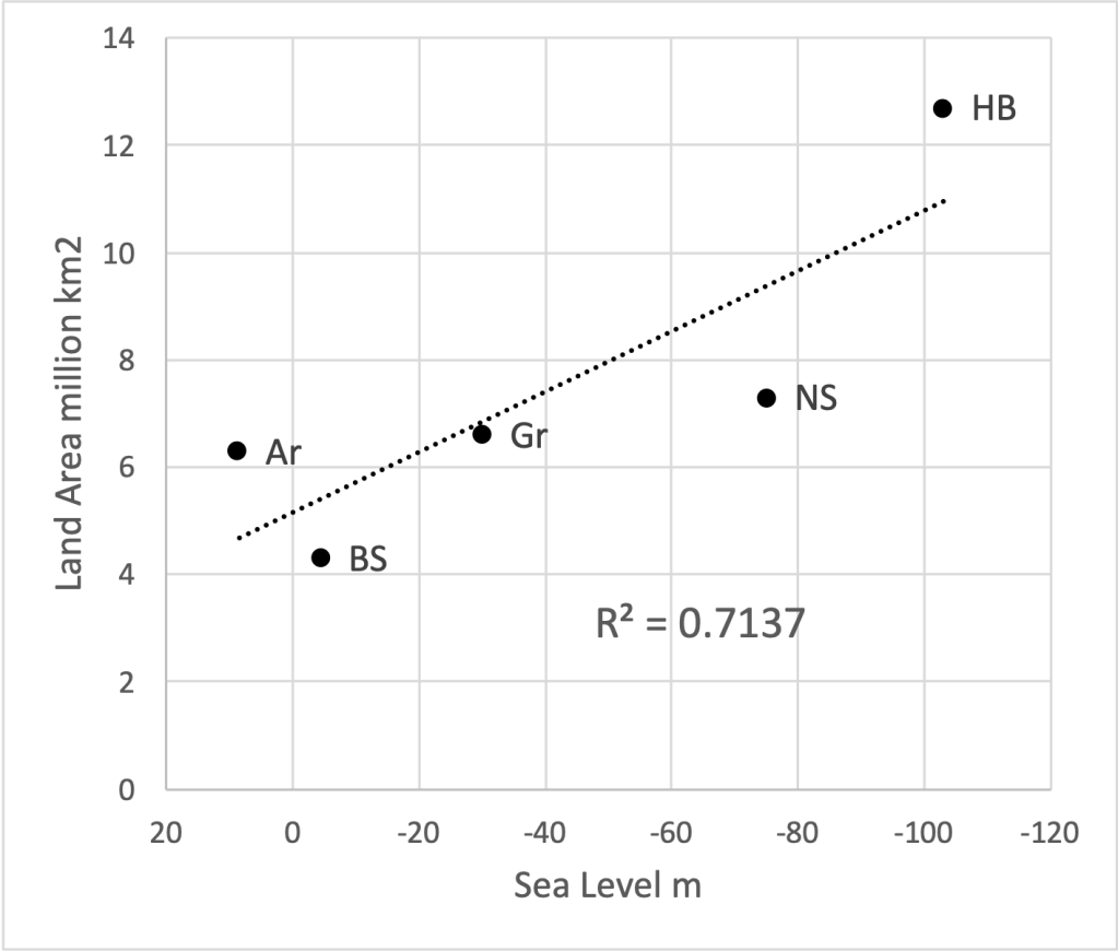
Aside from central Greenland, most of the landmass in and around the North Pole is relatively flat. According to our theory, when landmasses move into the polar zone, they begin to accumulate snow and ice. When they move out of the polar zone, the ice melts. The situation in the Antarctic is different because of its elevation. Glaciers exist in the Alps, Himalayas, Andes, and other mountainous areas in the world that are more than two to three thousand meters in elevation. About 40% of Antarctica is 2500 meters or more above sea level.
The ice over most of the Southern Continent (at least 62%), which is more than 1500 meters in elevation probably would not have melted even if it had been shifted well out of the polar zone. Thus, in contrast to the accumulation and melting of ice in the northern polar zone and its effect on global sea levels, changes in the location of Antarctica would have been less of a factor.
The mountainous interior of Greenland has the most ice, which coincidentally has remained in the polar zone for the past 130,000 years. As shown below, areas with the thickest ice in Antarctica are not always the highest in elevation as they are in Greenland.

The Bottom Line
We have shown that changes in the geographic location of the polar zone, which Hapgood believed was responsible for ice ages in different parts of the world at different times, can explain the extent of the northern ice sheet at the time of the LGM, why the thickest ice at both the North and South Poles is where it is, and how, as discussed in the previous article, portions of Antarctica could have been ice-free during the North American ice age. Future articles will examine other implications of Hapgood’s revolutionary theory.

Discover more from Before Atlantis
Subscribe to get the latest posts sent to your email.


One Reply to “”