


An analysis of the orientation of ancient structures on four islands in the South Pacific suggests the possibility that a previously unknown civilization could have existed in this part of the world during the last Ice Age.
Nan Madol
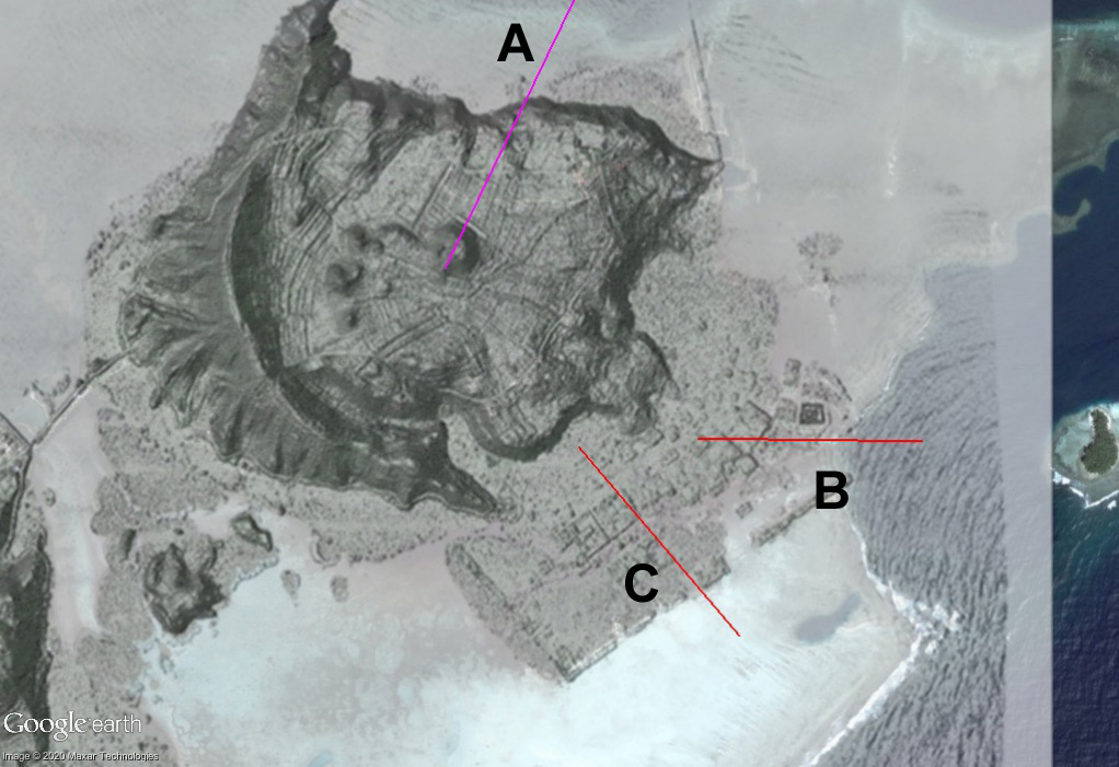
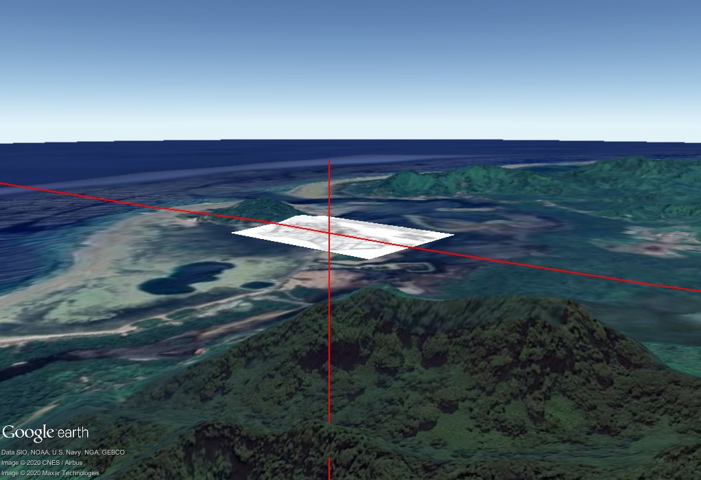
Nan Madol is a megalithic complex on the island of Pohnpei consisting of about a hundred rectangular islets. Most of the islets are surrounded by retaining walls constructed of long slabs of prismatic basalt laid on top of foundations of immense basalt boulders. Archaeologists believe that the earliest structures were built around 900 CE. It is thought that the enormous basaltic slabs were floated by some means from quarries on the other side of the island to their present location.
Nan Madol is divided into two areas. One to the southwest known as Madol Pah is where royal dwellings and ceremonial areas were located. The other area to the northeast known as Madol Powe is where the priests dwelled and most of the tombs are located.
Esteban (2014) measured the alignments of numerous structures at Nan Madol. He determined that the long southeast-facing retaining wall of Madol Pah is oriented at an azimuth angle of 56° and could have been aligned with the rising of the “Southern Cross” at the time the site is thought to have been built. This angle is confirmed in measurements made using a recent LIDAR image (Comer et al 2019).
An analysis of the alignments of Nan Madol and other sites discussed in this article is sometimes difficult since many structures are not perfectly rectangular and not always oriented in exactly the same direction. The azimuth angle of the west-southwest retaining wall of Madol Pah measured in the same LIDAR image mentioned above is approximately 137°, which is not at a right angle to the southeast wall. Together these two walls thus defined a general range of directions to the southeast between 137° and 146°.
Like other megalithic sites throughout the world, the lack of a compelling explanation for how such large structures could have been constructed using primitive technology suggests the possibility that the sites were first established by a previous technological civilization and then co-opted by later more primitive (indigenous) people.
Assuming a date of construction to satisfy a stellar alignment becomes somewhat of a circular argument since such alignments shift due to precession. A search for a more stable solar or lunar explanation that does not assume a date of construction leads to a consideration of alternative pole locations. If we assume the North Pole was in Hudson Bay at the time the site was first established, it would have been located at around 10° S latitude (it is currently at 6.84° N latitude). The southernmost (summer solstice) sunrise angle would range from 137.7° to 139.9°. It is thus possible that Madol Pah could have been aligned to the summer solstice sunrise at this time.
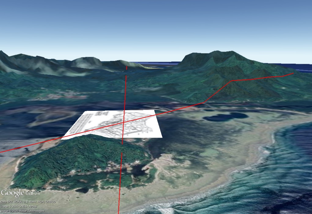
The largest structure at Nan Madol is Nan Dowas, which is constructed of stones weighing up to 50 tons. The alignments of this and other structures in the funerary area in Madol Powe are different from those in Madol Pah. According to Esteban (2003) Nan Dowas and a tomb at Sapwtakai, another megalithic site on Pohnpei, are both aligned in the same general direction, approximately 3° south of east. This angle is very close to the range of northernmost sunrise angles on the solstices (90.4° to 92.26°) relative to an assumed North Pole location in Hudson Bay suggesting that Nan Dowas could have also been aligned to the winter solstice sunrise at this time.
What is particularly intriguing about this ancient dating around the time of last glacial maximum when sea levels were more than 120 meters lower than their present levels is that Nan Madol and other reported ruins off of its eastern coast would have been well above sea level and the island itself would have been larger.
Leluh
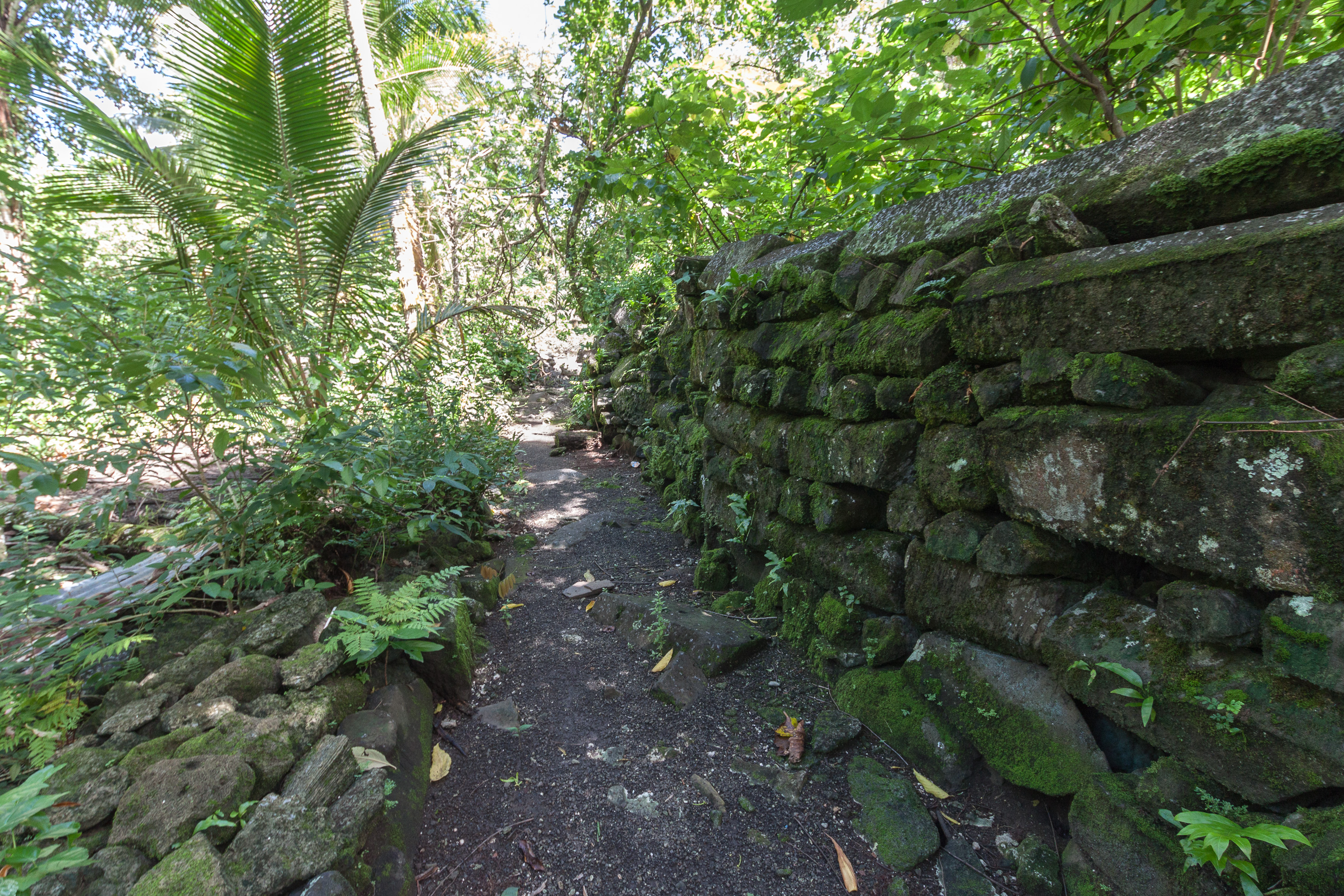
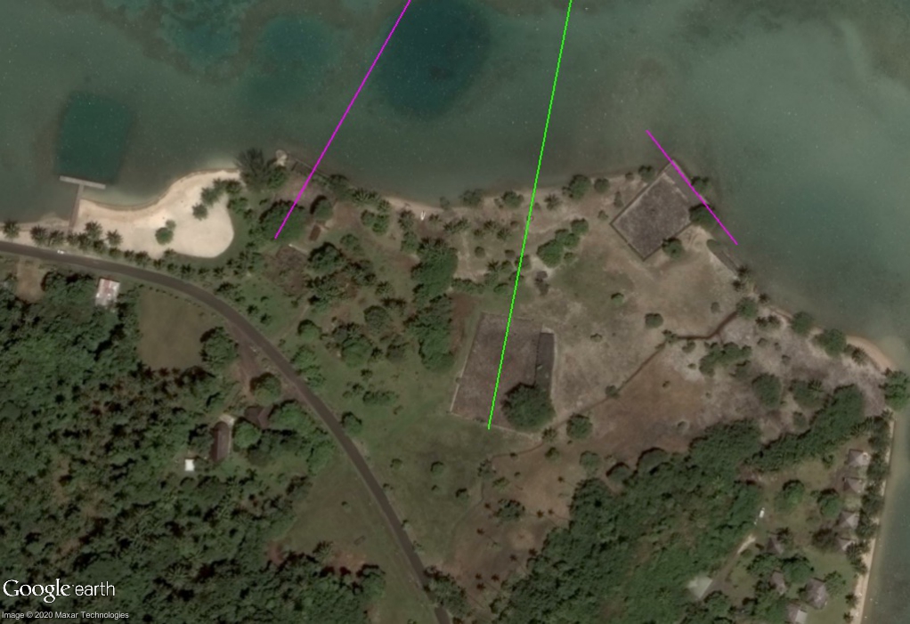
The ancient city of Leluh was built up as a man-made extension on a small island in a lagoon on the eastern side of Kosrae, an island 540 km east-southeast of Pohnpei. The same kind of prismatic basalt found at Nan Modal was used in Leluh to construct numerous walls and tombs. According to Morgan (1988) the stone was quarried from a site in Utwe (about 15 km from Leluh) and transported using rafts. Although the basalt itself cannot be dated, Uranium/Thorium (U/Th) dates from corals collected from structural materials suggest the tombs were built about 700 years ago (Richards et al 2015).
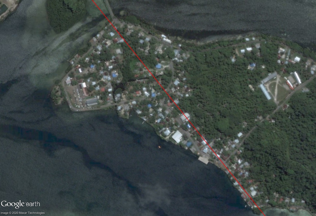
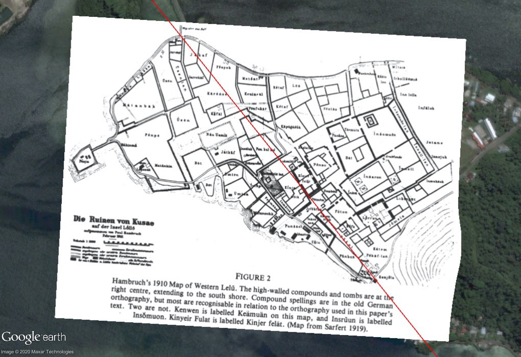
Even more intriguing than the materials used in construction is the similarity in the alignments at Leluh and Nan Madol. Esteban (2002) reports the orientations of the northeastern sides of five tombs range in azimuth from 47° to 59°. Their southeastern facing sides are thus aligned in the range 137° to 149°. Being at a similar latitude the solstice sunrise directions are similar to those at Nan Madol relative to the Hudson Bay pole. By registering Hambruch’s original 1910 map to create an image overlay in Google Earth we are able to verify that the ancient city itself is aligned in the same general direction of the solstices.
The range of sunrise directions assuming the North Pole was in Hudson Bay may also explain why Leluh was originally built off of the east coast of Kosrae. Extending sightlines in the solstice directions reveal that the southern sunrise and sunset directions relative to the Hudson Bay pole bracket the mountainous landscape of Kosrae to the southwest. On the summer solstice, the sun would have risen to the southeast over the ocean and set west between two mountains on Kosrae.
Taputapuatea
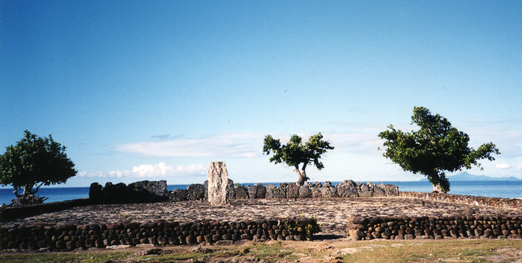
Taputapuatea is on the island of Raiatea in French Polynesia. Near the eastern tip of the island, there are three stone-paved trapezoidal areas called marae. Marae were meeting places in Polynesia where the world of the living could interact with the realm of the ancestors and the gods.
The long axes of two of the marae appear to be oriented toward former poles – one toward the Hudson Bay pole and another toward an earlier pole in Greenland. The minor axis of a third marae is aligned in a solstice direction relative to the Hudson Bay pole. Salvat et al (2019) have U/Th dated limestone slabs at the site to be 3000 to 5000 years old. Alignments to former poles suggest the original site could be even older.
Tonga
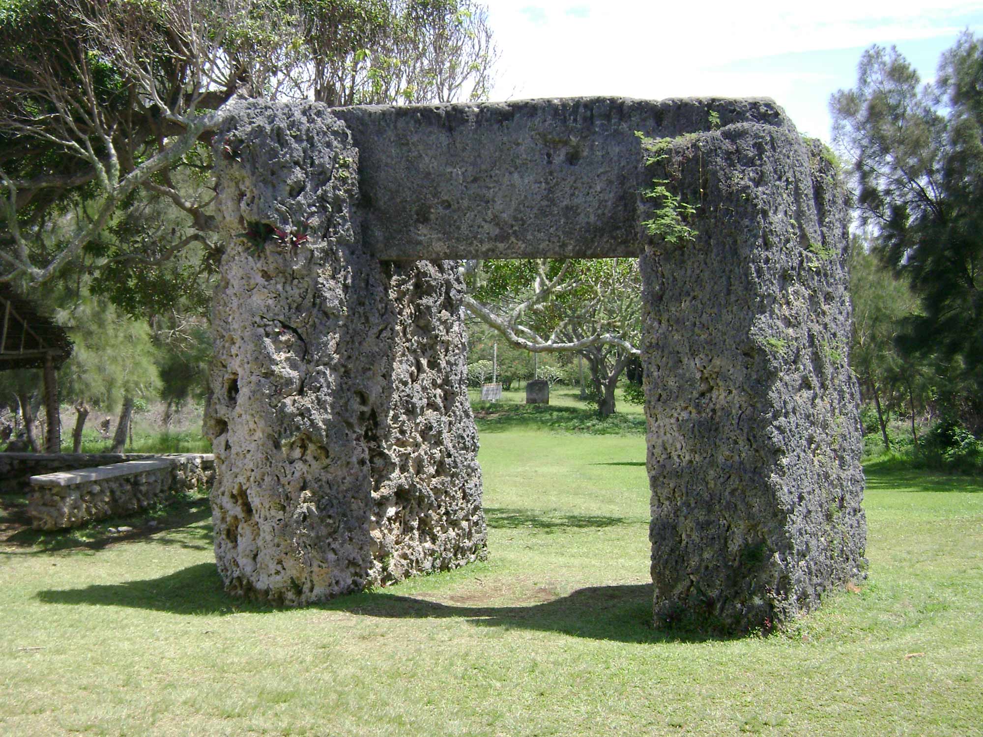
The Haʻamonga ʻa Maui Trilithon is a unique megalithic structure on the northern coast of the island of Tongatapu. It is constructed from three enormous blocks of coral limestone, the largest is 5 meters in height and weighs about 50 tons.
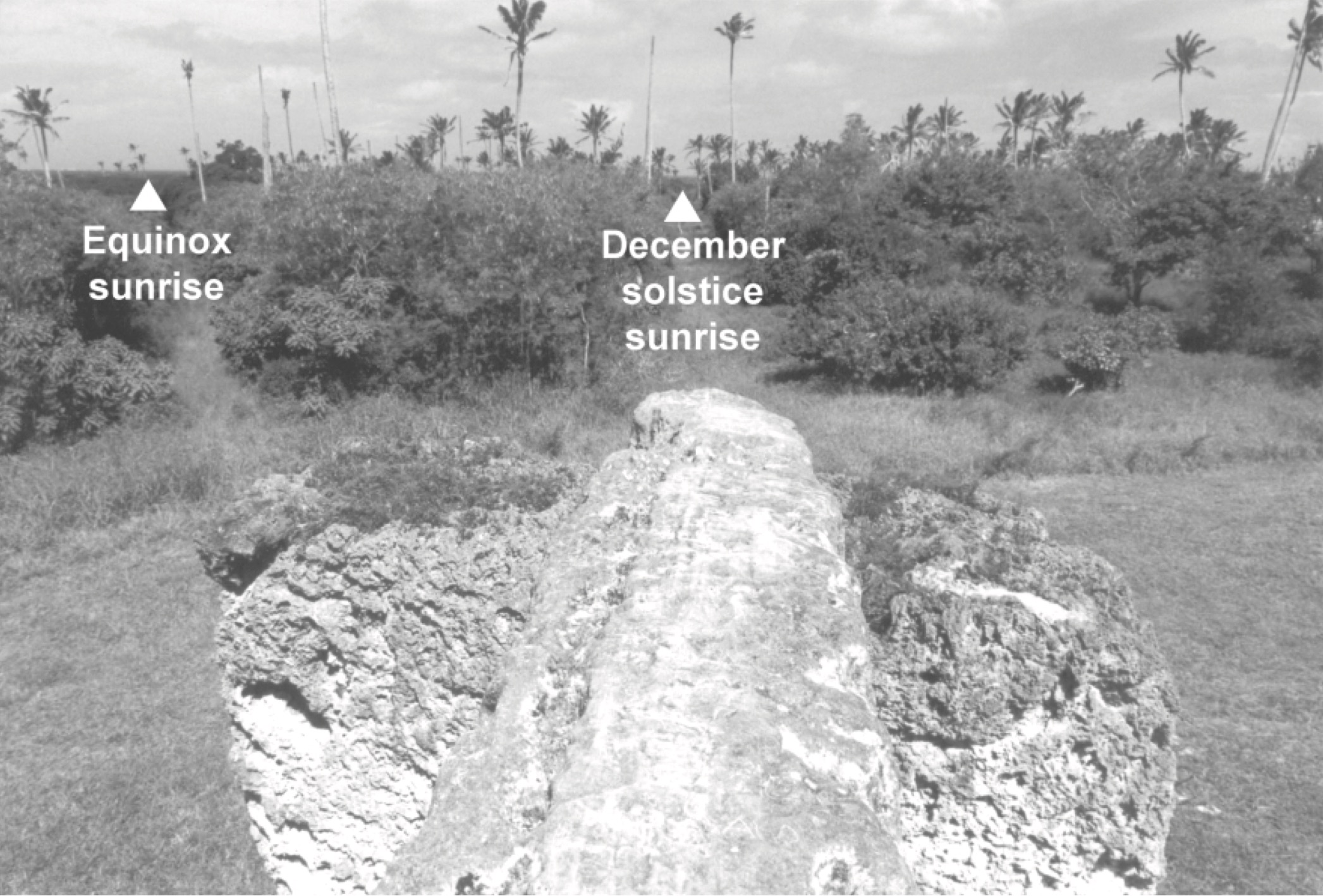
Although it is widely thought to have been aligned to the summer solstice sunrise/winter solstice sunset, an interesting photo taken along the lintel by Esteban reveals that it is misaligned by several degrees. It turns out to be very closely aligned perpendicular in the direction of the Hudson Bay pole and so would have been once oriented east-west. It is interesting to note that this direction is similar to that of land-use patterns in many parts of the island. Aveni (1980) notes that in Mexico alignments of churches built over earlier structures and planted fields often follow patterns that had been established in pre-Columbian times. Perhaps this pattern on the Tongan landscape was first established tens of thousands of years ago when the North Pole was in Hudson Bay.
Maori Flood Myth
According to Bůčková (2004) “Deluge is one of the most widespread mythical motifs throughout the world…” She explains how in the Maori mythology of the aboriginal people of New Zealand, their hero Tawhaki
“took his warriors and built a protected village upon the top of a mountain. It was here that Tawhaki called to the gods for revenge and the flood they let down was so disastrous that the whole earth was covered by water and all human beings perished. This episode may, however, be characterized as a cataclysmic deluge.”
Could the origin of this myth have been a catastrophe caused by a pole shift/crustal displacement that flooded all but the tallest peaks of the mountains in the South Pacific?
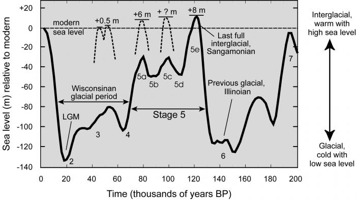
In Hapgood’s chronology, at the time of the last glacial maximum when sea levels were at their lowest, the North Pole was in Hudson Bay. Much more of the Tonga archipelago would have been above sea level at this time. In fact, most islands in the Pacific would have been much larger. According to Hapgood’s theory, when the pole shifted from Hudson Bay to its present location the ice on the old pole melted releasing an enormous quantity of water that caused sea levels to rise over 120 meters in 20,000 years. Over time the rise in sea level could have forced the original builders of Nan Madol and other enigmatic places in the South Pacific to flee these islands.
Perhaps Churchward’s Mu did exist after all, not as a supercontinent in the middle of the Pacific Ocean but as a vast archipelago, much larger than it is today, supporting an advanced civilization that had the capability to quarry, transport, erect, and align these and other (yet to be discovered?) enigmatic structures that are testament to its existence.
References
Aveni, Anthony (1980) Skywatchers of Ancient Mexico(Austin and London: University of Texas Press.
Bůčková, Martina (2004) “Deluge in Polynesian Mythology,” Asian and African Studies, Vol. 13, No. 2, 191-197.
Carlotto, Mark (2020a) “Toward a New Understanding of the Alignment of Ancient Egyptian Sites, https://dx.doi.org/10.2139/ssrn.3526820.
Carlotto, Mark (2020b) “An Analysis of the Alignment of Archaeological Sites,” Journal of Scientific Exploration, Spring (in press).
Carlotto, Mark (2020c) “A New Model to Explain the Alignment of Certain Ancient Sites,” Journal of Scientific Exploration, Summer (in press).
Comer, Douglas C., Comer, Jacob A., Dumitru, Ioana A., Ayres, William S., Levin, Maureece J., Seikel, Katherine A., White, Devin A. and Harrower, Michael J., (2019) “Airborne LiDAR Reveals a Vast Archaeological Landscape at the Nan Madol World Heritage Site,” Remote Sensing, 11, 2152; doi:10.3390/rs11182152
Esteban, César (2014) “Orientations and Astronomy in Prehistoric Monumental Tombs of Nan Madol (Pohnpei, Micronesia),” Monuments and People in the Pacific.
Esteban, César (2002) “Some Notes on Orientations of Prehistoric Stone Monuments in Western Polynesia and Micronesia,” Archaeoastronomy. The Journal of Astronomy in Culture.
Morgan, W. N. (1988) Prehistoric Architecture in Micronesia(University of Texas Press, Austin.
Richards, Zoe T., Shen, Chuan-Chou, Hobbs, Jean-Paul A., Wu, Chung-Che, Jiang, Xiuyang, and Beardsley, Felicia (2015) “New precise dates for the ancient and sacred coral pyramidal tombs of Leluh (Kosrae, Micronesia),” Science Advances, Vol. 1, no. 2, DOI: 10.1126/sciadv.1400060
Salvat, Bernard, Maric, Tamara, Goepfert, Tyler and Eisenhauer, Anton (2019) “The marae of Taputapuātea (Ra’iatea, Society Islands) in 2016: nature, age and origin of coral erected stones,” Dans Journal de la Société des Océanistes(no. 149).
Feature image: Nan Madol ruins in Pohnpei.
Photo by CT Snow, CC BY 2.0 https://commons.wikimedia.org/w/index.php?curid=3838239
Discover more from Before Atlantis
Subscribe to get the latest posts sent to your email.


Maori only arrived in New Zealand between 1200-1400 AD (approx), but having no written language, they were reliant on oral history-telling to keep their records. It wouldn’t surprise me if the flood was based loosely on fragments of a much older ancestral civilization further north in the Pacific, which could have seen sea level changes
LikeLike