

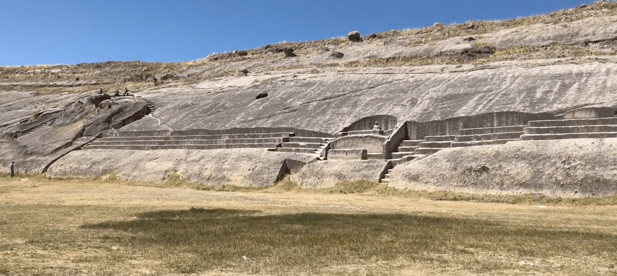
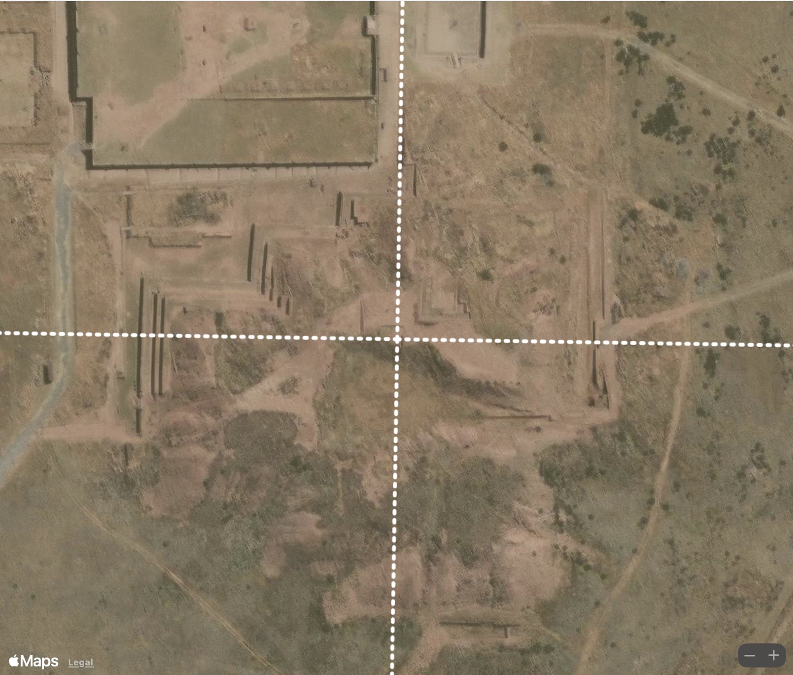
Inspired by videos created by Megalithomania and Brien Foerster, this article examines the unusual alignment of the Inca Steps of Quenuani, which is located between the towns of Cuturapi and Yunguyo on the Peruvian shore of Lake Titicaca.
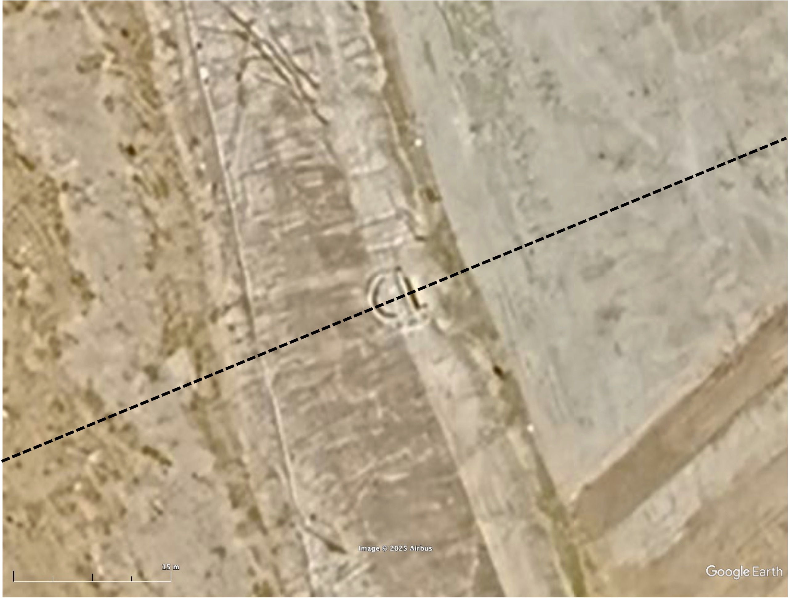
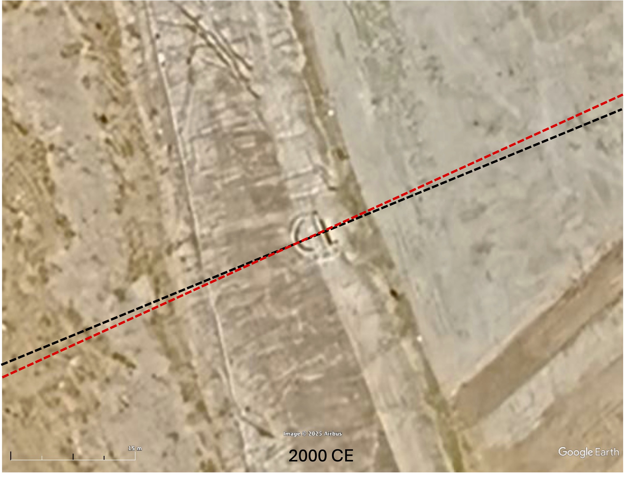
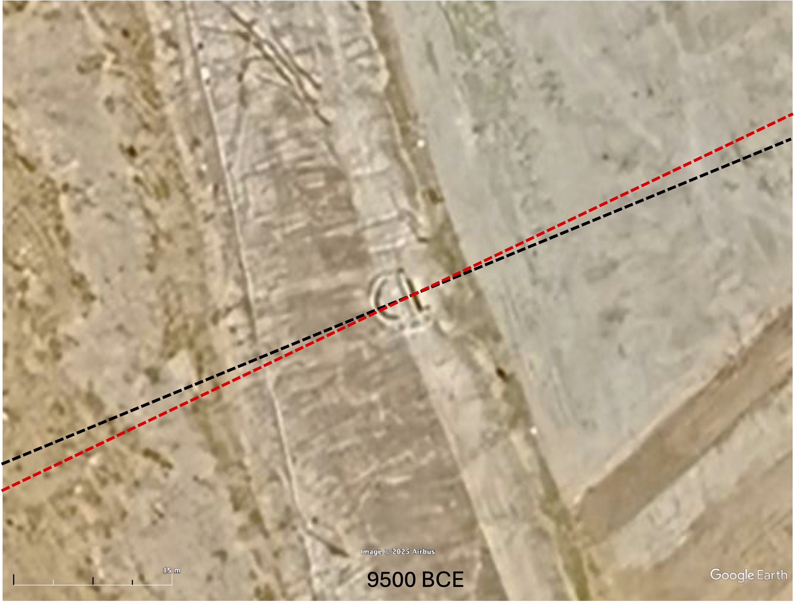
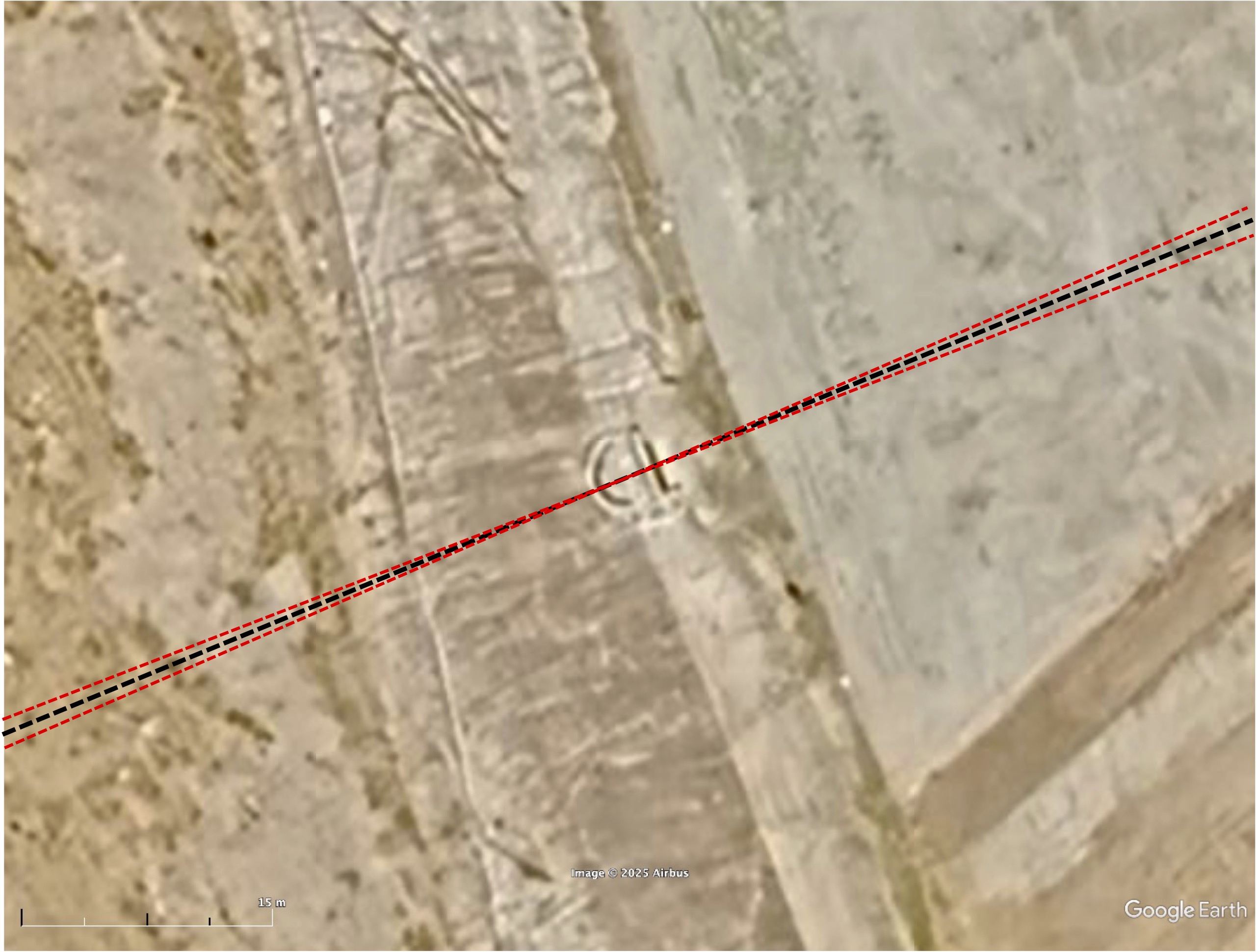
From clues in these videos, and with the help of Google Earth, the Inca Steps were originally estimated to be centered at (16.259446° S 69.171322° W). Since the article was first posted, a more recent Google Earth image shows a portion of the structure with clearly defined edges just north of this location at (16.259090° S, 69.171440° W). As shown in the figure below, the alignment of this feature (approximately 22.5° north of east) is south of the current summer solstice sunrise direction. Astronomical alignments to the Sun and Moon vary due to changes in Earth’s axial tilt between the time of construction and the present. Sometimes changes in obliquity explain site misalignment. However, in this case, the misalignment increases as we go back in time. For example, in 9500 BCE, the misalignment increases from 2° to 3° degrees. Other than measurement error, which is a possibility, could there be another explanation for the difference?
The site of Tiwanaku is located 38 miles southeast of Quenuani. Tiwanaku is not aligned exactly to the cardinal directions but is rotated slightly east of north. In Before Atlantis we propose four prior locations of the North Pole over the past 125,000 years based on Hapgood’s pole shift hypothesis. Between 75,000 to 125,000 years ago, the North Pole is thought to have been in northern Greenland. In this part of Peru, an ancient Greenland pole would have rotated structures 1-2° clockwise. In other words, if the North Pole were in Greenland, Tiwanaku would face due north.

Going back to Quenuani, if the North Pole were in Greenland, the Inca Steps would have been rotated 1-2° clockwise (south of east) from their current direction. As shown below they would have lined up much more closely in the summer solstice sunrise direction.
Based on its orientation, it is likely that Quenuani was built as a place to observe the sunrise over Lake Titicaca on the solstice. It is also possible, if Hapgood’s theory of pole shifts is correct, Quenuani, and other sites in the area such Tiwanaku and Puma Punku and may be related by virtue of their alignment to an ancient pole in Greenland and could be far more ancient than is currently thought.
Discover more from Before Atlantis
Subscribe to get the latest posts sent to your email.


Thanks to add some map for Quenuani!
LikeLike
Sorry Pal, this structure was built millennia before the Incans arrived on scene in Peru.
LikeLike
Don’t be sorry. That’s exactly what I wrote in the article.
LikeLike