


During an exploration and survey mission off the west coast of Cuba in 2001, unusual stone structures were detected in sonar imagery at depths ranging from 600 to 750 meters. The discovery was announced by Pauline Zalitzki, a marine engineer, and her husband Paul Weinzweig, who led the mission under the auspices of the Cuban government. Widely reported at the time by the popular press, the discovery has since become a topic of some speculation due to what seemed to be the lack of any follow-up investigation.
More than a decade later, a scientific report was published by the expedition’s lead scientist, Manuel A. Iturralde-Vinent, in which he states:
At depths between 600 and 750 metres below sea level, EXPLORAMAR researchers found a set of unusual structures that they called MEGA. Since the discovery was revealed to the press, various opinions have been raised about its origin, which have captured the popular imagination. There has been talk of a “submerged city”, the remains of “Atlantis”, a Mayan settlement, among other similar ideas.
He goes on to describe a follow-up investigation that was never reported by the popular press or cited in the scientific literature:
Investigations in the MEGA area were conducted over several years and included the collection of underwater video images, bottom sediment samples, mosaics of side-scan sonar lines, maps of the location of the lines and structures, photos of the observed structures and objects, aerial photos, several detailed bathymetric maps, topographic maps and scientific literature on western Cuba. A group of technicians and navigators on the Cuban Navy research vessel SS Ulysses participated in this work under the direction of engineer Paulina Zelitsky. The author participated in the final phase of the investigation, studying all the collected materials and performing the geological and geomorphological evaluation and interpretation of the possible origin of MEGA.
While researching these structures, I rediscovered Iturralde-Vinent’s report, which has been translated into English. Using it as a starting point, with the help of Google Earth, we can refine the location and depth of the MEGA site, and estimate the orientation of the underwater structures in the sonar scans.
Where Are the Structures?
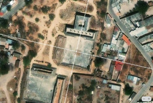
According to Wikipedia, the underwater formations are at 21.772547°N 84.836736°W southeast of the San Antonio lighthouse at the extreme western tip of Cuba. In his report, Iturralde-Vinent states they are between 21.85 degrees and 21.9 degrees in a submerged valley between the mainland and the Bajo de San Antonio. By registering his map to Google Earth we place the formations at approximately 21.991° N 84.983° W, almost 18 miles away from their previously stated location.

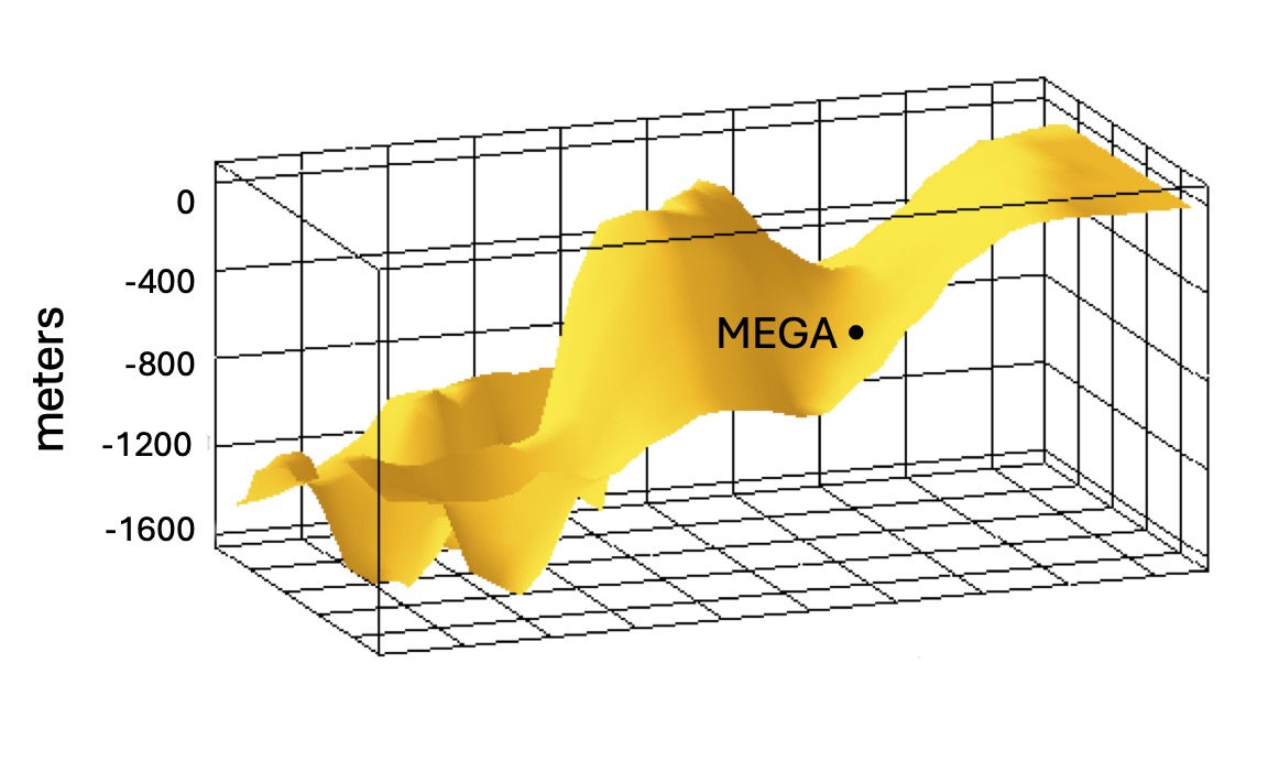
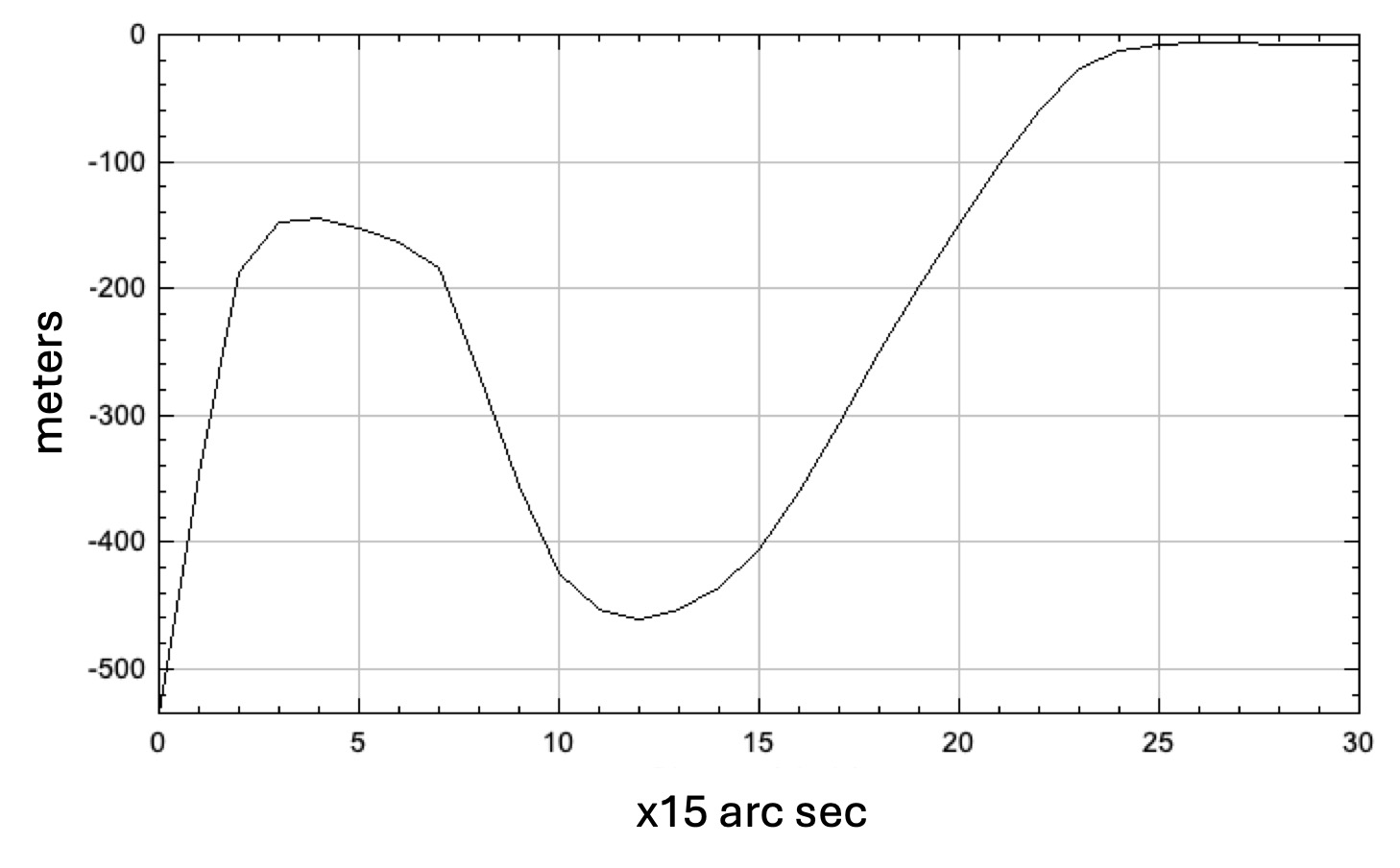
How Deep Are The Structures?
Iturralde-Vinent notes in his report that these structures are in the southeastern portion of the San Antonio Lowlands at depths between 600 and 750 meters. Registering 15 arc-second depth data over this area to Google Earth indicates a shallower range of depths from west to east at the estimated latitude of the structures. The data shows that the water becomes deeper as we move south and shallower north. Thus the structures may be further south than shown here or are in somewhat shallower water than he reported.

The Sonar Data
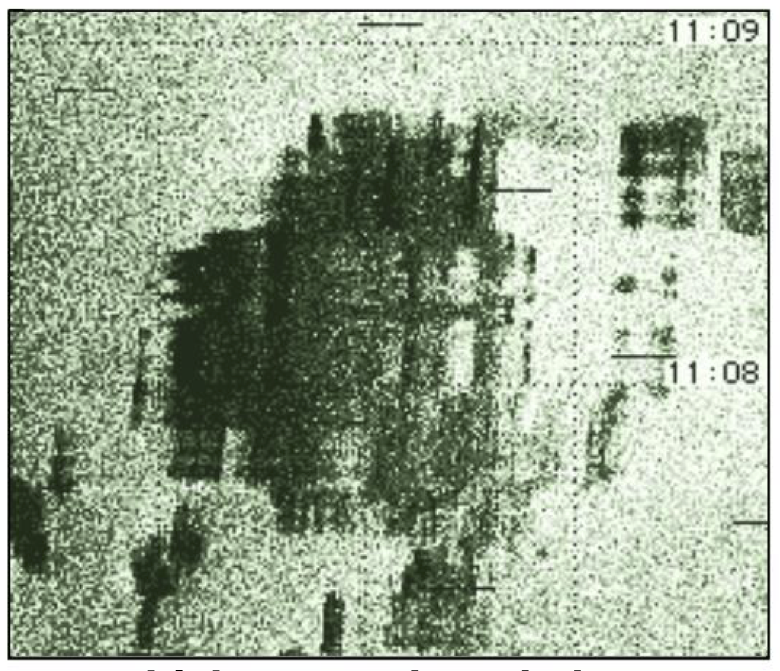
According to his analysis, side-scan sonar maps indicate two kinds of structures. The largest ones have the appearance of elongated geometric crests and depressions that resemble amphitheaters. Smaller ones are cubic, parallelepiped and pyramidal blocks, whose faces are relatively polished.

Iturralde-Vinent states “the linear nature of some structures and the presence of sectors with the appearance of elements are evident” and notes features that appear to be thick “walls” and “corridors.” Several examples are shown below. He goes on to say that the side-scan sonar image on the right “exemplifies one of the most striking structures and one that is difficult to explain by natural causes.”

Site Alignments
Assuming the sonar scans were accurately registered to a geographic (N-S-E-W) reference frame, the underwater structures are rotated clockwise from the cardinal directions by several degrees.
An analysis of the geographical orientation of almost two hundred archaeological sites in the Western Hemisphere (Beyond Atlantis, chapter 20) reveals that only about 1/3 are cardinally aligned N-S-E-W or in astronomically significant directions. The alignments of five of these sites, provided as context, along with one of the underwater formations, are shown below.
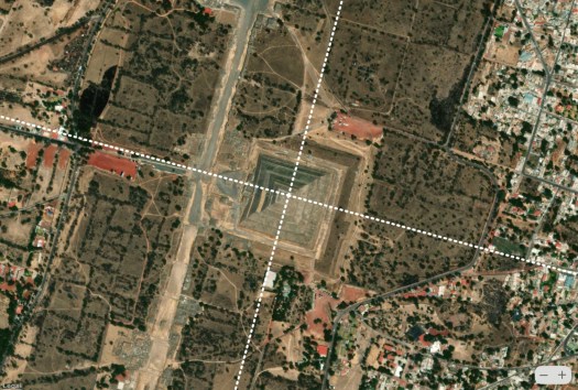


Notice the clockwise rotation angle of the sites decreases from west to east. In other words, Teotihuacan, north of Mexico City, which is furthest west is rotated 15.2° east of north, while the underwater formation off the western coast of Cuba, which is furthest east is rotated 5.6°. The misalignment of all of these sites can be resolved if we shift the point of reference from the current North Pole in the Arctic Sea to a previous hypothesized geographic pole location in Hudson Bay as shown below.

Thus, based on their alignment, if these structures are artificial, they could be 20,000 to 40,000 years old according to the pole shift timeline proposed in Before Atlantis.

Out of Time and Out of Place
In his analysis of the MEGA site, Iturralde-Vinent notes the presence of “well-rounded pebbles” and “volcanic scoria” in the area. Scoria is a pyroclastic, highly vesicular, dark-colored volcanic rock formed by ejection from a volcano as a molten blob and cooled in the air to form discrete grains called clasts. As there are no volcanoes in the area, the presence of scoria mixed in the seabed is hard to explain. Similarly, there is no mechanism to explain the presence of rounded pebbles that are typically found near rivers.
The depth of these structures would seem to rule out an artificial origin, even during the last glacial maximum (LGM) when global sea levels were at their lowest. However, if the Cuban underwater formations turn out to be artificial, something extraordinary must have happened for them to now lie hundreds of meters below the surface.
After more than two decades, isn’t it time to return to MEGA and find out?
The featured image at the top of the article depicts the Caribbean approximately 20,000 years ago during the last glacial maximum (LGM). (Google Earth/Zürich University of Applied Sciences)
Discover more from Before Atlantis
Subscribe to get the latest posts sent to your email.


Great work !! Related: awaiting your announcement of a pole predating BS based on sites that don’t align to any currently known pole. BS certainly wasn’t the first. Keep up the great work, thanks, Ray.Lampman
LikeLike
Love your stuff!
the flip side of power is Responsibility
LikeLike
“According to Wikipedia, the underwater formations are at 21.772547°N 84.836736°W southeast of the San Antonio lighthouse”Hey, this does not correspond to the location shown in the image you posted with the little thumb tack. If you look at the wikipedia article with the location, it is a long way southeast of where you place the thumbtack image. So which one of you is correct?Wiki article: https://en.wikipedia.org/wiki/Cuban_underwater_formationLink from wikipedia article to geolocation “21.772547, -84.836736”https://geohack.toolforge.org/geohack.php?pagename=Cuban_underwater_formation¶ms=21.772547_N_84.836736_W_type:landmark
LikeLike
Yes, it is quite a distance away. My map is based on the report of the expedition’s lead scientist, Manuel A. Iturralde-Vinent. I provide a link to his report in the article.
LikeLike
Hello, either you have your location wrong on your map, or wikipedia does on their map. But when googling the coordinates, it is always far southeast of where you have placed it according to the image with the thumbtack. What’s that about?
LikeLike
Wiki is wrong.
LikeLike