


In this article, we examine the alignments of certain structures at Chimalacatlán that suggest it might be the oldest archaeological site in Mesoamerica.
Buried Cities, Forgotten Gods
William Niven was a geologist and mineralogist who lived and worked in Mexico for more than five decades beginning in the late 19th century. Niven is perhaps best known for the clay tablets that he discovered in the 1920s, which were later popularized by James Churchward in his theory of a lost continent in the middle of the Pacific Ocean. Less known were Niven’s explorations three decades earlier in the Mexican state of Guerrero.
While on a trip prospecting for a particular garnet known to exist in this part of Mexico, Niven learned of a ruined city in the mountains that had been discovered by Don Lorenzo Castro a few years earlier. After an unsuccessful attempt to reach the area in 1891 Niven returned a year and a half later to find
“Broken walls, ruined buildings, huge in size beyond comprehension… marked the slopes as far as the eye could reach. Once this was a rolling plateau, dropping gently away from the mountain wall, but now it is cut into giant ridges by gorges from 200 to 1,000 feet deep – gorges whose sides are scarred with broken buildings, ridges covered with ruins of great houses…” [1]
Chimalacatlán
It is likely that some of the ruins Niven saw are those located near the town of Chimalacatlán. In “Lost Cities of the Mexican Highlands,” Marco Vigato compares the ruins in Chimalacatlán to those in South America
“Unlike the Andean region of South America, with its impressive megalithic architecture as in the region of Cuzco, capital of the Inca empire, and Tiwanaku, nothing on the scale of the impressive megalithic walls and constructions of Peru seems to have ever characterized Mesoamerican architecture. There is however one remarkable exception to this rule, which is as impressive in its monumentality and scale as it is also remarkably unknown to the public at large, including many of the very specialists in Mesoamerican archaeology and architecture. This is the case of the megalithic platforms and walls of Chimalacatlán, in the south of Morelos and near the border with the state of Guerrero.”
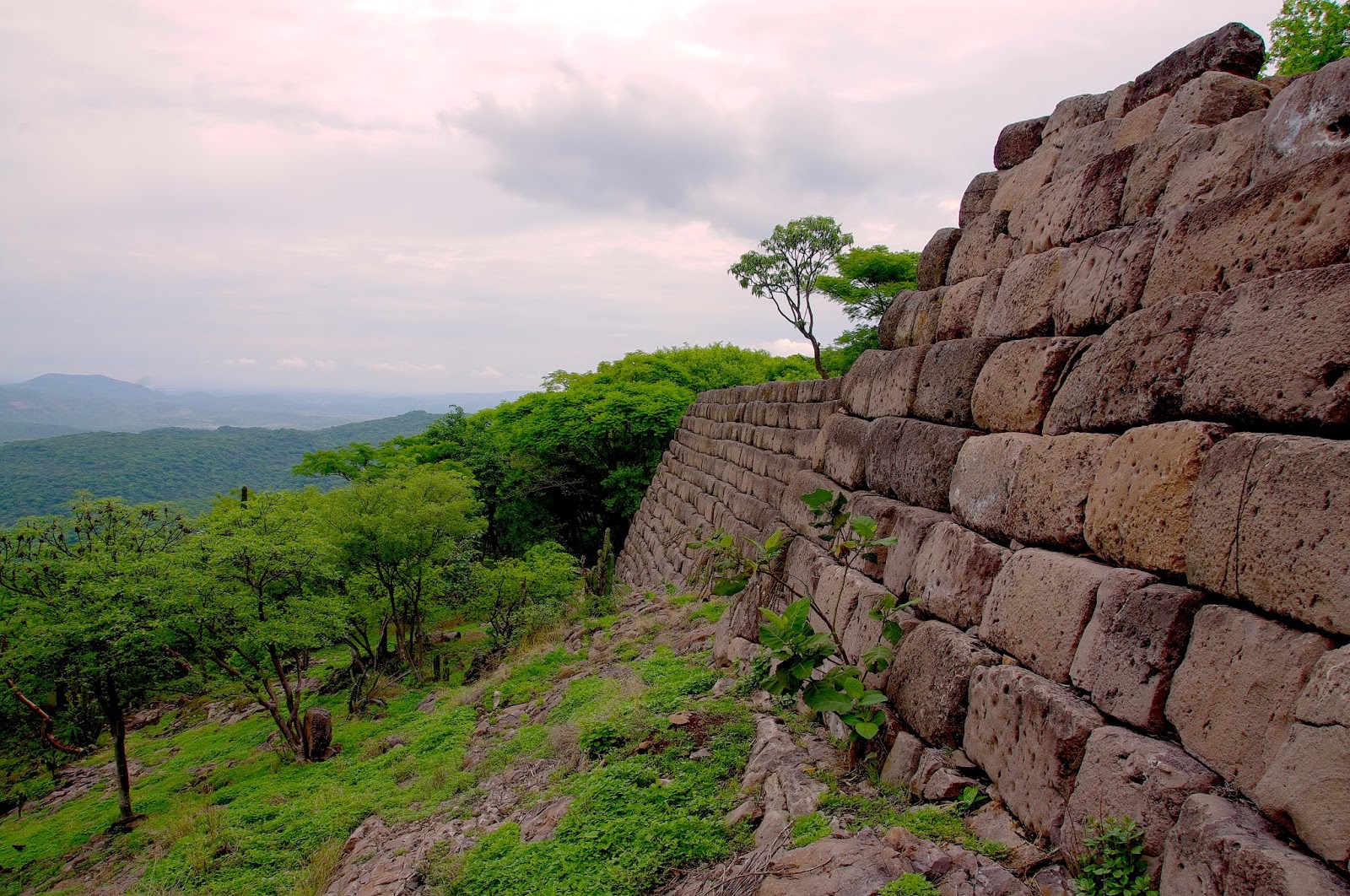
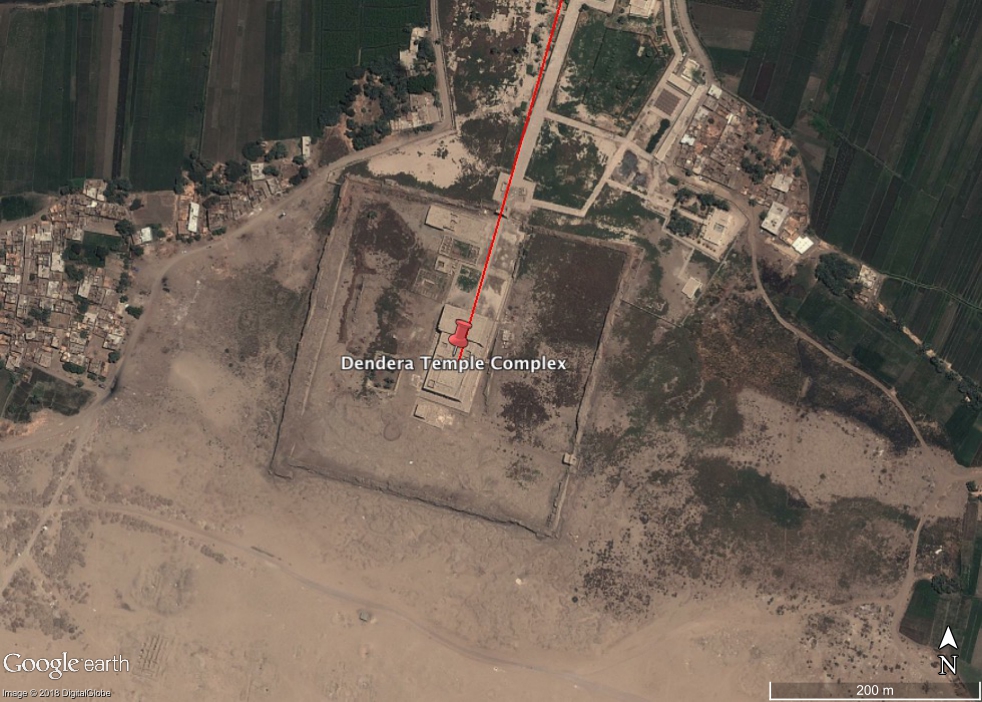
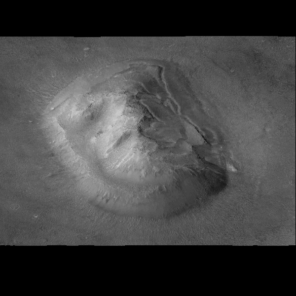
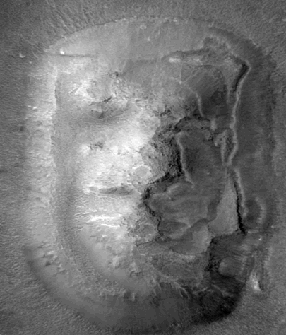
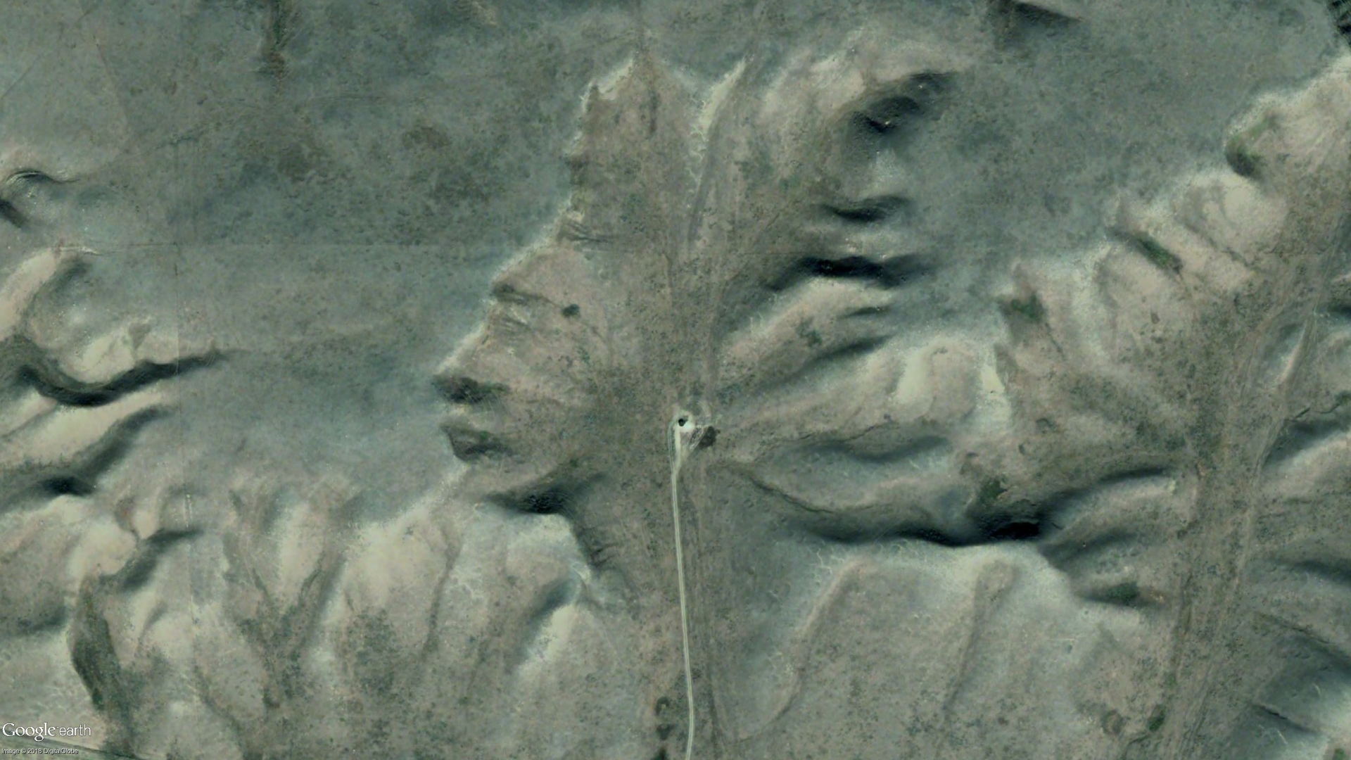
Vigato characterizes the archaeological site, which is several kilometers southwest of the town of Chimalacatlán, as “a set of dry stone platforms, placed at different levels, once connected through a system of monumental ramps and stairway” that form “a set of plazas at different levels, roughly following the profile of the natural elevation.”

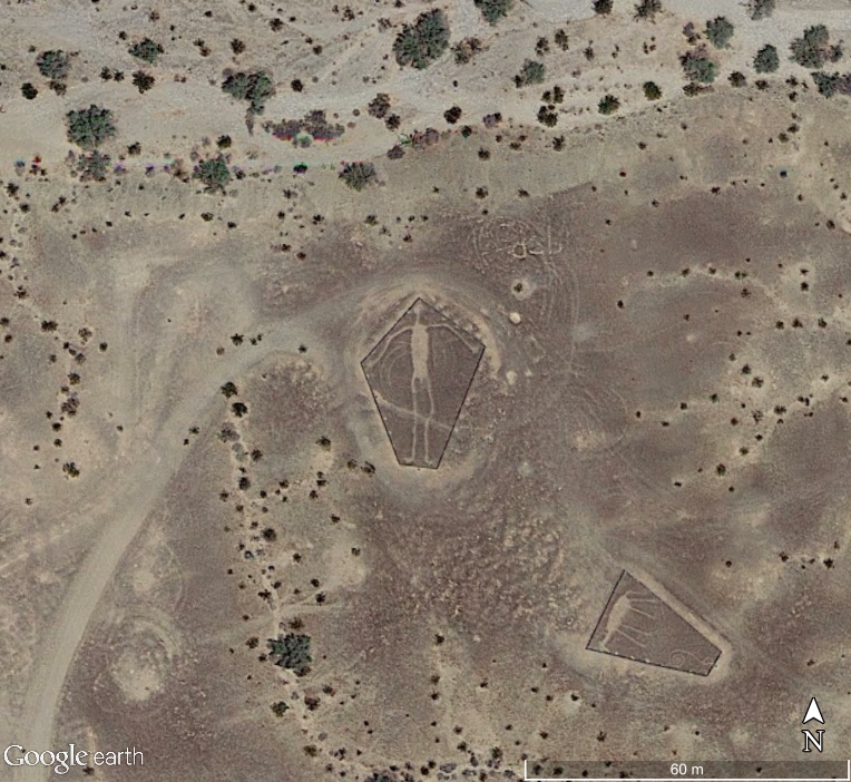
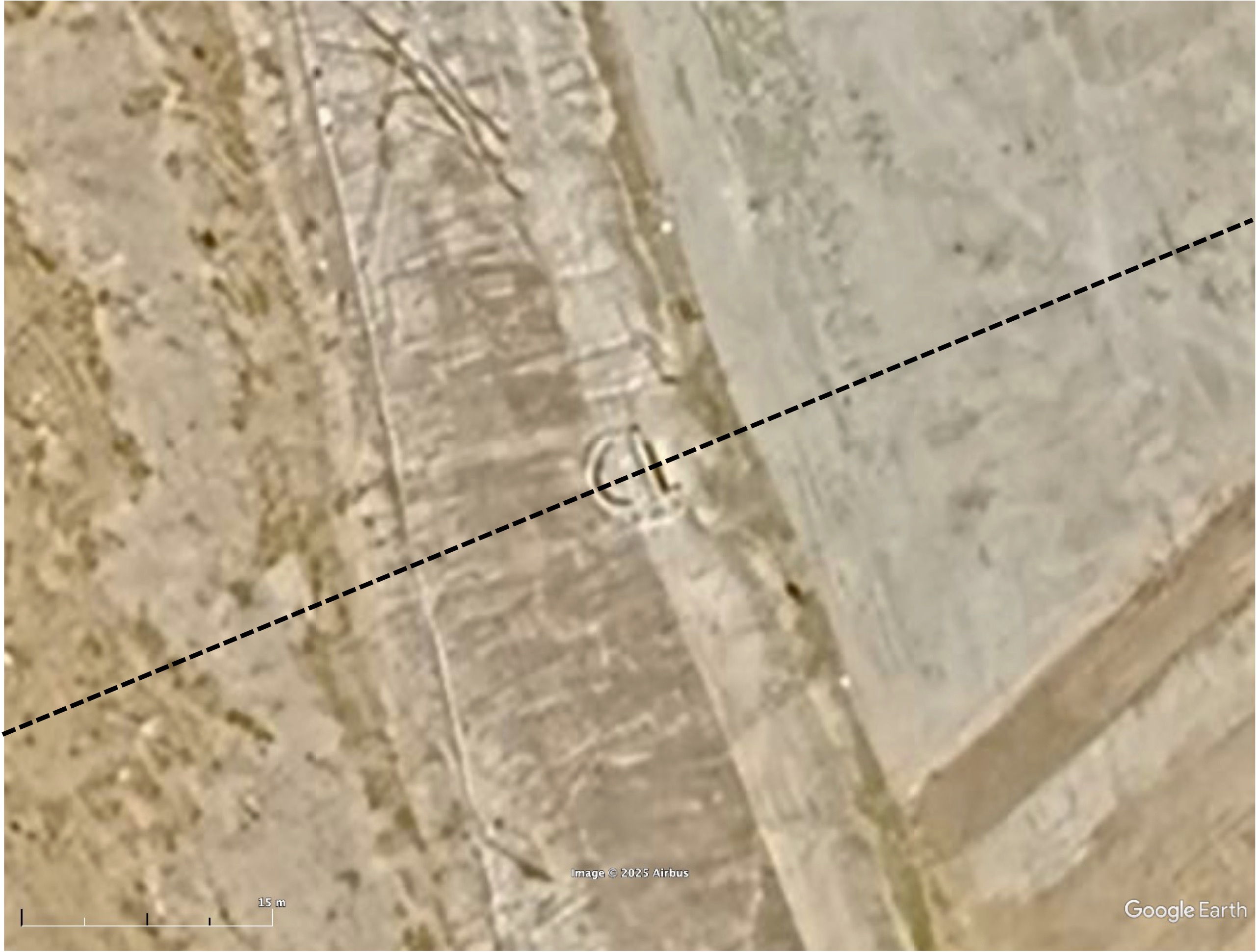
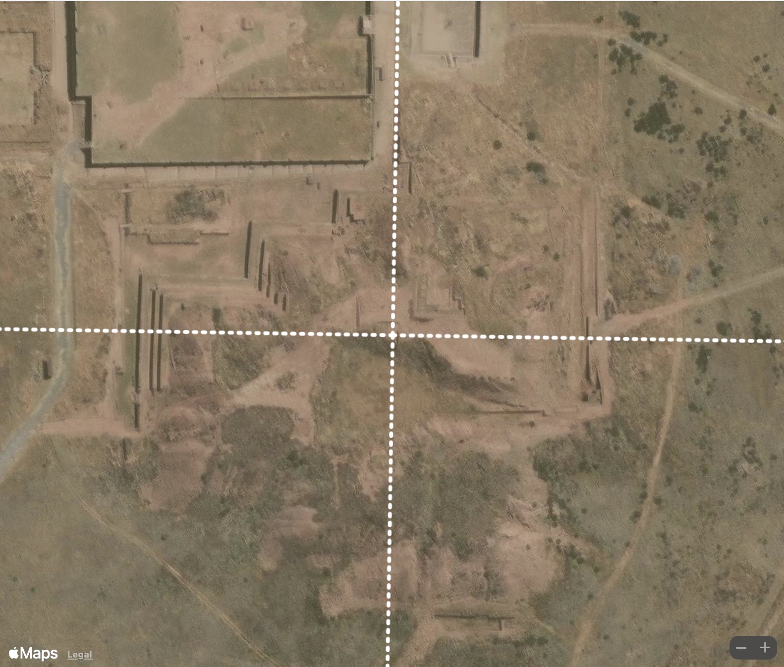
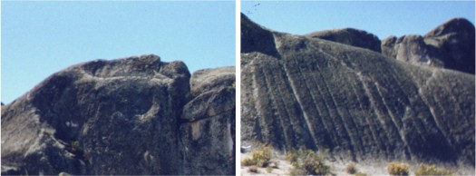
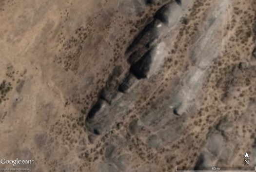
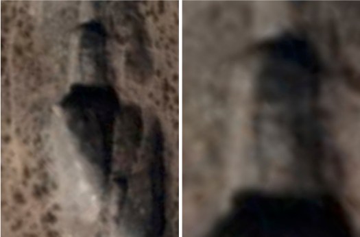
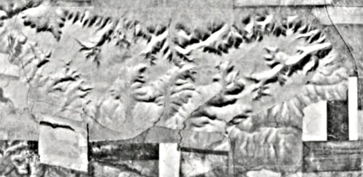
Three structures are visible in Google Earth imagery. C1 is a “megalithic acropolis” consisting of two stone platforms each about 30×30 meters in area whose “outer walls reach at least 7 to 8 meters high at the northwest corner and are entirely built of massive ashlars, some of which over 2.5 meters long. The construction is of remarkable quality and accuracy, consisting of several layers of carefully laid out and jointed megalithic stone blocks.” [2]
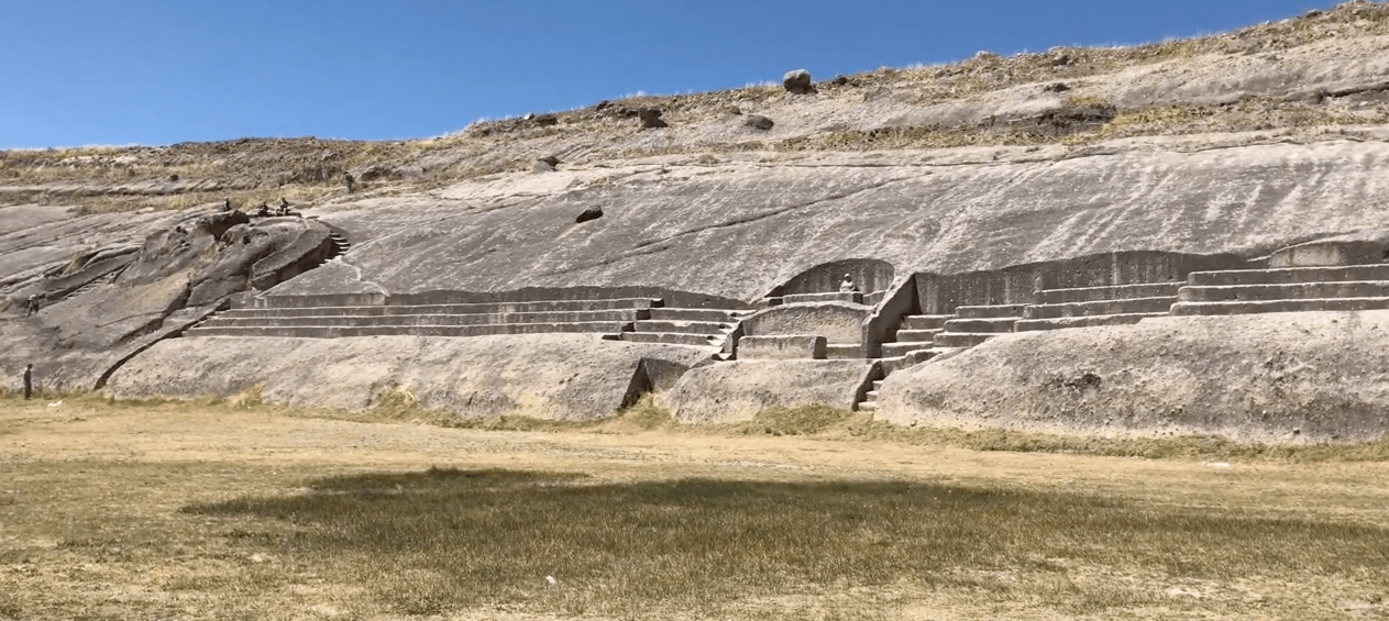
C2 is at the summit of Cerro del Venado. Vigato describes the structure as being pyramid-like in appearance, “consisting of four super-imposed terraces, all sharing the same trapezoid shape with the exception of the top platform, which is a perfect square. Although some larger stones were employed in the construction of this pyramid, and a few well-cut stone blocks are visible on some of the terraces, the workmanship is generally poorer than the rest of the megalithic platforms, employing smaller and more irregular stones.” [2]

C3 is on the Mesa del Venado near the entrance to the site. The walls of the structure are composed of mid-sized, roughly cut stones and are the least sophisticated in terms of the size and shape of the stones used suggesting the possibility that it was a later addition to the site.

Many have speculated that these ruins might be the remains of a mythical place called Tamoanchan, considered to be the cradle of all Mesoamerican civilizations. Is there a way to date Chimalacatlán based on the alignments of these structures?
Ancient Alignments
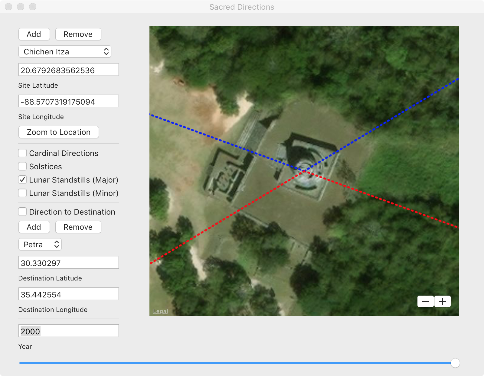
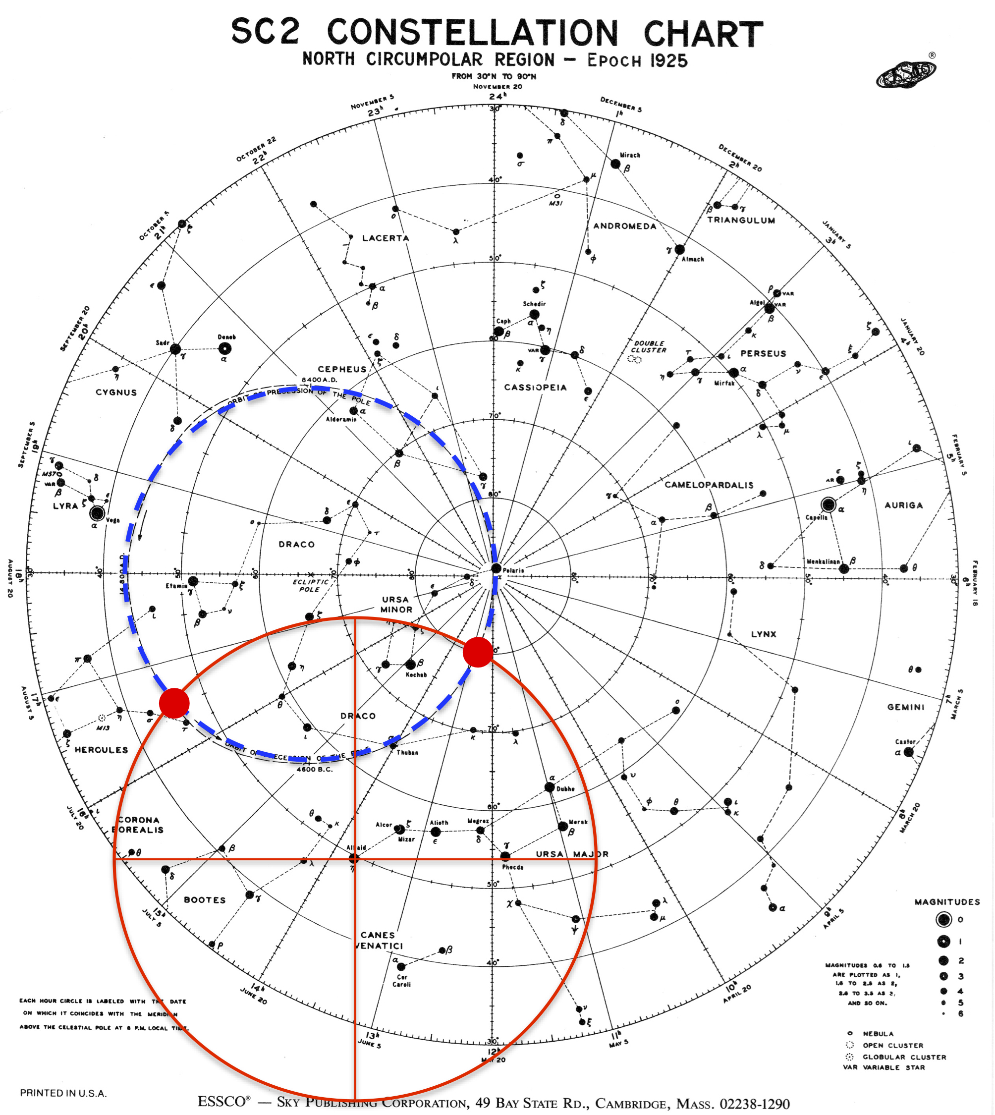
As discussed in Before Atlantis numerous sites in Mexico appear to have been aligned to ancient poles that are hypothesized to have once existed in Hudson Bay, Greenland, and the Norway Sea. For example, Teotihuacan is aligned to Hudson Bay, which based on current climate data could have been the location of the North Pole prior to the end of the last ice age, approximately 12,000 to 18,000 years ago. Tenochtitlan (today’s Mexico City) and Chichen Itza are aligned to locations in northern Greenland and the Norway Sea that could have been the locations of the North Pole at earlier climate epochs as far back as 75,000 years ago. By virtue of the alignments of these sites to older poles, we hypothesize that the sites are as old as poles.
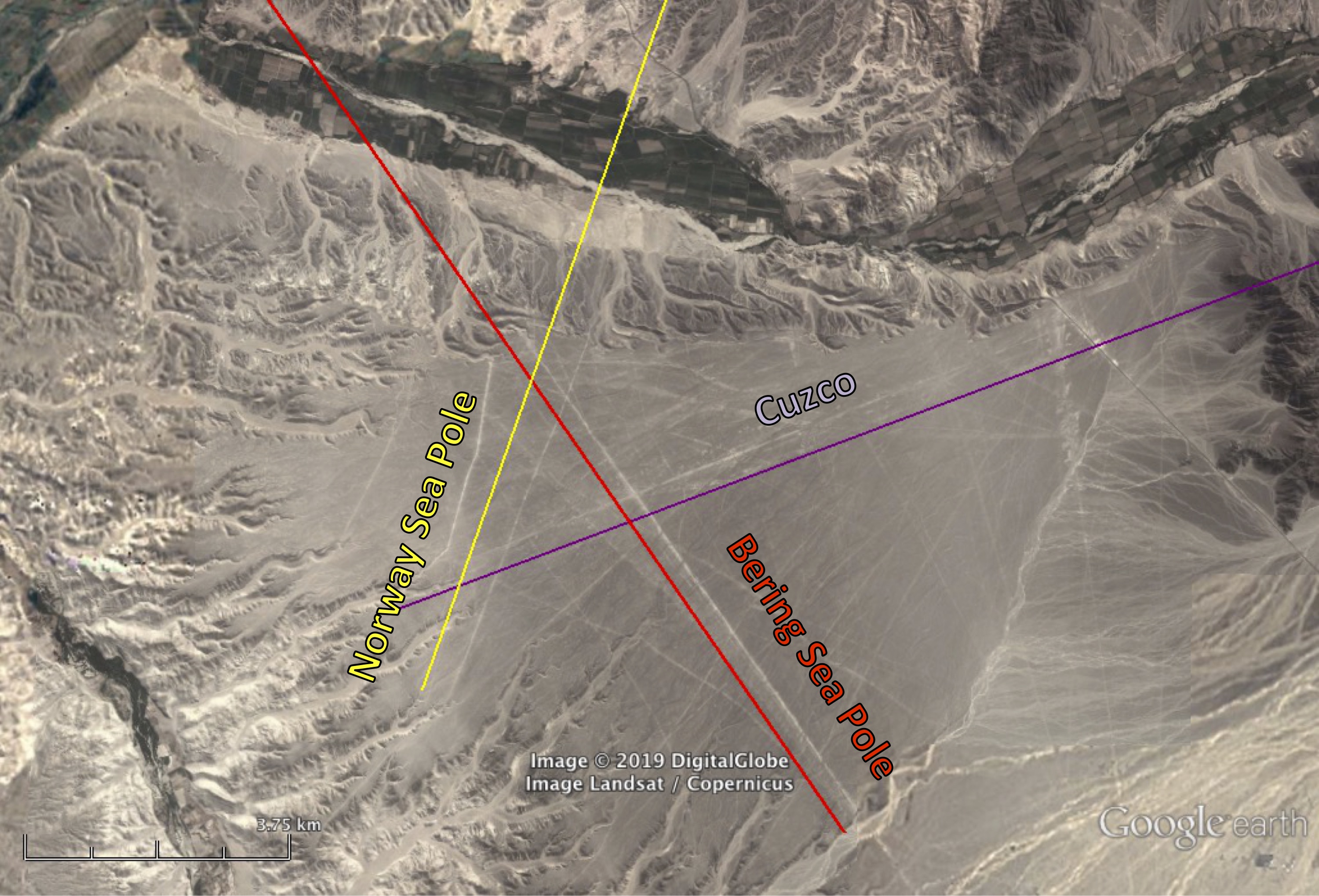
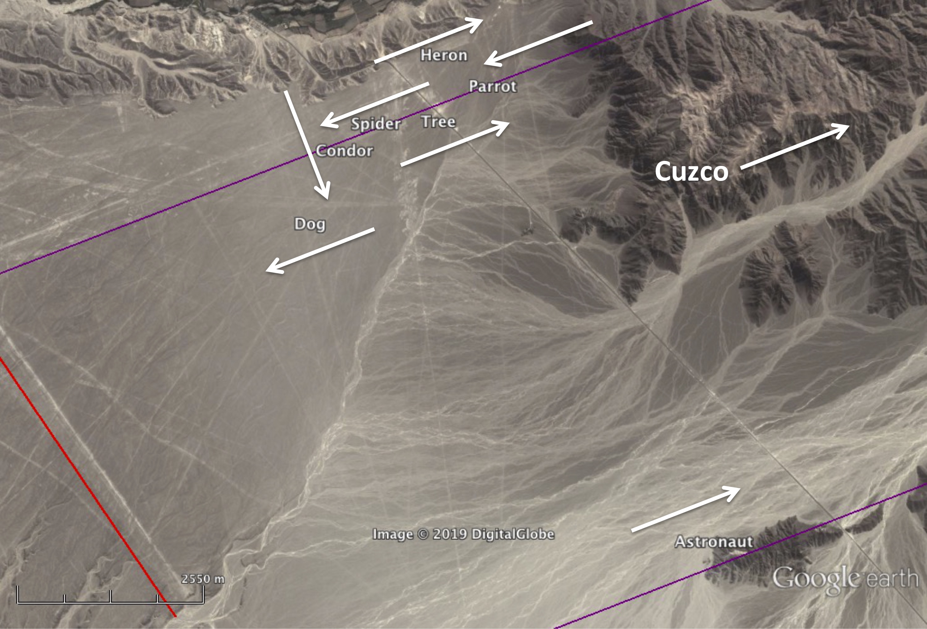
Places in South America such as Cuzco and sites in Peru’s Sacred Valley and in other parts of the world appear to be aligned to an even older pole located north of the Aleutian Islands in the Bering Sea. Up to this point, no site in Mesoamerica had been found to be aligned in the direction of the Bering Sea pole, implying that Mesoamerica was not settled until after the Bering Sea to Norway Sea pole shift, which is estimated to have occurred about 125,000 years ago.
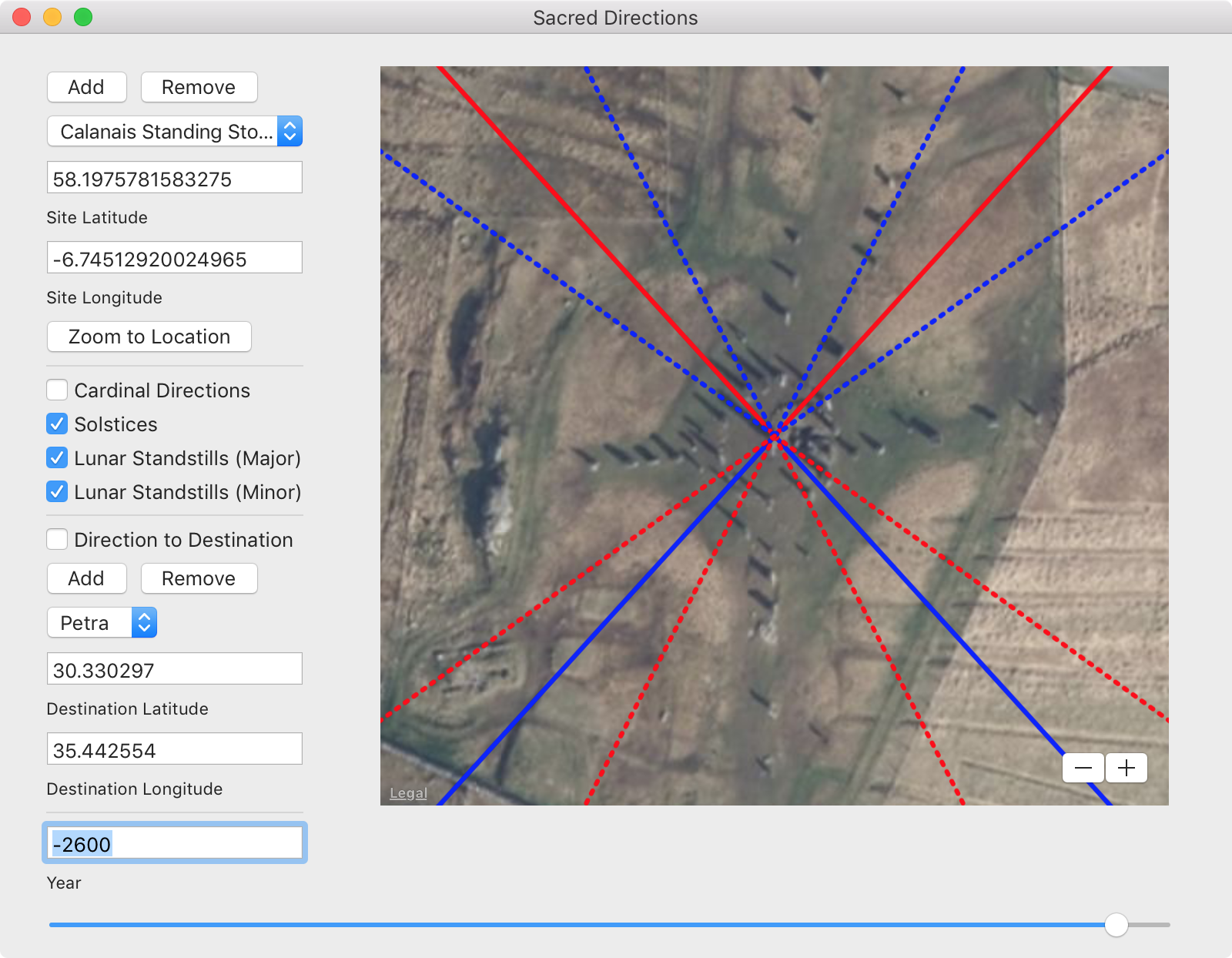
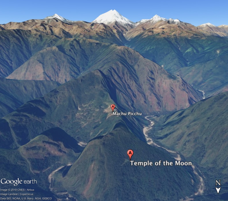
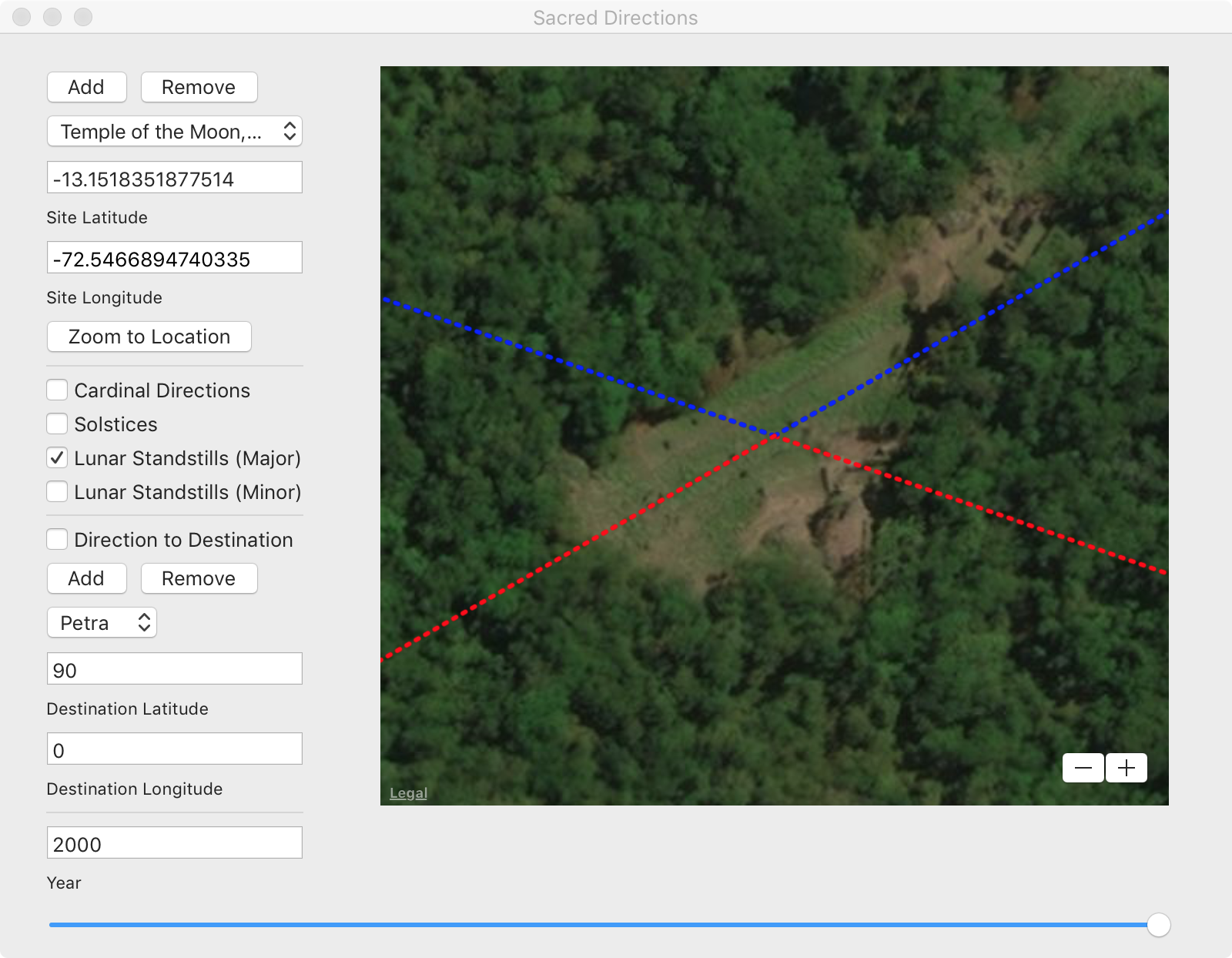
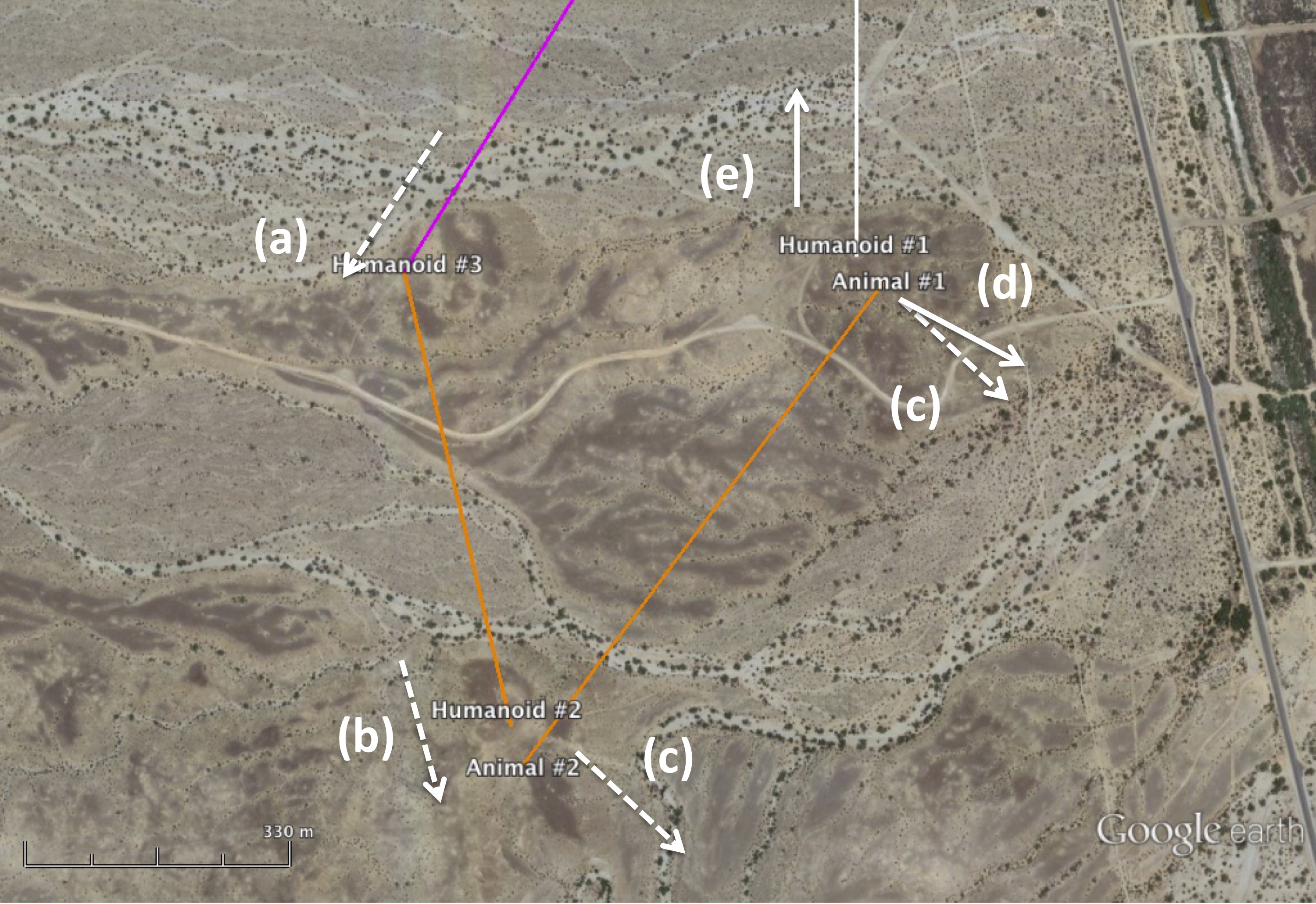
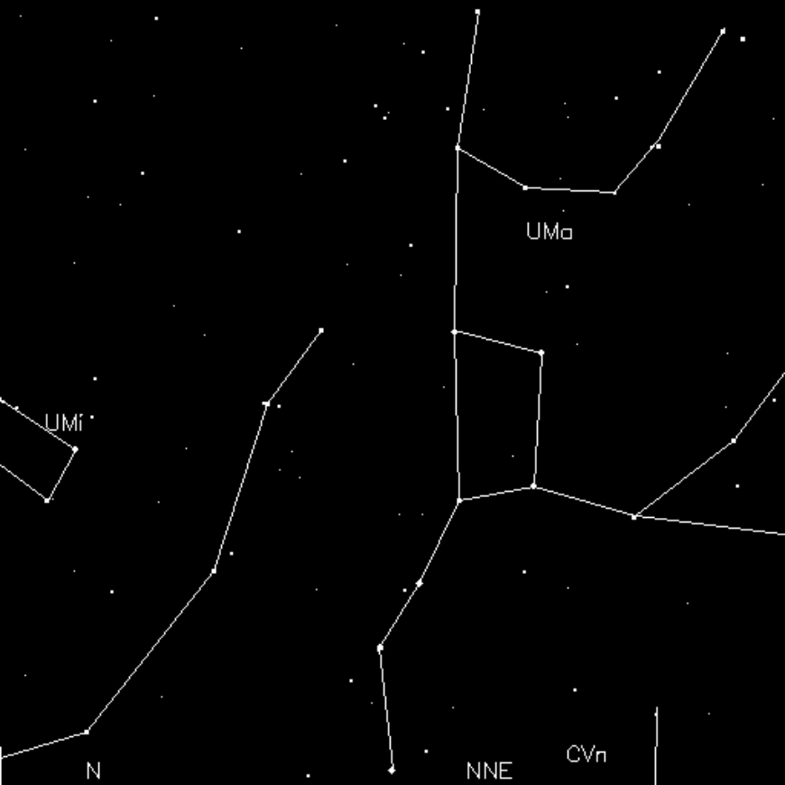
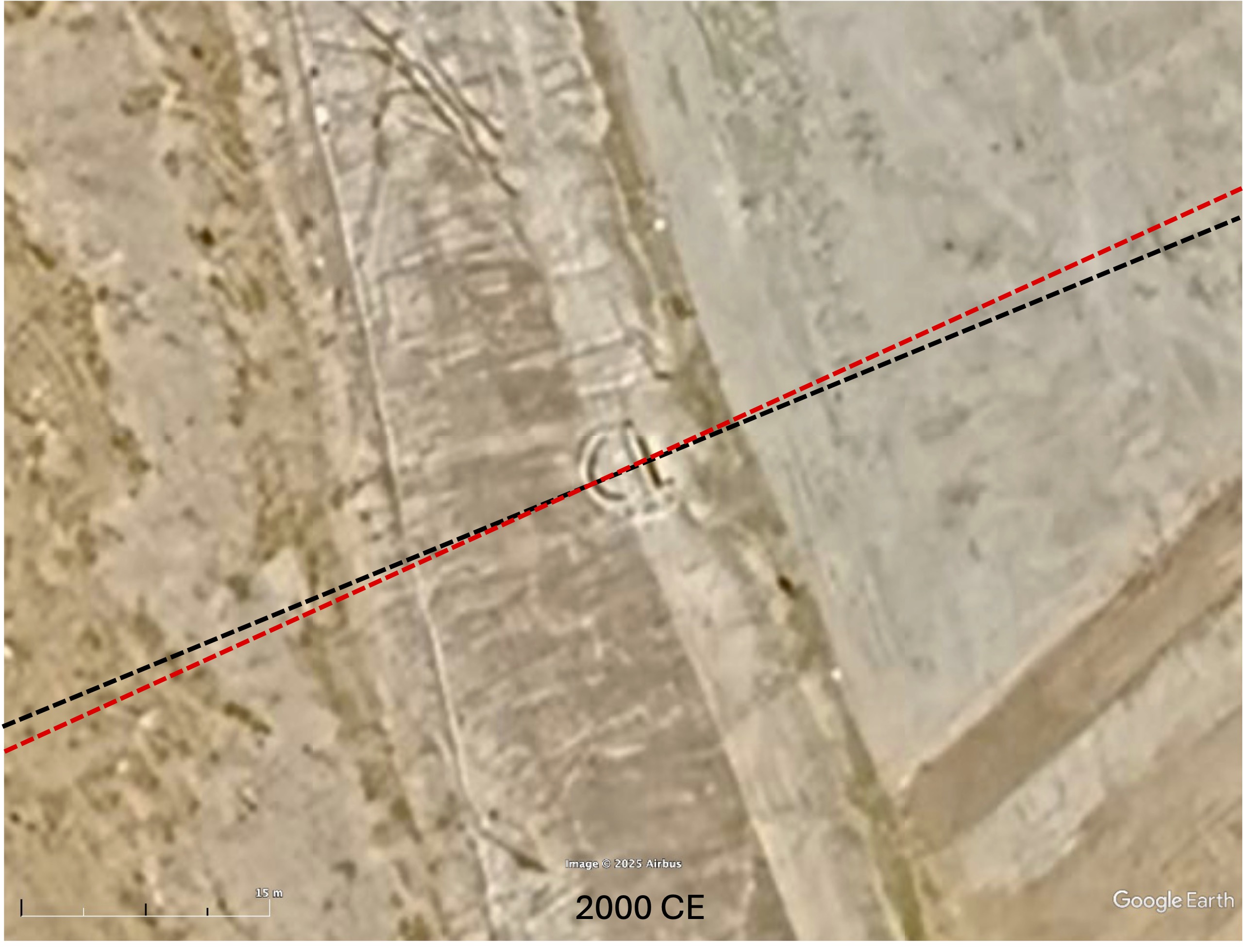
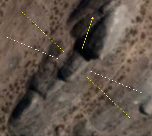
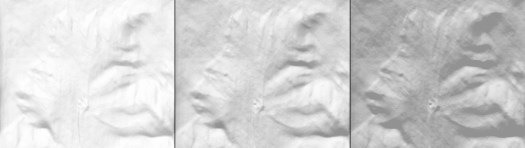
At Machu Picchu, the Temple of the Three Windows lines up with the Bering Sea pole. Similarly, at Ollantaytambo, the Wall of the Six Monoliths also faces that direction. Smaller less sophisticated structures at these sites are aligned in other directions. Figure 5 reveals that the megalithic acropolis at Chimalacatlán, the structure we call C1 is also aligned to the Bering Sea pole.
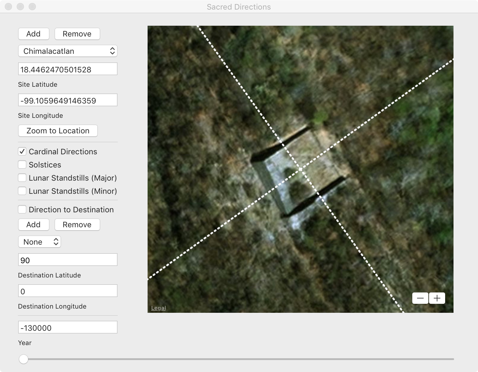
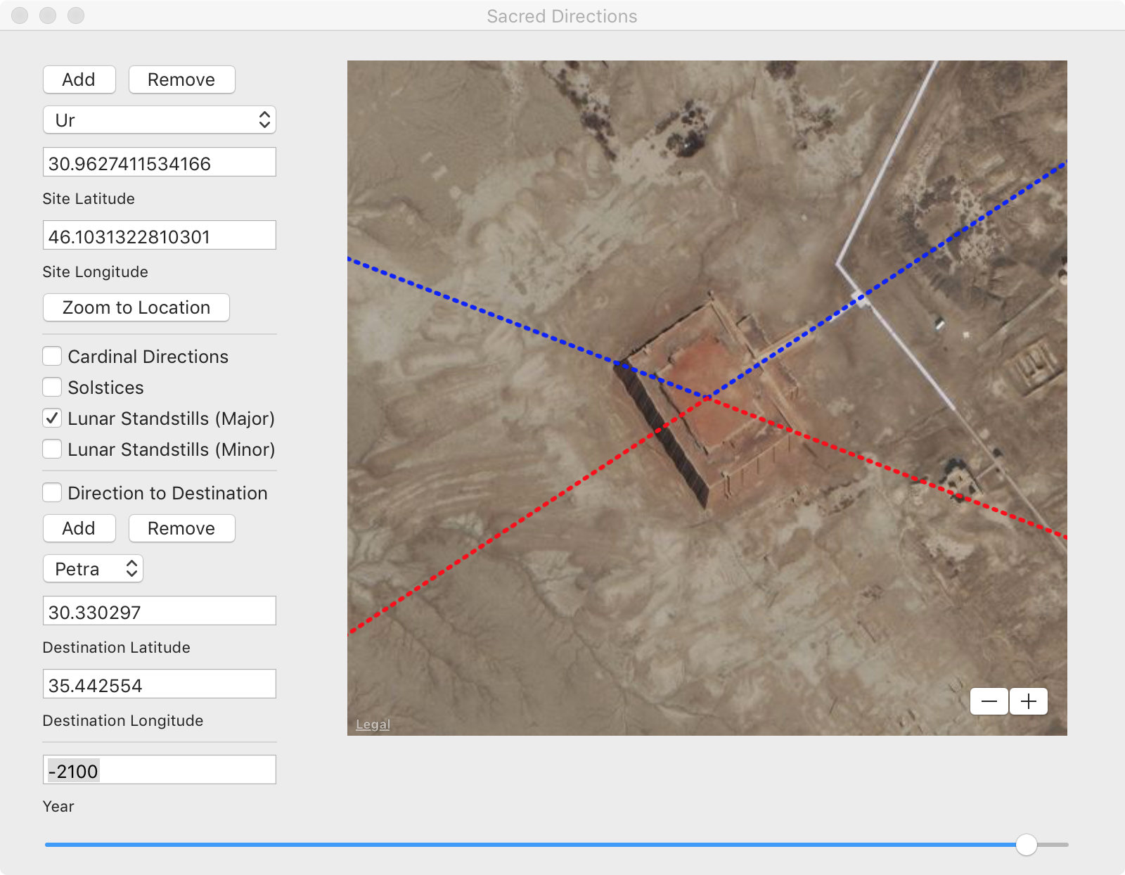
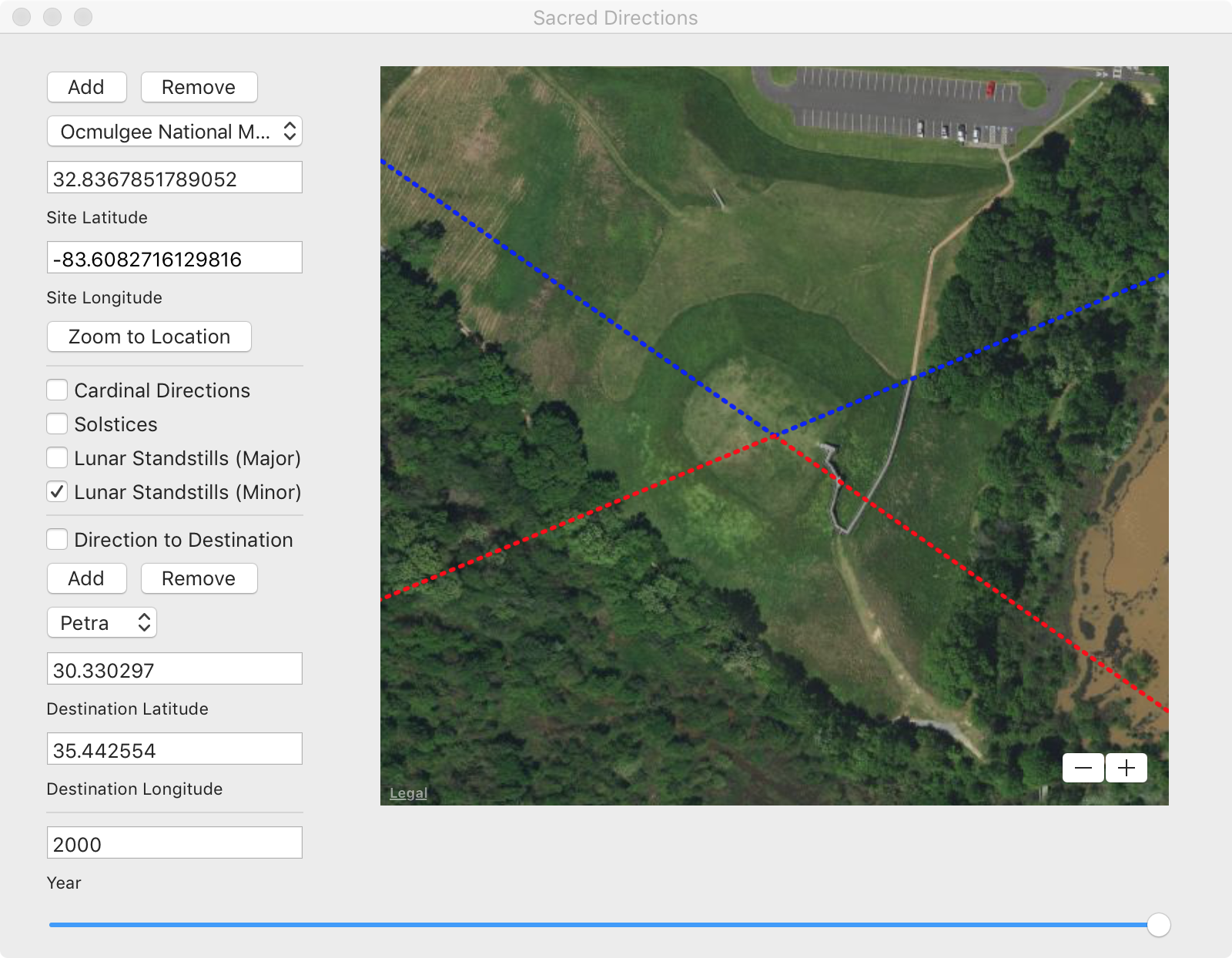
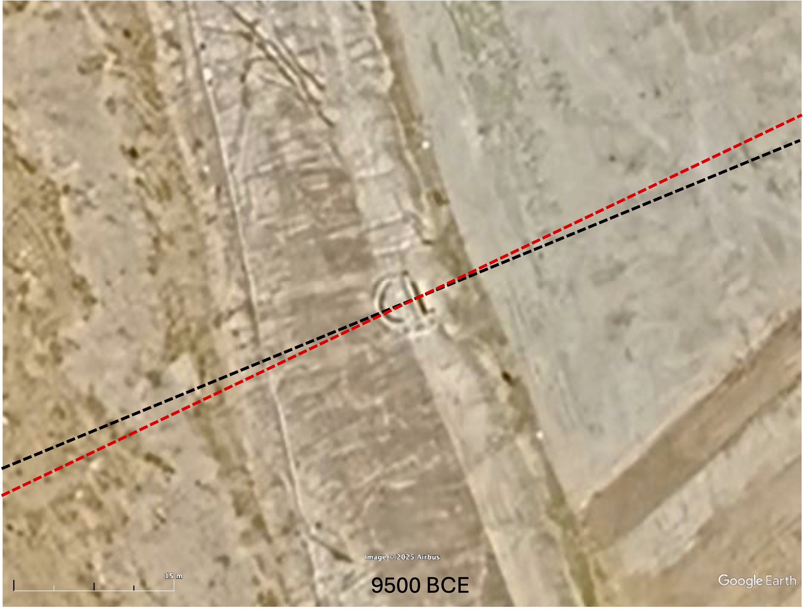
C2, the pyramidal structure uphill from C1 also references the Bering Sea pole but in another way. Where C1 would have been oriented to the cardinal directions relative to the Bering Sea pole, i.e., to the sunrise on the equinox, C2 would have faced the most northern direction of moonrise and most southern direction of moonset (Figure 6). The alignment of C3 is less clear but could have also been oriented to the moon at this time.

Other Alignments
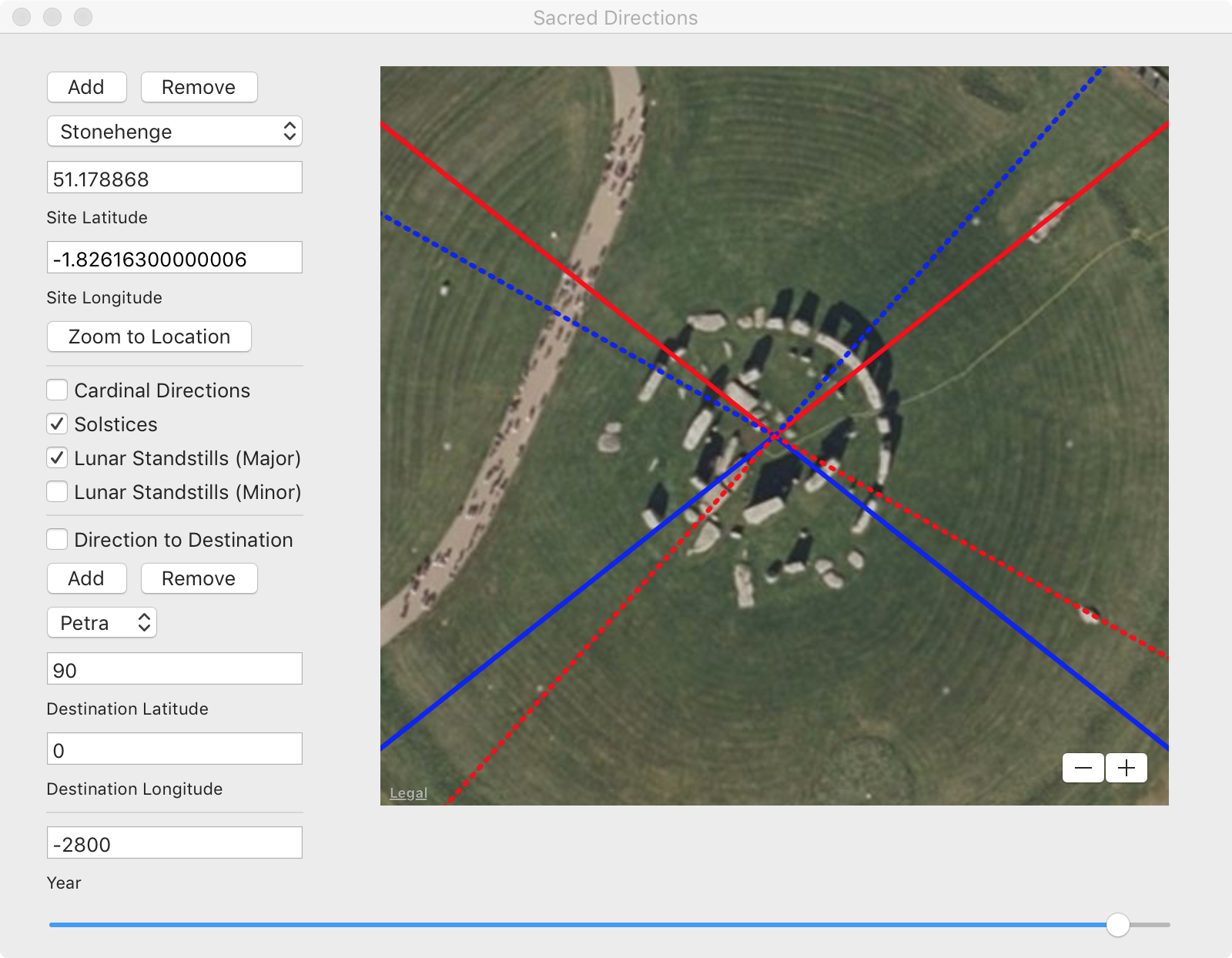
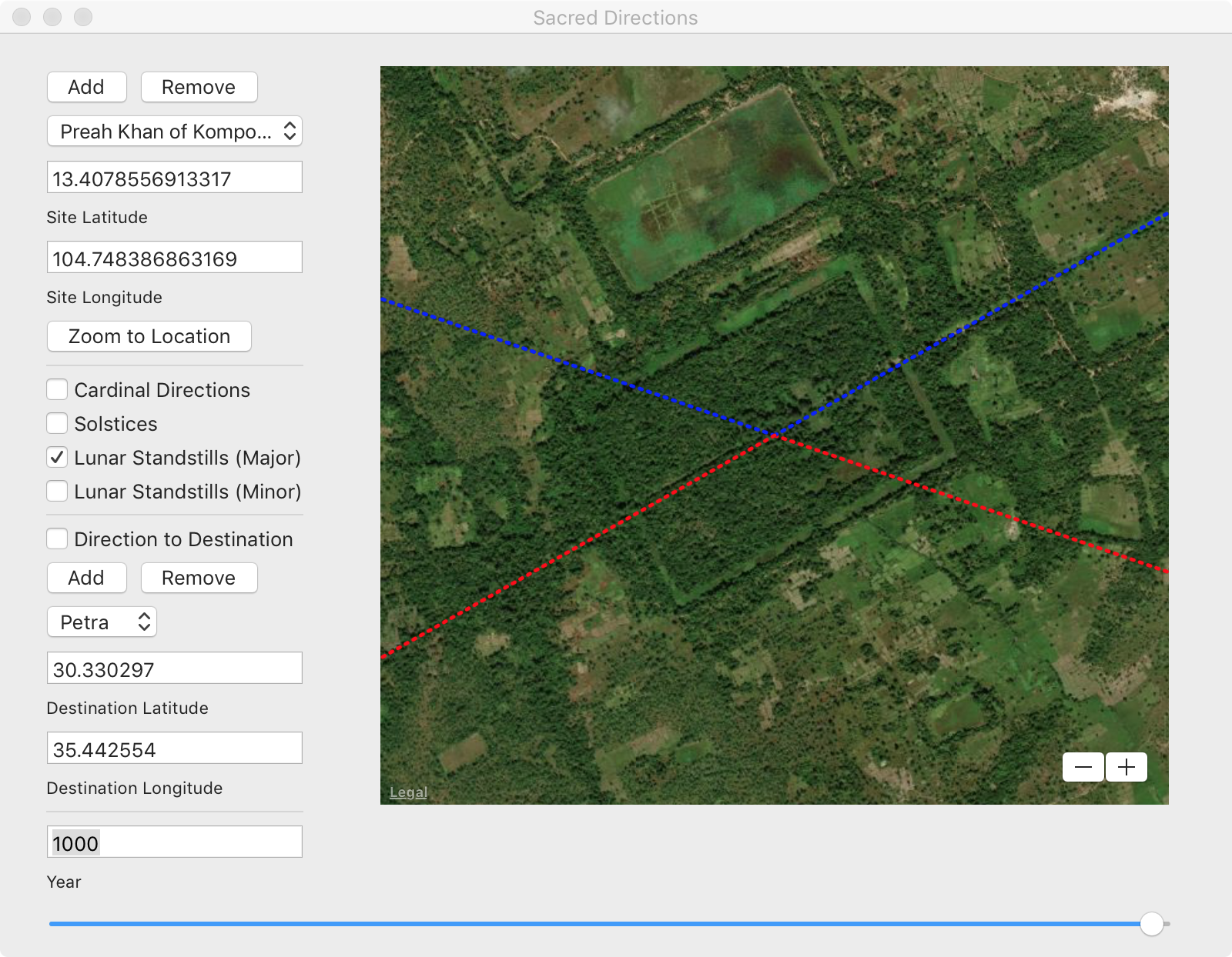
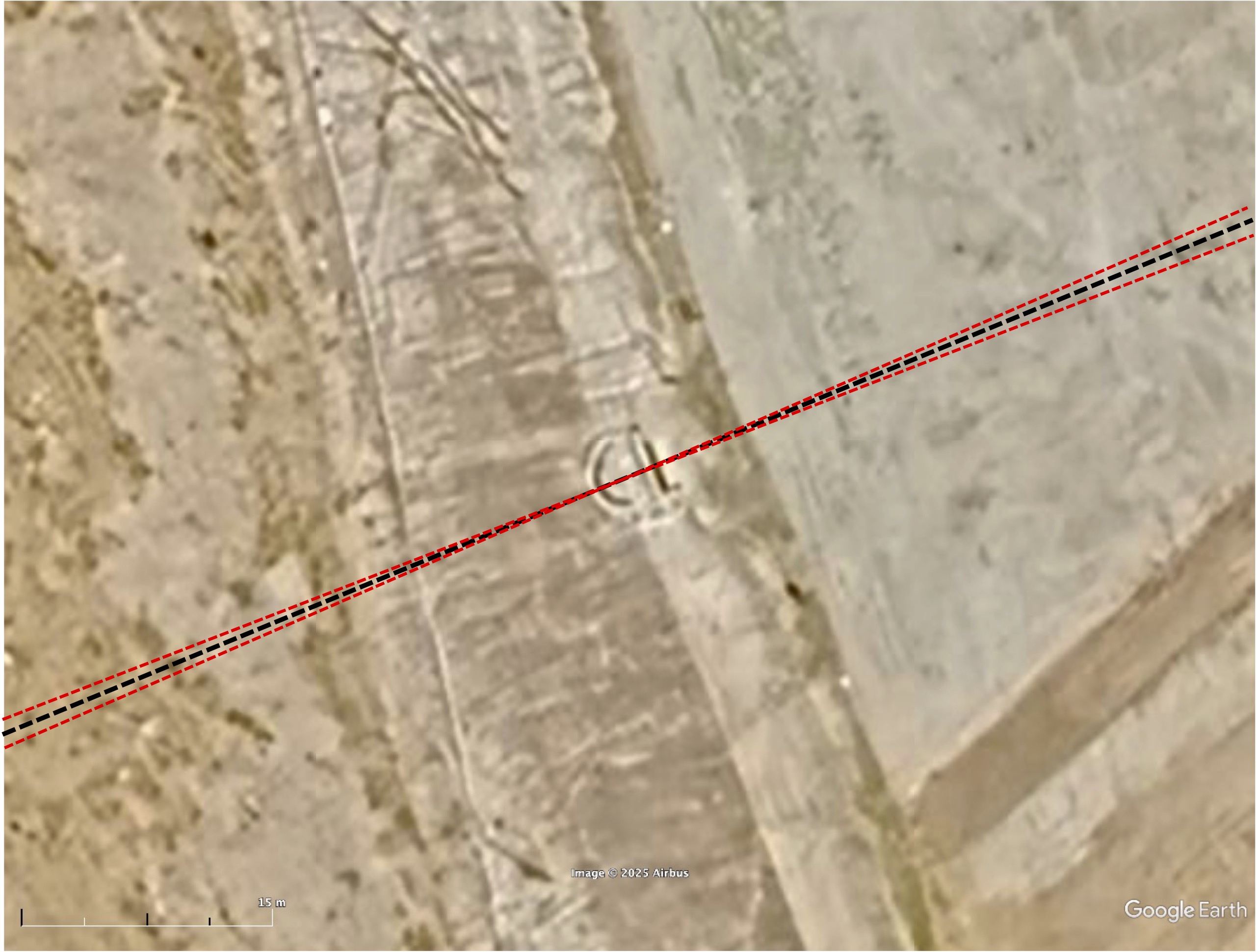
Using the Sacred Directions archaeoastronomy app it is possible to quickly assess other alignment possibilities. For example, moving the time slider forward in time to after the Bering Sea to Norway Sea pole shift, C2 became aligned both to the sun and the moon (Figure 7). This suggests the possibility that C2 could have been added later.

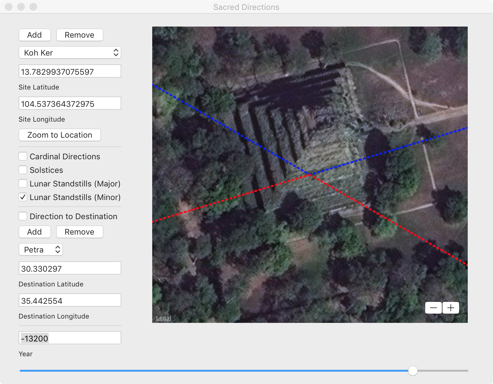
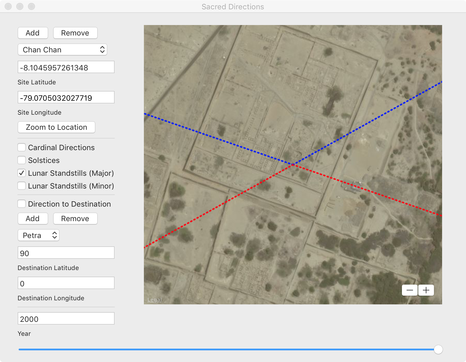
Moving the time slider to the present time reveals a less ancient but equally plausible explanation in which all three structures line up to major lunar standstills. Perhaps like other sites such as Chan Chan in Peru that might have once faced an ancient north pole and were later repurposed as lunar sites after subsequent pole shifts, the same could be true for Chimalacatlán. If so, evidence that the ancient people here worshipped the moon might be found in artifacts, iconography, or other sources of information. Otherwise, the possibility exists that the ruins at Chimalacatlán might be as old as those in Peru based on similarity in construction materials, technique, and alignment, and so could have been the first settlement in Mesoamerica.
In an article [3] published in 1896 by The American Antiquarian and Oriental Journal, Niven reported that ruins could be found in every foot-hill and mountain ridge over an area in excess of 900 square miles in this part of Mexico. If Chimalacatlán were once a part of Tamoanchan perhaps other sites can be found and analyzed in this context.
References
[1] Robert S. Wicks and Roland H. Harrison, Buried Cities, Forgotten Gods: William Niven’s Life of Discovery and Revolution in Mexico and the American Southwest, Texas Tech University Press, 1999.
[2] Marco Vigato, “Lost Cities of the Mexican Highlands,” Uncharted Ruins.
[3] “Remarkable Discovery of the Ruins of a Prehistoric City in Mexico,” The American Antiquarian and Oriental Journal Vols. 18-19, 1896.


