


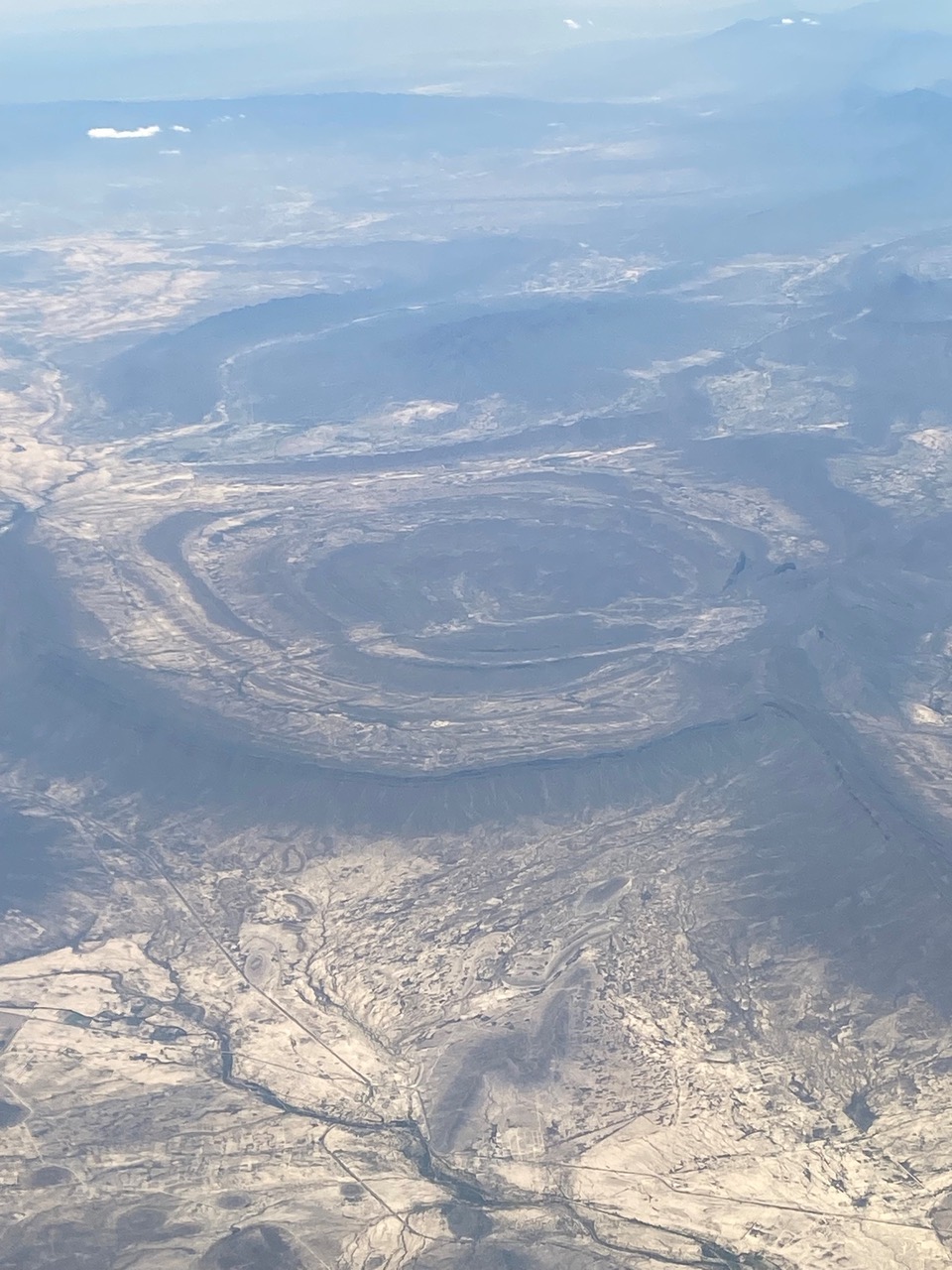
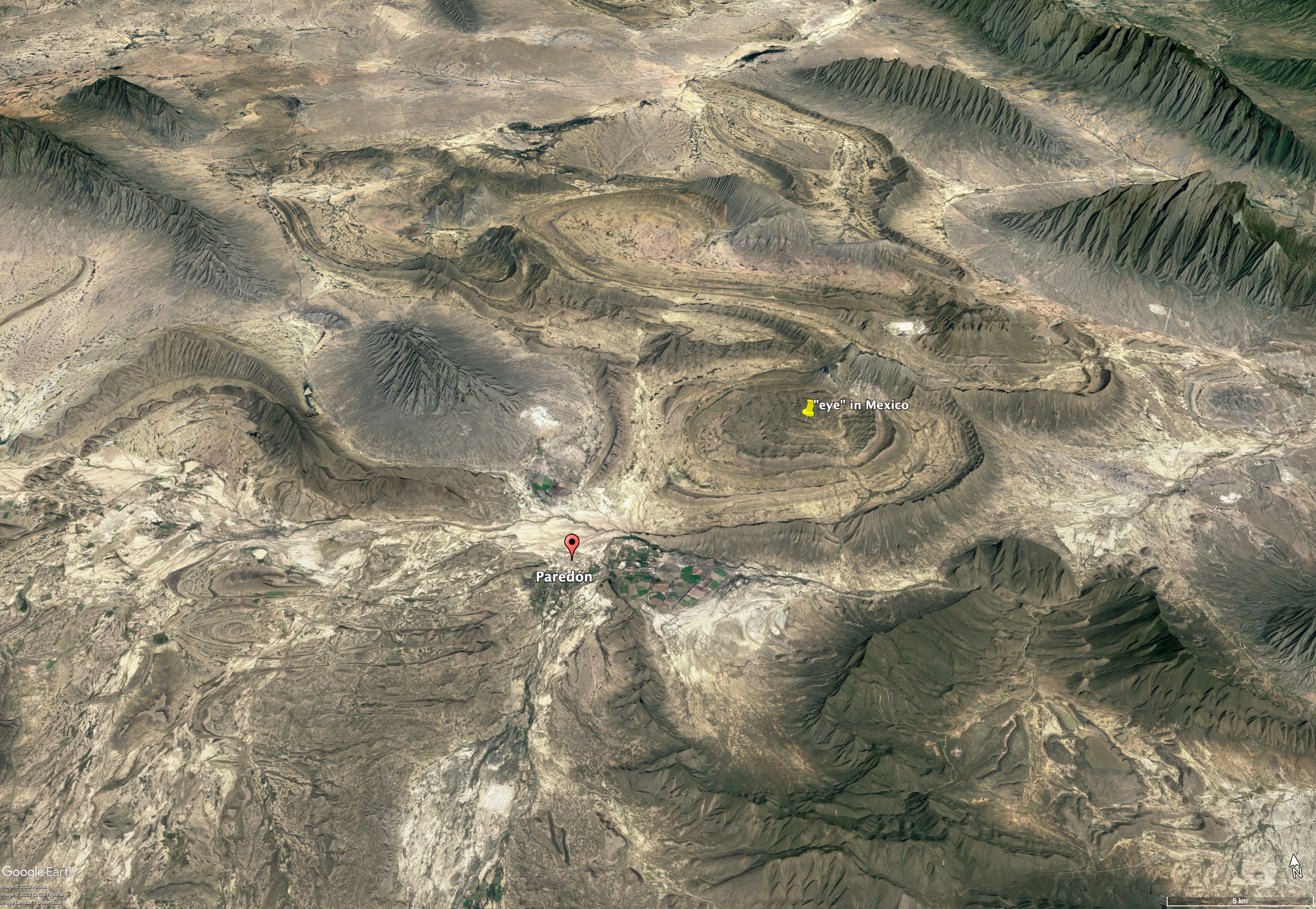
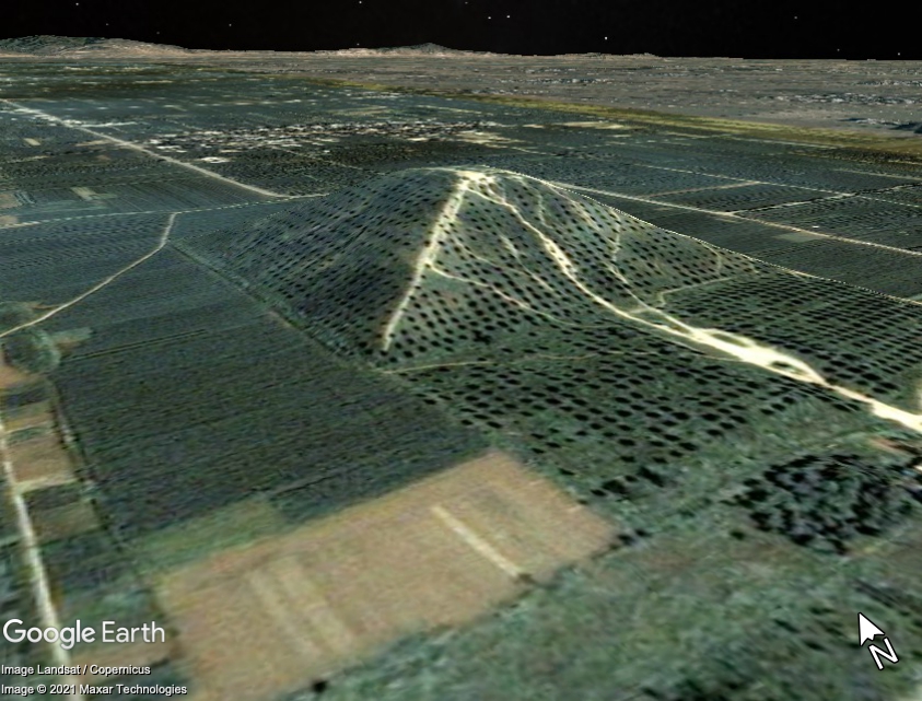
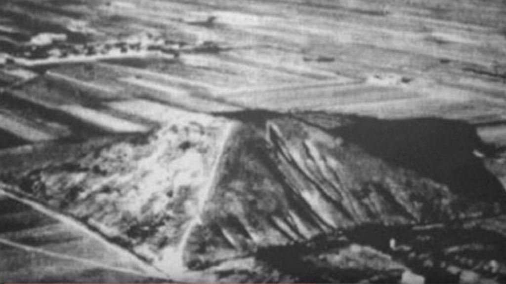
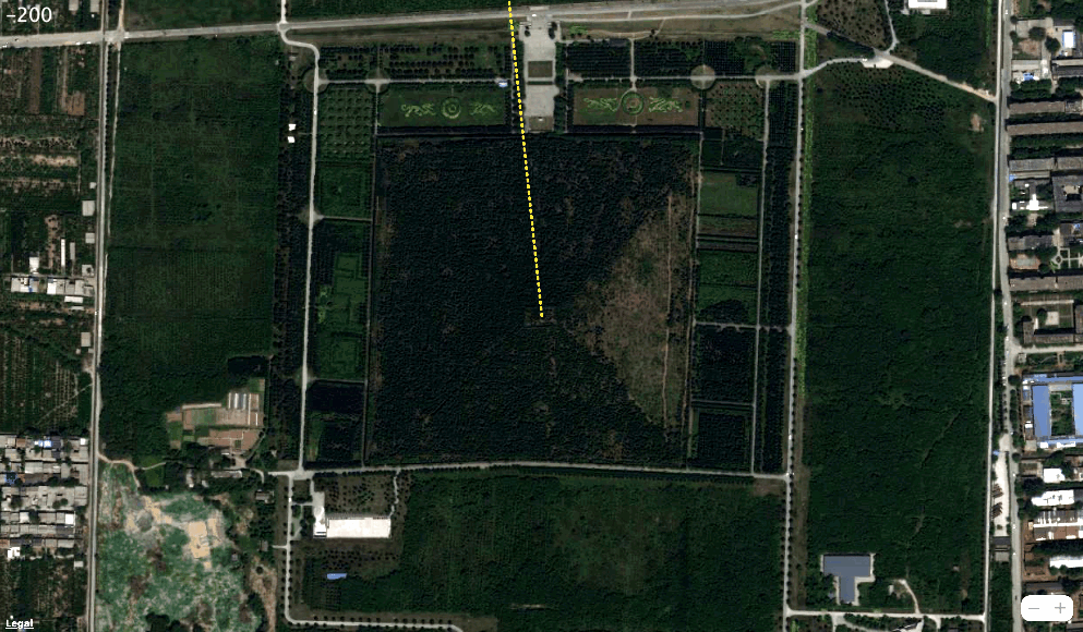
The Richat Structure also known as the “eye” of the Sahara in Mauritania is a deeply eroded geological structure of exposed layers of sedimentary rock that appear as concentric rings. Because of its shape, some believe it to be the remains of Plato’s Atlantis. Scott Sanem contacted me about a similar structure in Paredon located in northeastern Mexico that he has seen many times from the air.

Elephant Remains in Mexico
Wondering if this feature like the Richat Structure could be evidence of a previous civilization in this part of the world, Scott discovered an interesting article in the November and December 1903 issue of The American Antiquarian. The article entitled “Elephant Remains in Mexico” begins with the following introduction:
From the City of Mexico comes a statement bearing the signature of Dr. Nicholas Leon, archaeologist of the National Museum of Mexico. The signature would justify the belief that proper investigation of the facts related has been made. The one great fact is that an ancient city, which was located near the present town of Paredon, in the state of Coahuila, some 500 miles north of the City of Mexico, was suddenly destroyed in some past age by an overflow of water and mud, and that its remains are still existent on the spot. Many massive walls have been found, but they are covered with a mass of deposited earth, sixty feet in thickness. And mingled in this earth are human skeletons, the tusks of elephants, etc., distributed in a way which indicates that the overflow of water and mud was sudden, giving no time for escape.
Dr. Leon, who was one of the most respected archaeologists in Mexico at this time, joined the National Museum in Mexico City in 1900 and became head of the Department of Anthropology. The article continues:
The account which has fallen under our notice is somewhat brief. We cannot vouch for its accuracy, and simply present the report:
Portions of buildings, so far unearthed, show that the city — at least the largest of the cities were covered by the debris of the flood, there being at least three cities destroyed— was very extensive. The indications are that there were many massive structures in the fallen city, and that they were of a class of architecture not to be found elsewhere in Mexico. According to the estimates of the scientists under whose directions the excavations are now being made, the city in question had a population of at least 50,000.
The destruction which was brought by the flood was complete. All the inhabitants of the cities were killed, as well as all the animals. Skeletons of the human inhabitants of the cities and of the animals are strewn all through the debris, from a depth of three feet from the surface to a depth of sixty feet, showing that all the debris was deposited almost at once. Measurements show that the debris is on an average, sixty feet-deep where the largest of the cities stood.
Most remarkable of the minor finds that have been made at Paredon is that of the remains of elephants. Never before in the history of Mexico has it been ascertained positively that elephants were ever in the service of the ancient inhabitants. The remains of the elephants that have been found at Paredon show plainly that the inhabitants of the buried cities made elephants work for them. Elephants were as much in evidence in the cities as horses. Upon many of the tusks that have been found were rings of silver. Most of the tusks encountered so far have an average length, for grown elephants, of three feet, and an average diameter at the roots of six inches. Judging from the remains of the elephants so far unearthed, the animals were about ten feet in height and sixteen to eighteen feet in length, differing very little from those at present in existence.
Several editorial comments follow that leave with reader with some doubt about the credibility of Dr. Leon’s report:
Now, these statements in reference to the elephants’ bones found among the ruined cities need confirmation, before they are accepted by the majority of archaeologists. It is true that the tusks and bones of mastodons are frequently found in the swamps of Michigan, Ohio, and Indiana, but they are supposed to belong to the same species which are found in the frozen mud of Siberia and the gravels of the Northwest coast. A species covered with hair and adapted to the cold climate, and quite different from any-that would be found as far south as Mexico. The circumpolar regions are full of these creatures, which have perished, but their bodies have been preserved in the ice-beds. Other animals, such as the buffalo and bison, have over run portions of this continent, since the days of the mastodon, but none of them reached as far south as Mexico.

An Ice Age Civilization in Northeastern Mexico?
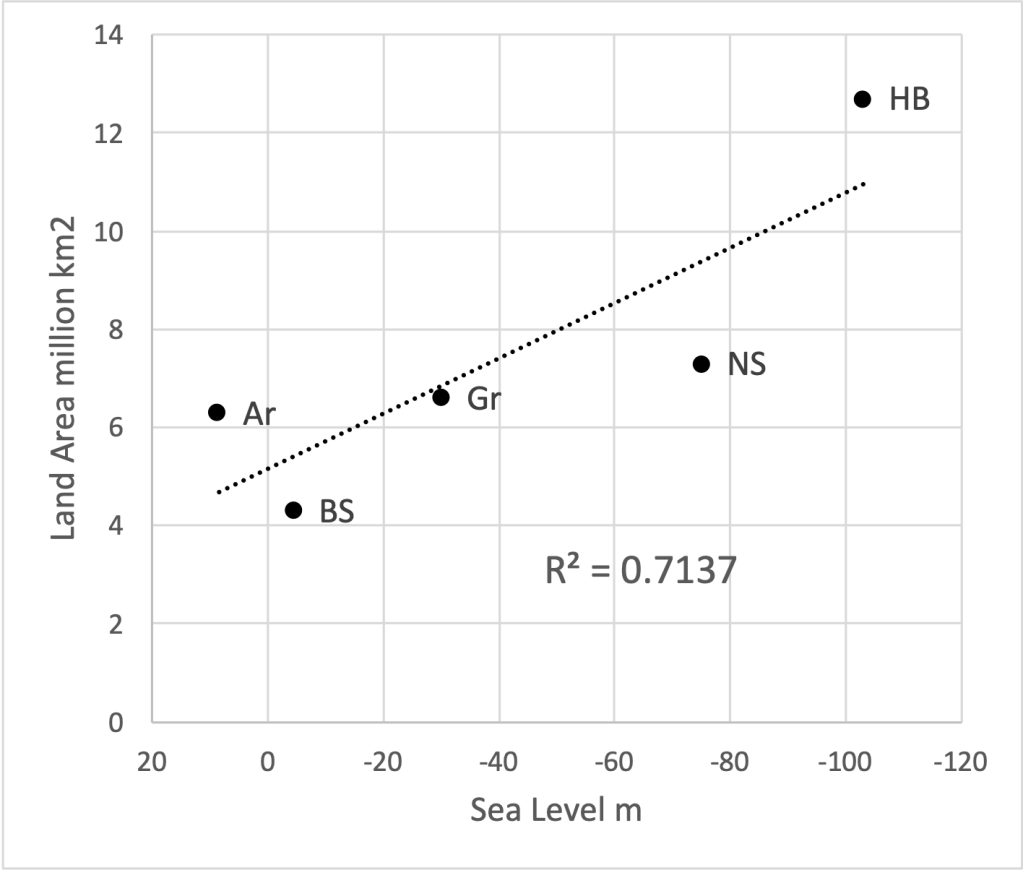
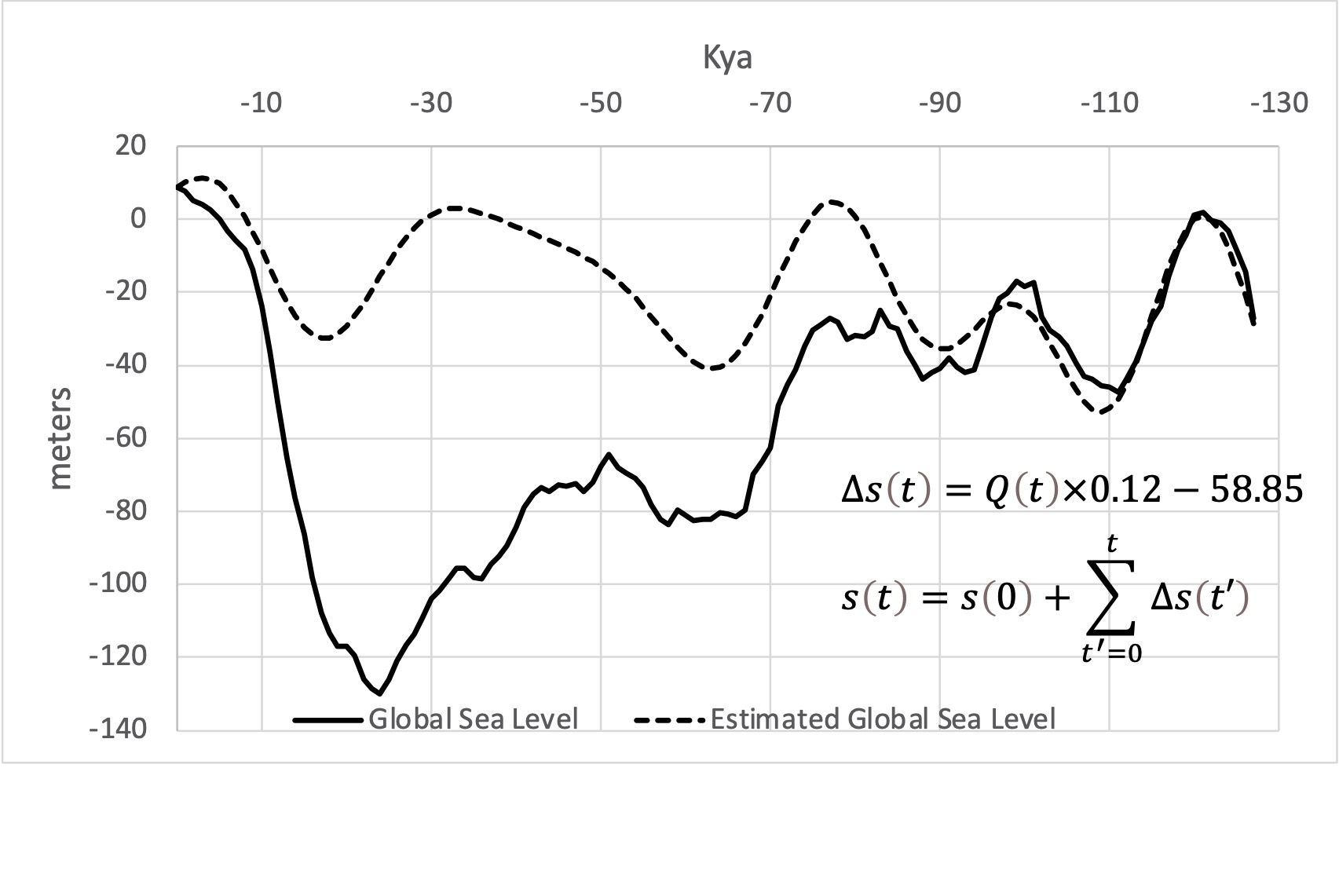
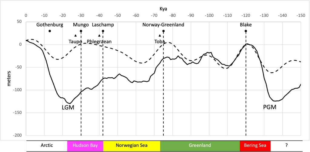
The discovery of hundreds of mammoth skeletons recovered at an airport construction site north of Mexico City in 2020 suggests the bones unearthed by Dr. Leon were not those of elephants but of mammoths. As we saw in the previous article, if we accept the possibility of crustal displacements as a working hypothesis, according to Hapgood’s theory, if the North Pole were in Hudson Bay during the North American ice age, most of the places mammoth remains have been found would have been in the temperate zone relative to the former pole. That region, which is known as the Mammoth Steppe stretches from the Iberian Peninsula in western Europe, across Eurasia, through Beringia, and into North America. The discovery of mammoth remains near Mexico City suggests this region extended into Northern Mexico.

The bones found at “Mammoth Central” near Mexico City are estimated to be 10,000 to 20,000 years old. If the elephant remains found by Dr. Leon were those of mammoths, then this portion of his report becomes extremely interesting:
The one great fact is that an ancient city, which was located near the present town of Paredon, in the state of Coahuila, some 500 miles north of the City of Mexico, was suddenly destroyed in some past age by an overflow of water and mud, and that its remains are still existent on the spot. Many massive walls have been found, but they are covered with a mass of deposited earth, sixty feet in thickness. And mingled in this earth are human skeletons, the tusks of elephants, etc., distributed in a way which indicates that the overflow of water and mud was sudden, giving no time for escape.
Geological Evidence of a Crustal Displacement?
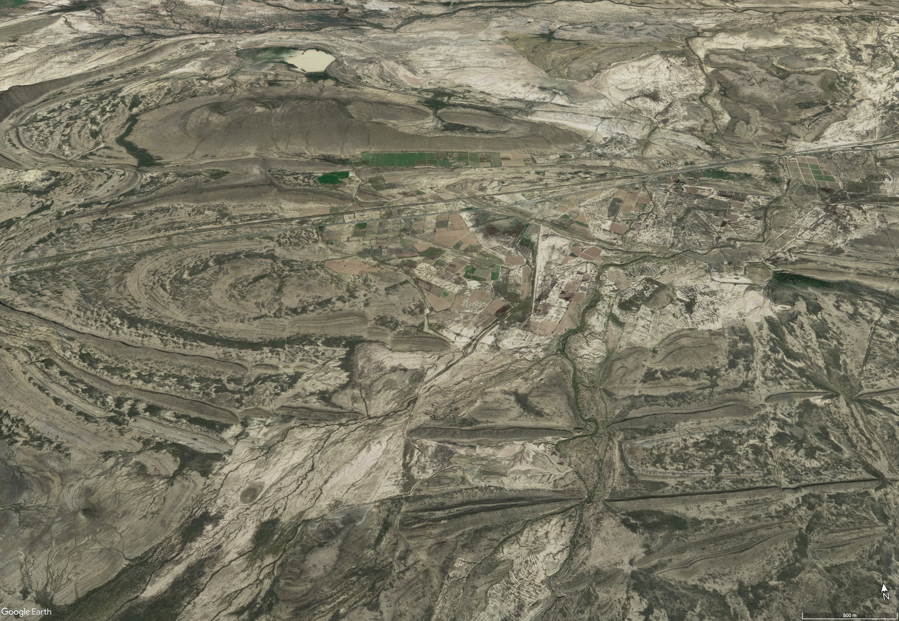
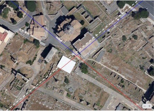
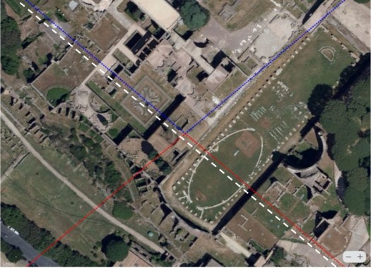
The Richat Structure is thought to be a kind of symmetrical uplift feature known as a dome, probably volcanic in origin. Where the Richat Structure is an isolated formation in the Sahara, the “eye” of Mexico, exists along with other similar features in a region that lies between the mountains to the west and the coastal plain to the east.
Although it is not itself an impact feature, domes can sometimes be found near impact craters. Besides volcanism, domes can also form as the result of a process known as diapirism in which less dense materials rise to the surface, and from horizontal stresses resulting in the formation of a system of basins and domes, a process known as refolding.
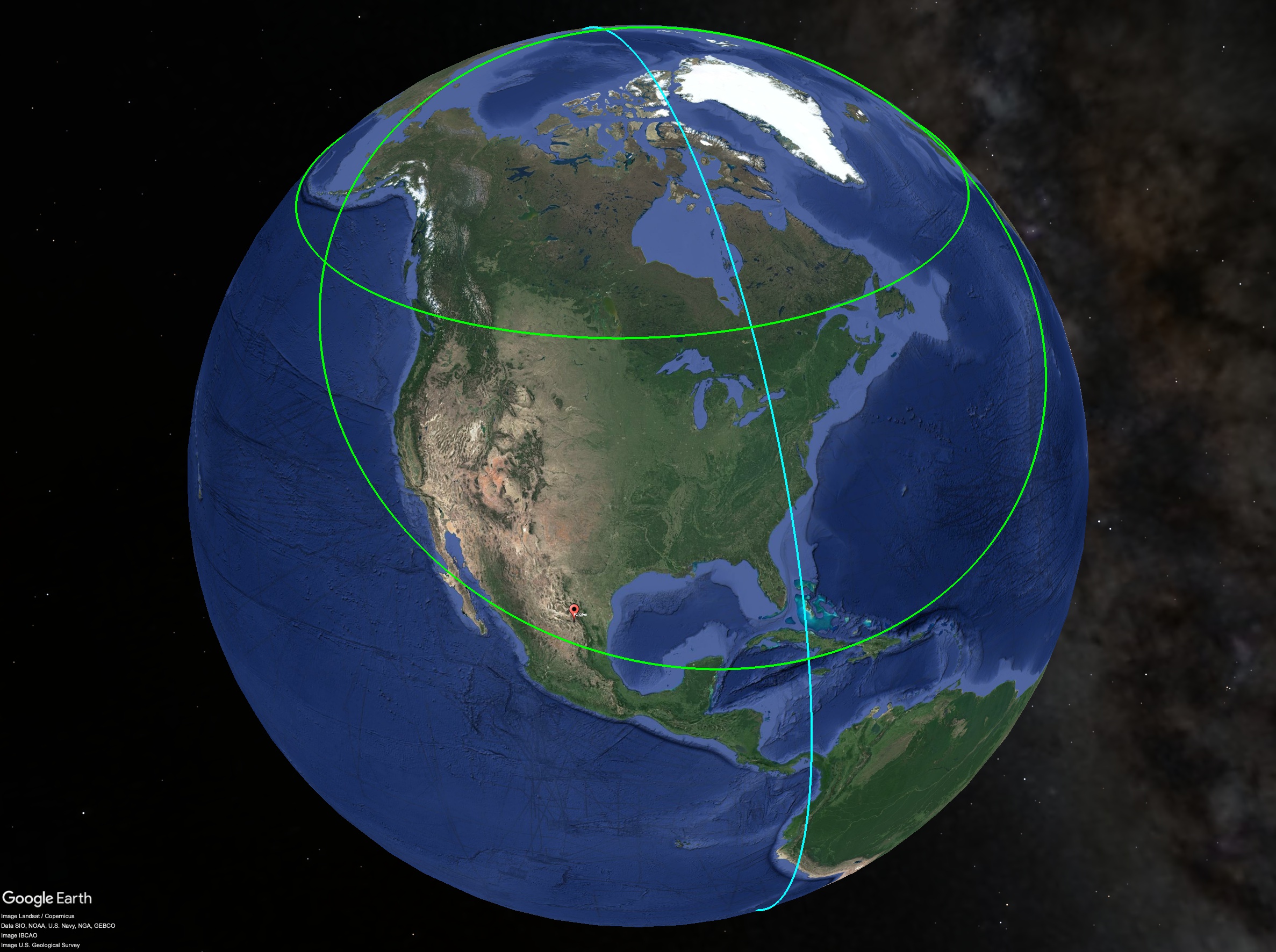
If a crustal displacement shifted the North Pole from Hudson Bay to the Arctic, the line of maximum displacement would have been only about 1400 miles to the east. Could horizontal stresses caused by a crustal displacement have been responsible for the unusual landscape around Paredon?
Conclusion
Evidently, Dr. Leon never published a detailed account of his findings in a scientific paper:
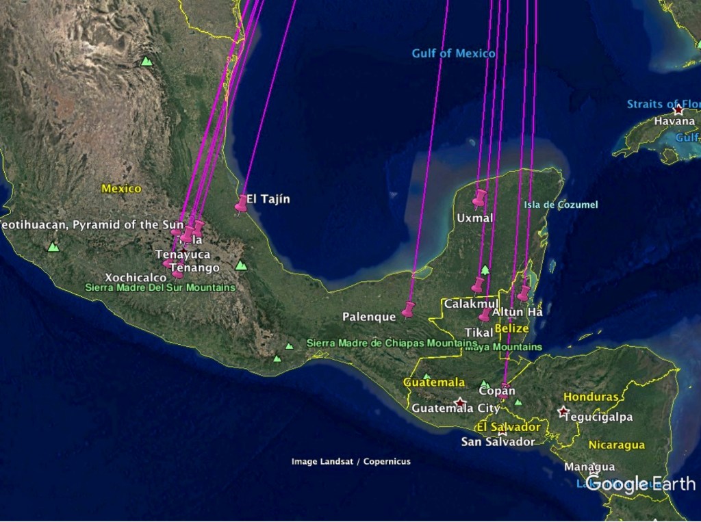
The cities of Mexico are supposed to have been built not earlier than 1500 A. D.—about 500 years ago. If any were built earlier, they are in ruins, but no remains of elephants have been discovered among the ruins, in fact no semblance of the elephant has been recognized in the sculpture, except in a few cases, where what resembles an elephant’s trunk, or the trunk of a tapir, is found on the sculptured columns at Copan. The discovery of elephant bones would bo too important a matter to be ignored, but the article seems sensational and has been sent to the newspapers as a sensational item, and not to the scientific societies, so far as we have learned.
One has to wonder if Dr. Leon’s field notes still exist in some form, in some place, say in the basement of the National Institute of Anthropology and History (INAH) in Mexico City, and if so, do they provide sufficient detail to tell us where his finds are located? In the same way ancient sites discovered in Turkey dated to 10,000 BCE or more replaced what had been the most ancient sites in Mesopotamia, could there be ruins in Mexico that are even older, perhaps thousands of years older than even the Younger Dryas, dating to the end of a previous age, to the end of the last ice age?


