In the 1950s, Viktor Sarianidi discovered the ruins of an ancient civilization known as the Bactrian-Margina Archaeological Complex (BMAC) centered in the Murghab Oasis of Turkmenistan. Sarianidi believed the people who settled in this region had migrated east from Anatolia by way of Mesopotamia in search of arable land. Others argue this civilization, which is also known as the Oxus Civilization, was indigenous to the region preceded by earlier civilizations dating back to the seventh millennium BCE. An analysis of archaeological sites in Central Asia reveals that relatively few are aligned to the cardinal points or in astronomical directions such as solstices or lunar standstills. Using Charles Hapgood’s theory of crustal displacement as a working hypothesis, over two-dozen sites are shown to reference previous locations of the North Pole. We propose that these sites were first established tens of thousands of years ago when the climate was less arid than it is today and that the Oxus and preceding civilizations in this region were the descendants of an even earlier civilization that existed up until the time of the last ice age.
Click here to read the full paper.
Climate Changes
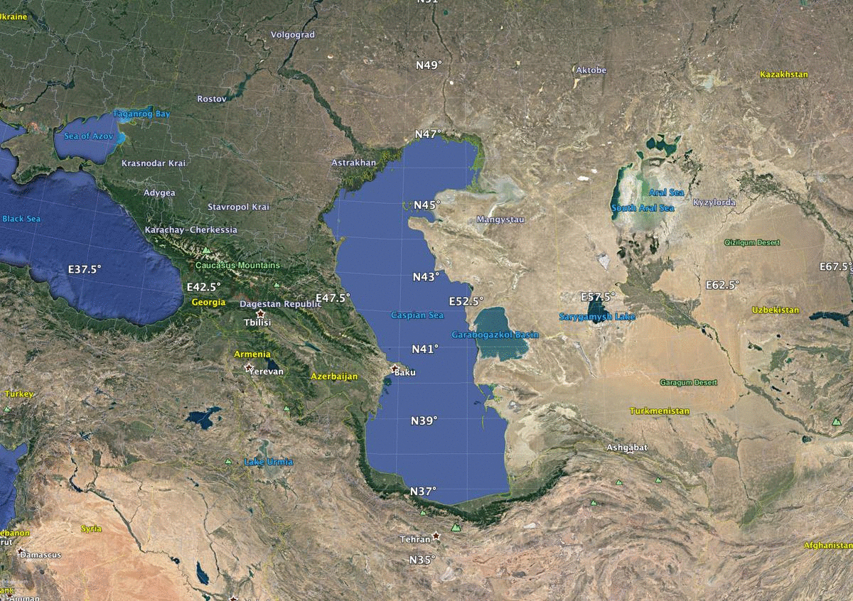
Bordered by the Caspian Sea to the west and what’s left of the Aral Sea to the north, much of Turkmenistan and Uzbekistan are deserts.
At the time of the last glacial maximum, around 20,000 years ago, sea levels were approximately 120 meters below current levels and the string of basins stretching from the Black Sea east to the Caspian and Aral seas were cut off from the Mediterranean Sea. At that time, the glaciers in the Hindu Kush were significantly larger. Fed by these glaciers, the volume of water in rivers flowing north into Central Asia was greater than it is today forming a large freshwater lake in the basin now occupied by the Caspian and Aral seas. A similar freshwater lake in the Black Sea basin fed by rivers flowing south from Central Europe also existed at this time.
When the glacial period ended, the climate in Central Asia became increasingly arid, and these lakes began to shrink in size. Meanwhile, as the North American and other ice sheets melted, global sea levels began to rise. Ryan et al (1997) proposed that around 7500 years ago the level of the Mediterranean Sea rose above the Bosporus causing the Black Sea basin to flood. Chepalyga (2007) argues the flood event created a vast inland sea in what he calls “a cascade of Eurasian basins” that existed 9,000-17,000 years ago. The area of the inland sea was about six times greater than that of the Great Lakes of North America. According to Chepalyga, the timing and magnitude of the flood event “would have been an impressive phenomenon to late Paleolithic humans and could have been reflected in old epic poems and mythology. In particular, a similar basin was described in the ‘Avesta’ (the Zoroastrian Holy Scriptures) under the name of Vorukashah Sea.”
After the flood event as the climate in Central Asia became progressively more arid, the water level of the Caspian and Aral seas decreased. Today, with the Amu Darya (Oxus) River no longer reaching the Aral Sea, it has all but disappeared.
Archaeological Sites
Sarianidi’s discoveries followed the explorations of the American geologist Raphael Pompelly a half-century earlier who published Explorations in Turkestan – a compendium of reports describing the geology and archaeology of the region (Pompelly 1905). Pompelly’s report describes several sites he visited including Merv, an ancient city mentioned in the Avesta, the sacred book of Zoroastrianism, and Samarkand, one of the oldest continuously inhabited cities in Central Asia.
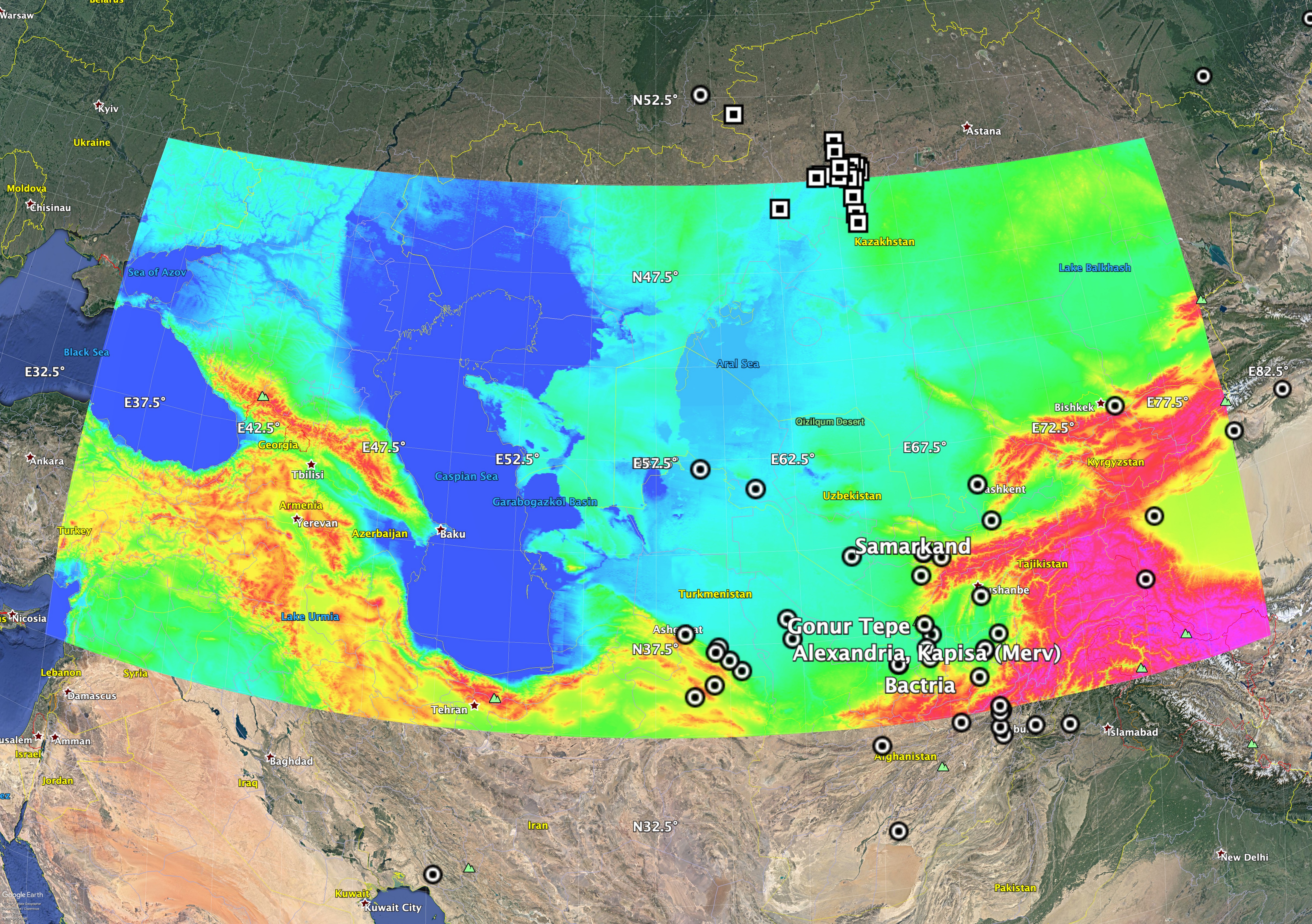
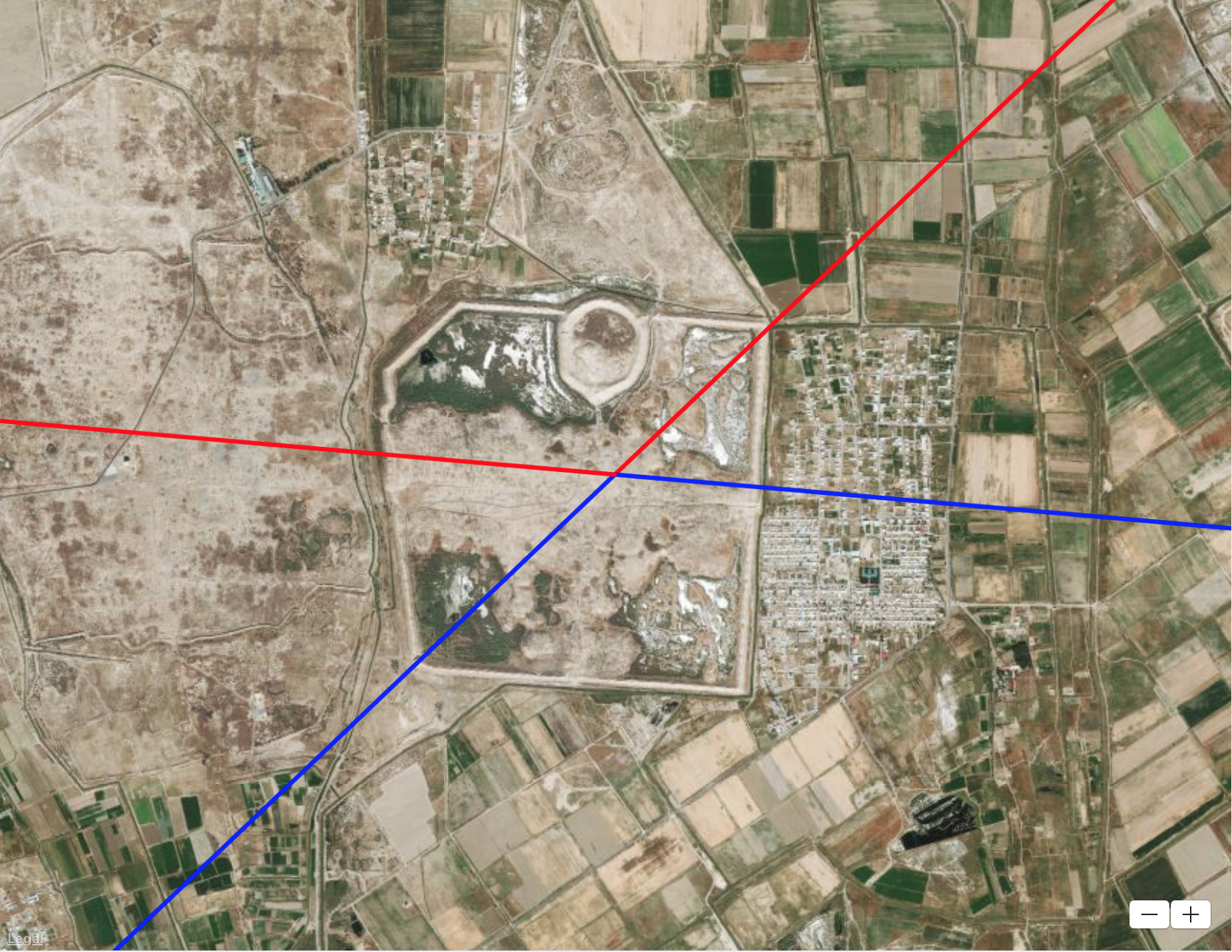
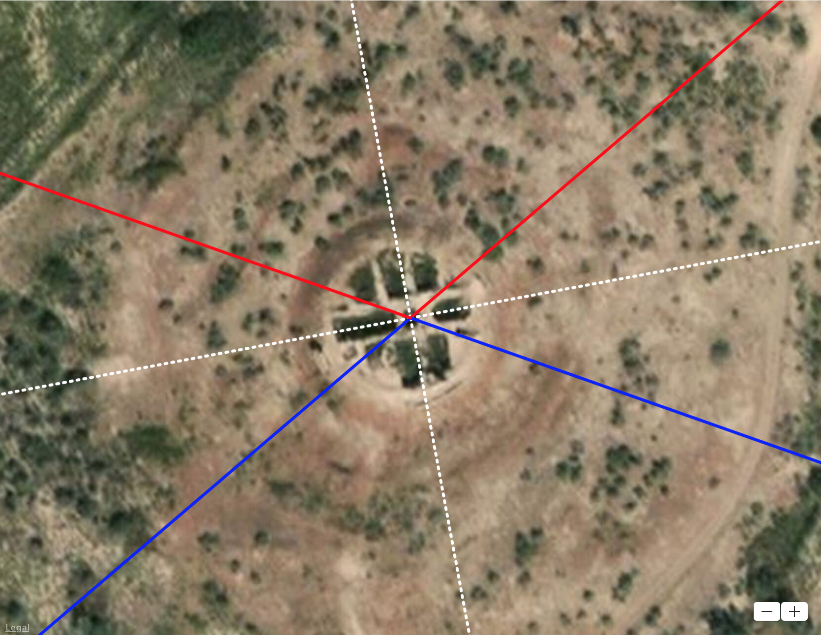
Gonur Tepe
Sarianidi spent more than four decades excavating the ruins at Gonur Tepe at the edge of the Karakum Desert. According to Lamberg-Karlovsky (2013), Sarianidi found different building levels with as many as four temples built on top of each other and states “even after more than thirty years of research and excavation, the chronology and stratigraphy of the BMAC remains deeply problematic.”

As seen from above, the palace complex at the center of the site is closely aligned to the cardinal directions. Zooming out to see more of the site reveals an eastern skew in the orientation of structures to the south. These structures are not aligned along solar or lunar directions or toward any of the Hapgood poles but do appear to indirectly reference the Hudson Bay pole suggesting the first structures at Gonur were built before 12,000-18,000 years ago. Specifically, the southern wall is aligned in the winter solstice sunrise/summer solstice sunset direction relative to the former pole. Interestingly, the complementary summer solstice sunrise/winter solstice sunset direction relative to the Hudson Bay pole lines up along the northeast-southwest diagonal of the site.
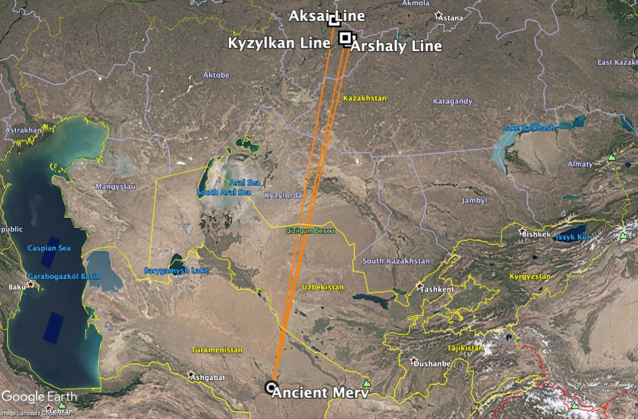
Ancient Merv
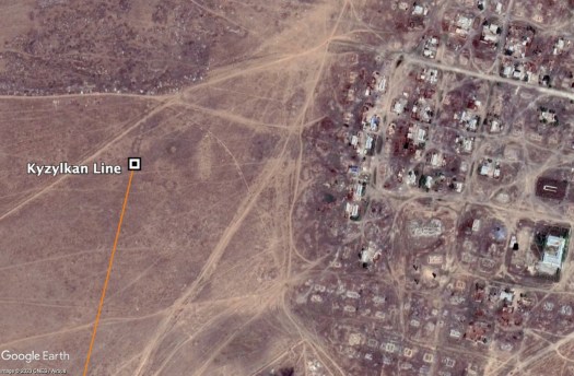
The ancient city of Merv is approximately 38 miles south of Gonur Tepe. There are three walled structures at Merv: Gyaur Kala (at one time the citadel for the larger Hellenistic city of Antiochia Marginana), Sultan Kala, and Abdullah Khan Kala. Gyaur Kala is believed to be the oldest part of the site, and Abdullah Khan Kala the most recent. Like Gonur, Gyaur Kala, and Sultan Kala appear to reference the Hudson Bay pole. The north and south walls of Gyaur Kala are aligned to the winter solstice sunrise/summer solstice sunset relative to the Hudson Bay pole. Like Gonur, the summer solstice sunrise/winter solstice sunset direction relative to the Hudson Bay pole is along the northeast-southwest diagonal of the site. Structures within the Shahriyar Ark section of Sultan Kala are similarly aligned.
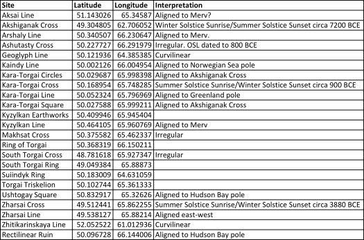
Did this tendency to align sites to solstices continue after the Hudson Bay pole shift? Abdullah Khan Kala, which was founded in the 15thcentury, is aligned in current solstice directions. Twelve of the sites examined are aligned in solstice directions relative to current or previous locations of the North Pole.
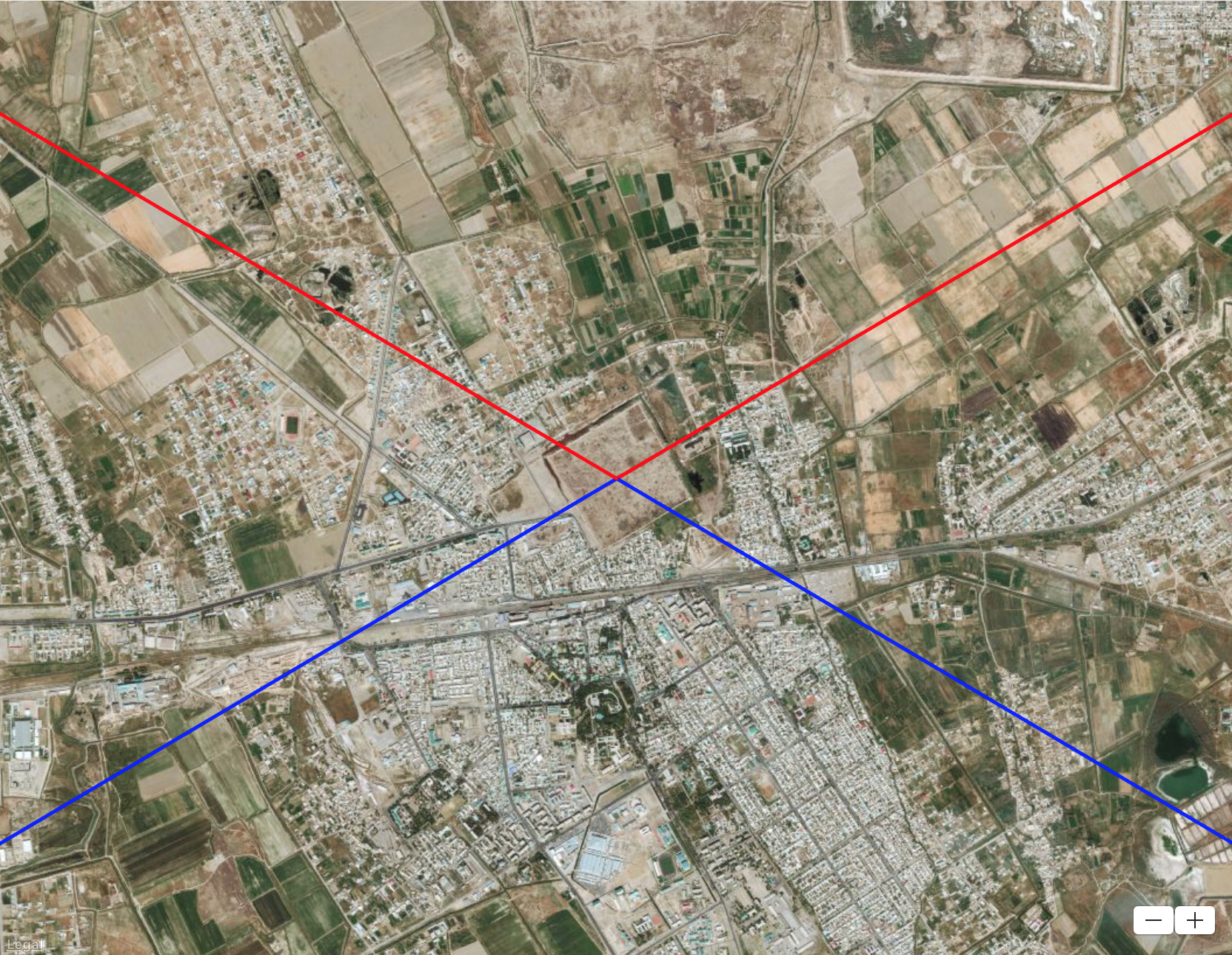
But could these directions have some other explanation? In Zoroastrianism, six seasonal festivals are celebrated during the religious year. Two are associated with equinoxes, two with solstices, and two with the mid-spring and fall. The alignments of the south walls of Gonur Tepe and Gyaur Kala are 4-5° south of east. The sunrise in this direction occurs in late winter just before the equinox and in early fall just after the equinox and so do not appear to correspond to Zorastrian festival dates.
Samarkand
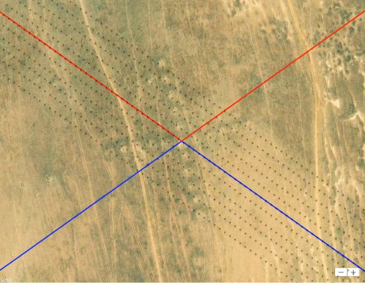
Gonur Tepe and Merv are located within the Murghab Oasis in southeastern Turkmenistan. Samarkand is about 300 miles northeast of Merv in southeastern Uzbekistan on the Zeravshan River. Thought to be one of the oldest cities in Central Asia, the oldest part of Samarkand is a hill known as Afrosiah. Its alignment is potentially even more interesting than Gonur and Merv. Excavated rectilinear ruins near the center of the hill are rotated too far from the cardinal directions to align to solstices or mid-season sunrise/sunsets. The ruins appear to be aligned both to the Norwegian Sea pole and in the direction of Merv. If the alignment were toward Merv, Samarkand, like Merv, could be more than 12,000-18,000 years old. Alternatively, if Samarkand was first established when the North Pole was in the Norwegian Sea, the site could be 60,000-80,000 years old.

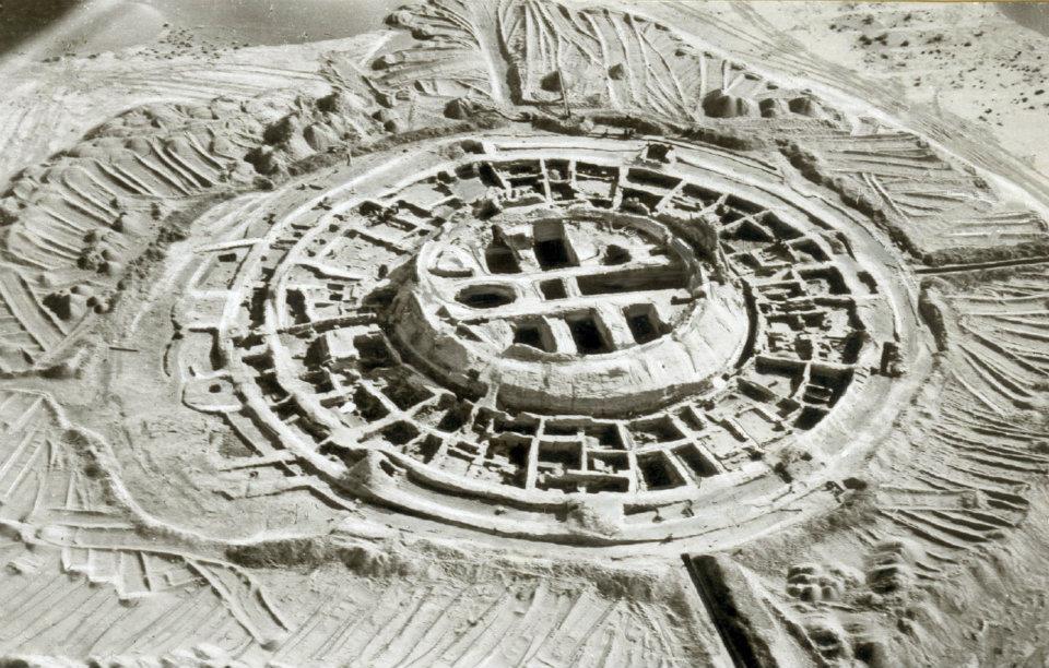
Koi Krylgan Kala
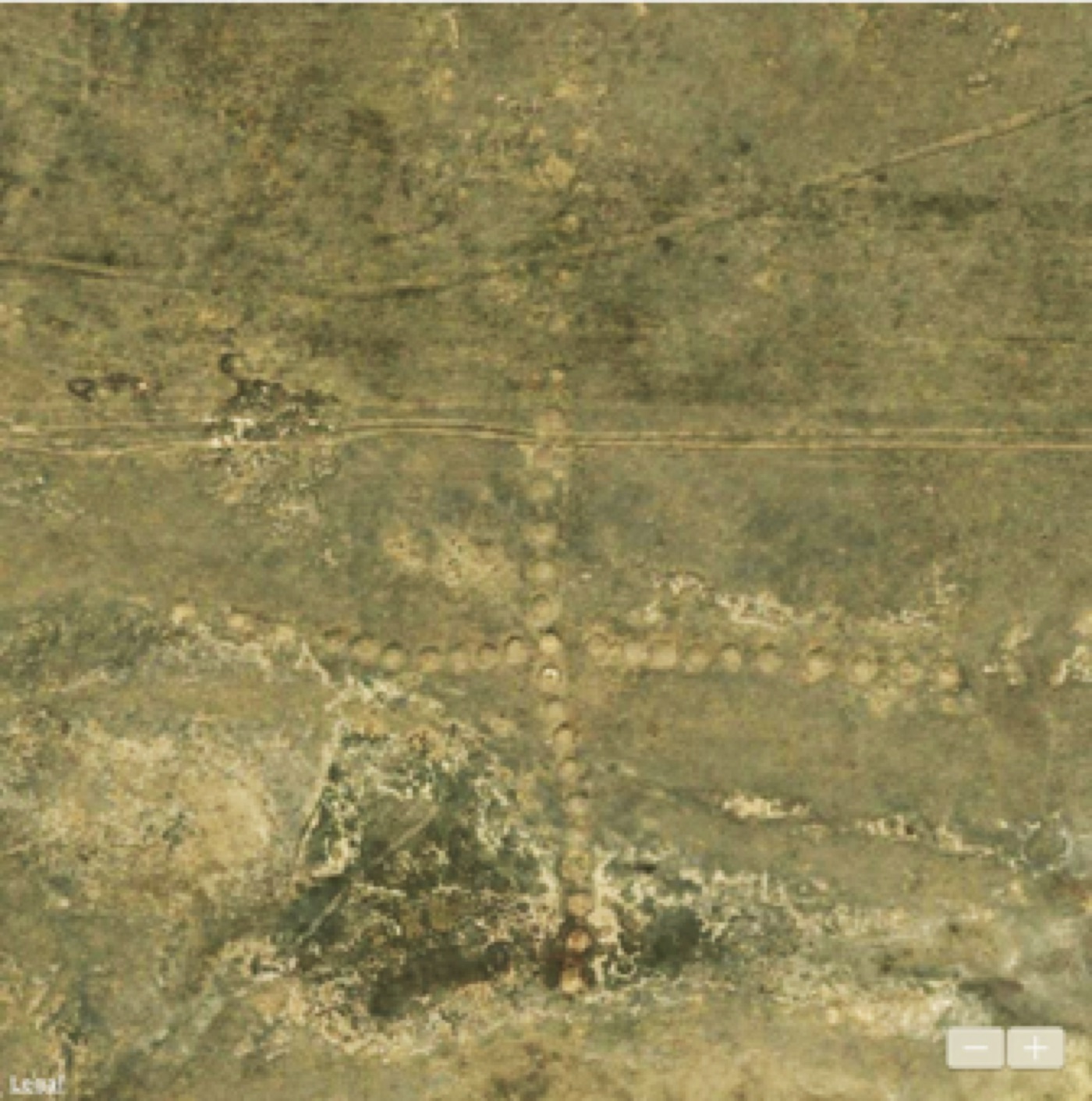
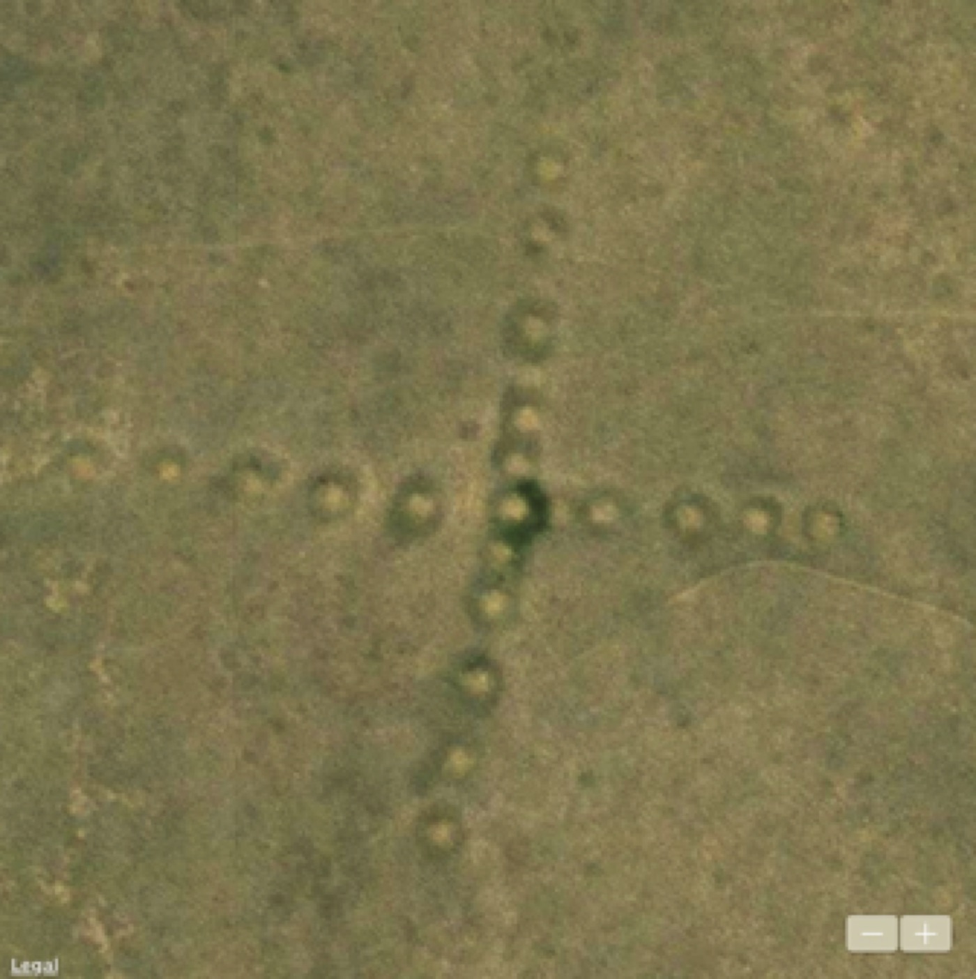
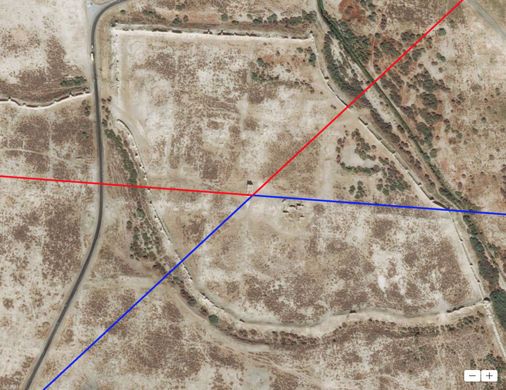
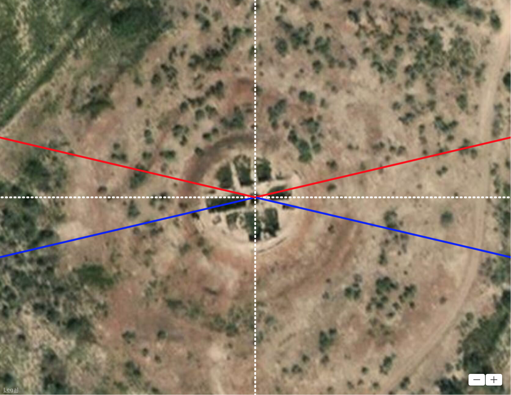
Koi Krylgan Kala (shown at the top of the article) is an ancient temple complex in the Amu Darya (Oxus) Oasis in Uzbekistan. Archaeological excavations in the 1950s unearthed numerous artifacts including terracotta figures of gods and goddesses, most notably Anahita – the divinity of the waters. The six Zorastrian festivals are associated with the six “primordial creations” of Ahura Mazda: sky, waters, earth, plant life, animal life, humankind. The festival day honoring the water is May 25. The site is very closely aligned in the sunrise direction on that day. It is also possible, that Koi Krylgan Kala may even be older than Samarkand or Merv by virtue of its alignment to an even earlier position of the North Pole in Greenland more than 80,000 years ago.
The Signature of a Lost Civilization?
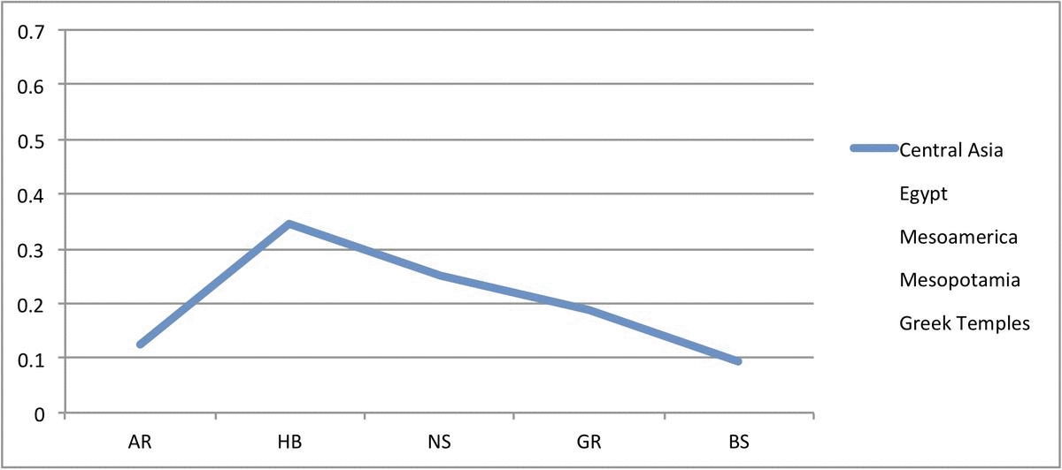
Let us assume a three-part working hypothesis: 1) Hapgood’s theory of crustal displacement, 2) human civilizations tend to align places of importance to the geographic pole/cardinal directions or in astronomical directions relative to the geographic pole at the time of construction, and 3) the probability that a site survives depends on its age, i.e., there should be fewer sites aligned to previous poles and more sites aligned to the current pole. The dramatic decrease in the number of sites in Mesoamerica and Central Asia aligned to the current pole could be interpreted as a loss of resources and/or megalithic construction technology after the Hudson Bay pole shift. Based on the number of sites, both Mesoamerica and Central Asia civilizations appear to peak during the time of the Hudson Bay pole and then decline.
An analysis of site alignments in Egypt (Carlotto 2020a) suggests that the lack of sites aligned to previous poles in Lower Egypt close to the Mediterranean could have been the result of a flood or some other disaster 12,000-18,000 years ago caused by the last crustal displacement event that destroyed those sites. In contrast, there are many sites in Upper Egypt aligned to previous poles. Far from large open bodies of water and geological faults, it is possible that civilization in Upper Egypt survived the disaster. Civilizations partially destroyed in other parts of the world could have recovered, perhaps with outside help. Given its proximity to Egypt, it is possible that Greece and other parts of Europe were rebuilt after the last pole shift.
The Epic of Gilgamesh describes a catastrophic flood that affected but did not destroy Mesopotamian civilization in the Tigris-Euphrates valley. It is unlikely that a widespread Black Sea/Eurasian basin flood event destroyed a preexisting civilization in Central Asia. It is more likely that subsequent climate changes made it increasingly more difficult to survive in a place that was gradually becoming desert. Although Central Asia was probably one of the major centers of civilization in the early days of Oxus Civilization it later declined as the climate became more arid and water resources increasingly scarce.
References
Raphael Pumpelly (1905) Explorations In Turkestan, Carnegie Institution of Washington.
Charles H. Hapgood (1958) Earth’s Shifting Crust: A Key to Some Basic Problems of Earth Science, Pantheon Books.
William B.F. Ryan, Water C. Pitman III, Candace O. Major, Kazimieras Shimkus, Vladimir Moscalenko, Glenn A. Jones, Petko Dimitrov, Naci Gorür, Mehmet Sakinç, and Hüseyin Yüce Seyir (1997) “An Abrupt Drowning of the Black Sea Shelf At 7.5 Kyr BP,” Marine Geology 138: 119–126.
L. Chepalyga (2007) “The late glacial great flood in the Ponto-Caspian basin”. In Yanko-Hombach, V.; Gilbert, A. S.; Panin, N.; Dolukhanov, P. M. (eds.). The Black Sea Flood Question: Changes in Coastline, Climate, and Human Settlement, Springer: 118−148.
C.C. Lamberg-Karlovsky (2013) “The Oxus Civilization,” CuPAUAM39, 2013: 21-63 ISSN 0211-1608 22.
Motuzaite Matuzeviciute, A.V. Logvin, I. Shevnina, A.M. Seitov, J. Feng, and L. Zhou (2015) “OSL dates for the ancient geometric earthworks of Kazakhstan,” Archaeological Research in Asia, http://dx.doi.org/10.1016/j.ara.2015.12.001.
Mark Carlotto (2020a) “Toward a New Understanding of the Alignment of Ancient Egyptian Sites,” Available at SSRN: http://dx.doi.org/10.2139/ssrn.3526820.
Mark Carlotto (2020b) “A New Model to Explain the Alignment of Certain Ancient Sites,” Journal of Scientific Exploration, Vol. 34, No. 2. https://doi.org/10.31275/20201619
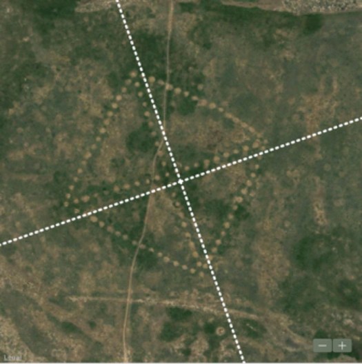
Mark J. Carlotto (2020c) “Analyzing the Geometry of the Torgai Steppe Geoglyphs,” http://dx.doi.org/10.13140/RG.2.2.23925.19681
Seyyed Hossein Nasr (1976) Islamic Science: An Illustrated Study, World of Islam Festival Publishing Company Ltd.: 92-93.